Urban Design Element
INTRODUCTION
Nature and Purpose
The Urban Design Element concerns the physical character and order of the city, and the relationship between people and their environment.
San Francisco's environment is magnificent, and the city is a great city, but the unique relationships of natural setting and man's past creations are extremely fragile. There are constant pressures for change, some for growth, some for decay.
The Urban Design Element is concerned both with development and with preservation. It is a concerted effort to recognize the positive attributes of the city, to enhance and conserve those attributes, and to improve the living environment where it is less than satisfactory. The Plan is a definition of quality, a definition based upon human needs.
This is a general plan, responding to issues relating to City Pattern, Conservation, Major New Development, and Neighborhood Environment. In the case of each of these four types of issues, the Element contains:
-
A review and definition of essential human needs;
-
An overall objective toward which both public and private efforts must be directed if the human needs are to be met and San Francisco's special characteristics are to be recognized, enhanced and conserved;
-
Fundamental principles, with graphic illustrations, reflecting the needs and characteristics with which the Plan is concerned, and describing the measurable and critical design relationships among parts of the environment such as open spaces, buildings, hills and streets; and
-
A series of policies necessary to achieve or approach the overall objective, which acknowledge the needs and principles, and which provide a continuing guide and directive for public and private decisions pursuant to this Element.
City Pattern
Human Needs
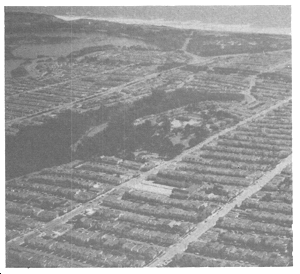
The agreeable pattern of San Francisco's appearance is, perhaps above all, what makes this a city with feeling. The pattern is a visual framework composed of the natural base upon which the city rests, together with man's development. In some ways the pattern is seen in two dimensions as though it were a map; in other ways it has a sculptural or three-dimensional form.
To describe the pattern is not to describe a rigid order, for rigidity will not produce a city meant for human needs. Rather than rigidity, the sense is one of balance and compatibility, with diverse and even random features fitting together to form the whole. The pattern is made up of:
WATER, the Bay and Ocean, which are boundaries for the city and a part of its climate and way of life. The water is open space, a focus of major views and a place of human activity.
HILLS AND RIDGES, which allow the city to be seen, define districts, and more than any other feature produce the variety that is characteristic of San Francisco. The central mass of Twin Peaks separates the city into quadrants, for example, while Telegraph Hill, Sunset Heights and Potrero Hill are neighborhoods. In the topographic form of the city, the valleys and plains are as important as the hills, for they define their own districts and give the hills their visual meaning.
OPEN SPACES AND LANDSCAPED AREAS, whose dark green patterns enrich the color of the city and define and identify hills, districts and places for recreation. These areas may be large, as at the Presidio, Lake Merced and Golden Gate Park, smaller but still prominent as at Bayview Hill and Alta Plaza, or mixed with buildings as on the slopes of Russian Hill and Buena Vista.
STREETS AND ROADWAYS, which unify the pattern, emphasize the hills and valleys, provide vistas and open space and determine the character of development. Streets and roadways are of many types, each with its own functions and characteristics, and together they make up a system that accommodates man's movements and joins the districts of the city.
BUILDINGS AND STRUCTURES and clusters of them, which reflect the character of districts and centers for activity, provide reference points for human orientation, and may add to (but can detract from) topography and views. Some buildings and structures, such as the Golden Gate and Bay Bridges, Coit Tower, the Palace of Fine Arts and City College, stand out as single features of community importance, while elsewhere the dominant pattern of man's development is a light-toned texture of separate shapes blended and articulated over the landscape.
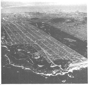
People perceive this pattern from many places and during many activities; from their homes and neighborhoods, from parks and the shoreline during recreation, from places of work, from the streets while traveling, and from entranceways and observation points while visiting the city.
The uses and benefits of the city pattern are many and profound. This pattern is, first of all, bound up in the image and character of the city. To weaken or destroy the pattern would make San Francisco a vastly different place.
Second, the city pattern has important psychological effects upon residents of the city. It provides organization and measured relationships that give a sense of place and purpose and reduce the degree of stress in urban life. Outlooks upon a pleasant and varied pattern provide for an extension of individual consciousness and personality, and give a comforting sense of living with the environment.
The pattern also helps people to identify districts and neighborhoods, particularly those in which they themselves live. Recognition of such areas by their prominent features, their edges and their centers for activity breaks up a large and intense city into units that are visually and psychologically manageable. Furthermore, awareness of districts and neighborhoods increases the pride in one's area and in one's own life.
People also have a need to understand their city, its logic and its means of cohesion. They need to know where to find activities, and how to reach their destinations in shopping areas, downtown, at institutions and at places of entertainment and recreation. The city pattern helps them find their way, without inconvenience or lost time, letting them see the routes to be taken. Travel congestion is reduced if the best routes are easily found, and safety is increased.
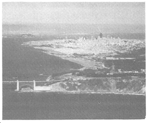
Two of the controllable elements that help strengthen the city pattern are visually prominent landscaping and street lighting. Because these elements can be so easily affected in a positive way by human actions, and especially by programs of the City government, they are given important attention in the policies of this Element. Opportunities for use of these elements are by no means fully realized now, and systems for landscaping and lighting are incomplete. As a consequence, parts of the city pattern that otherwise would be easily read are unclear, and the functions of the street system are apt to be confused both by day and at night. In addition, some areas of the city are favored by the amenities produced by good landscaping and lighting systems while others are not.
The human needs outlined above for the city pattern are further addressed by the fundamental principles that follow, and by the policies that conclude this section of The Urban Design Element. In certain ways they are addressed, as well, in the other three sections of the Element: by policies dealing with conservation of resources that are part of the city pattern; policies for moderation of major new development to enhance rather than detract from the city pattern; and policies to make the pattern more perceptible in the neighborhood environment. Such an interchange of needs and policies occurs throughout the sections of the Element, for the Element is a unified document and its sections are closely related.
OBJECTIVES
OBJECTIVE 1
EMPHASIS OF THE CHARACTERISTIC PATTERN WHICH GIVES TO THE CITY AND ITS NEIGHBORHOODS AN IMAGE, A SENSE OF PURPOSE, AND A MEANS OF ORIENTATION.
San Francisco has an image and character in its city pattern which depend especially upon views, topography, streets, building form and major landscaping. This pattern gives an organization and sense of purpose to the city, denotes the extent and special nature of districts, and identifies and makes prominent the centers of human activity. The pattern also assists in orientation for travel on foot, by automobile and by public transportation. The city pattern should be recognized, protected and enhanced.
Principles for City Pattern
These fundamental principles and their illustrations reflect the needs and characteristics with which this plan is concerned, and describe measurable and critical urban design relationships in the city pattern.
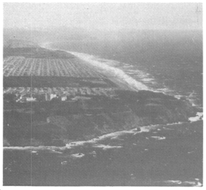
| 1. | The city's overall visual structure can be strengthened and enhanced by use of large-scale planting on certain streets and open spaces. |
 |
| 2. |
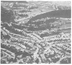
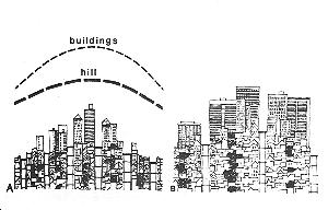
Street layouts and building forms which do not emphasize topography reduce the clarity of the city form and image. A: Tall, slender buildings at the tops of hills and low buildings on the slopes and in valleys accentuate the form of the hills. B: Contour streets on hills align buildings to create a pattern of strong horizontal bands that conflict with the hill form. |
|
| 3. |
Clearly visible open spaces act as orientation points, and convey information about the presence of recreation space to motorists and pedestrians. COMMENT: Because Buena Vista Park is visible from many parts of the city, it is often used as a point of reference. The foliage, in contrast to the surrounding developed areas, indicates the proximity of recreational means. |
|
| 4. |
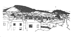
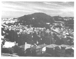
Where large parks occur at tops of hills, lowrise buildings surrounding them will preserve views from the park and maintain visibility of the park from other areas of the city. COMMENT: Areas around Mount Davidson and Twin Peaks have a pattern of low development. The hilltops are therefore citywide focal points of natural landscape, functioning much as Telegraph Hill's summit does in the North Beach area. |
 |
| 5. | Street spaces impart a unifying rhythm to the pattern and image of the city. | |
| 6. |
Landscaped pathways can visually and functionally link larger open spaces to neighborhoods. COMMENT: The roadside planting of Park Presidio and Sunset Boulevard, and the landscape connections between Mount Sutro, Twin Peaks, Laguna Honda and Glen Canyon are examples of a system that links parks and other open spaces to one another. Such linkages, creating strong defining features, can be extended to other parts of the city. |
|
| 7. |
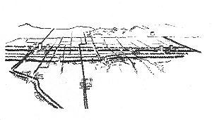
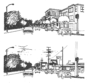
The pattern of major streets can be made more visible and apparent to users of the street system if the landscaping and lighting of major streets is different from that of local streets. A: The consistent use of one type of tree, planted in regular intervals, can impart a sense of order and continuity appropriate to major through streets. B: Informal, diverse patterns of planting and varieties of plant materials can act as an appropriate indication of local residential streets. |
 |
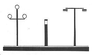
| C: The difference between through and local streets can be made clearer by varying the apparent brightness, spread and color of light, as well as the height, spacing, and scale of street fixtures. |
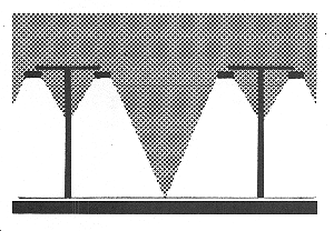
|
|
| MAJOR THROUGH STREETS: Intense light, sidewalk and walls well-illuminated, blue-white light, paired spacing of high light standards. | 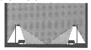 |
|
| COLLECTOR STREETS: Well-lighted streets and sidewalks, color-corrected (white) light, alternate spacing of Intermediate height light standards. | 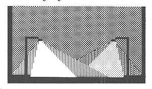 |
|
| LOCAL STREETS: Low glare, warm color light, alternate spacing of low height light standards. |  |
|
| IMPORTANT INTERSECTIONS: More intense light focussed upon intersections and crosswalks. | 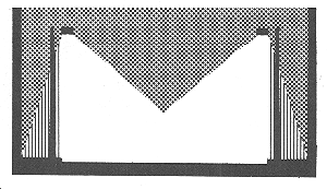 |
|
| 8. |
Large-scale or extensive planting on major roadways that define areas of the city can enhance the importance of the roadways as both thoroughfares and visual boundaries. COMMENT: The extensive landscaping along the James Lick Freeway at Potrero Hill is one example. Other "boundaries" such as Nineteenth Avenue, Ocean Avenue and Monterey Boulevard could be made clearer by such planting. |
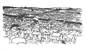 |
| 9. | Special lighting fixtures and quality of light can enhance the identity of districts, distinctive areas, and important shopping streets. | 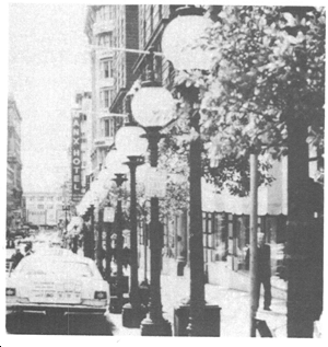 |
| 10. | Views from roadways that reveal major destinations or that provide overlooks of important routes and areas of the city assist the traveler in orientation.COMMENT: Traveling north along San Jose Avenue, the driver's position and direction are confirmed by the view of downtown across the Mission District. | 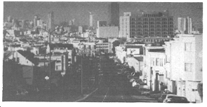 |
| 11. | Arterial routes can be clarified by screening unattractive or distracting elements with landscaping when such elements cannot be removed. Natural foliage can soften and modify the effect of extensive retaining walls, large bleak surfaces or unattractive views. The terraced retaining wall along the east side of Potrero Hill is an example of such landscaping. | |
| 12. |
Open spaces with direct views down streets have a greater sense of spaciousness and can be seen more easily from a distance. A: Hilltop open space larger than a block provides views down abutting streets. B: Hilltop open space occupying a single block and surrounded by buildings provides views only from its edges, obliquely down streets. |
 |
| C: Smaller open space on a hill occupying the street right-of-way provides direct views down the street. | 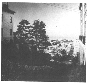 |
|
| 13. | Hilltop roads and open spaces provide panoramic views of adjacent buildings are far enough below the viewpoint. | |
| 14. | Highly visible open space presents a refreshing contrast to extensive urban development. | |
| 15. |
Strong and organized development adjacent to parks creates an effective contrast and makes the street space between the two a pleasing space to be in. Weak and disorganized development adjacent to parks neither complements nor effectively contrasts with the park edge. |
 |
| 16. |
Certain streets, because of unusual width or direction, are important form elements in themselves, giving identity to districts and order to the city structure. COMMENT: Columbus Avenue and Market Street are examples of such streets. Any major interruptions of these streets would reduce their value as form elements. |
|
| 17. | Wide streets with low and/or scattered buildings are poorly defined and do not contribute to an orderly city pattern and image. | |
| 18. | Green space closing a street provides an accent on an upper slope or top of hill. | |
| 19. |
Uninterrupted grid streets in flat areas often result in monotonous vistas. Closure formed by planting contains the street space, creating a more comfortable environment. |
|
| 20. |
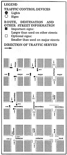
The width of intersecting streets, the information displayed on street signs, and the type and location of traffic control elements can indicate the function and relative importance of streets. COMMENT: These diagrams illustrate how the relative importance of streets can be expressed at intersections. For some intersection conditions different arrangements of curb alignment, control devices or information may be required. |
 |
| 21. | Transit routes, stops and transfer points can be more easily understood and remembered if they are distinctively identified by signs, landscaping and illumination. | 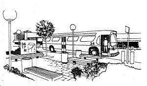 |
| A: Attractive, easily seen symbols at bus stops that indicate the type of service and the route can facilitate use of the transit system. | 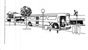 |
|
| B: The importance of transfer points can be expressed by the amount and type of landscaping, provision of shelters for waiting passengers, and nighttime lighting. | 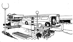 |
Image and Character
POLICY 1.1
Recognize and protect major views in the city, with particular attention to those of open space and water.
Views contribute immeasurably to the quality of the city and to the lives of its residents. Special consideration should be given to major views whenever it is feasible, with special attention to the characteristic views of open space and water that reflect the natural setting of the city and give a colorful and refreshing contrast to man's development.
Overlooks and other viewpoints for appreciation of the city and its environs should be protected and supplemented, by limitation of buildings and other obstructions where necessary and by establishment of new viewpoints at key locations.
Visibility of open spaces, especially those on hilltops, should be maintained and improved, in order to enhance the overall form of the city, contribute to the distinctiveness of districts and permit easy identification of recreational resources. The landscaping at such locations also provides a pleasant focus for views along streets.
POLICY 1.2
Recognize, protect and reinforce the existing street pattern, especially as it is related to topography.
Streets are a stable and unifying component of the city pattern. Changes in the street system that would significantly alter this pattern should be made only after due consideration for their effects upon the environment. Such changes should not counteract the established rhythm of the streets with respect to topography, or break the grid system without compensating advantages.
The width of streets should be considered in determining the type and size of building development, so as to provide enclosing street facades and complement the nature of the street. Streets and development bordering open spaces are especially important with respect to the strength and order in their design. Where setbacks establish facade lines that form an important component of a street's visual character, new and remodeled buildings should maintain the existing facade lines.
Streets cutting across the normal grid pattern produce unusual and often beneficial design relationships that should not be weakened or interrupted in building development. Special consideration should be given to the quality of buildings and other features closing major vistas at the ends of these and other streets.
POLICY 1.3
Recognize that buildings, when seen together, produce a total effect that characterizes the city and its districts.
Buildings, which collectively contribute to the characteristic pattern of the city, are the greatest variable because they are most easily altered by man. Therefore, the relationships of building forms to one another and to other elements of the city pattern should be moderated so that the effects will be complementary and harmonious.
The general pattern of buildings should emphasize the topographic form of the city and the importance of centers of activity. It should also help to define street areas and other public open spaces. Individual buildings and other structures should stand out prominently in the city pattern only in exceptional circumstances, where they signify the presence of important community facilities and occupy visual focal points that benefit from buildings and structures of such design.
The form of buildings is covered in greater detail in this Plan under the section on Major New Development.
POLICY 1.4
Protect and promote large-scale landscaping and open space that define districts and topography.
Open spaces provide a unifying and often continuous framework across the city. These open spaces are most prominent when they occur on hills and ridges and when they contain large trees and other large-scale masses of landscaping. Future landscaping efforts, both public and private, should be directed toward preservation of existing trees and other planting that contribute to this framework, and toward addition of large-scale landscaping that will add to and fill out the framework.
Where open spaces of any kind can be made more prominent by addition of new or large-scale landscaping, such additions should be made in order to enhance the city pattern and make the open spaces more visible in nearby neighborhoods. New building development should respect existing landscaping and avoid displacing or obscuring it. In the event that such landscaping must be displaced or obscured, a strong effort should be made to replace it with new landscaping of equal or greater prominence.
Organization and Sense of Purpose
POLICY 1.5
Emphasize the special nature of each district through distinctive landscaping and other features.
The design of improvements for street areas, and to some extent for private properties as well, should capitalize on opportunities to emphasize the distinctive nature of districts and neighborhoods.
Street landscaping, in particular, can be selected and designed according to a special theme for each area, providing a sense of place in addition to its other amenities. Planting for public open spaces and on private properties can be carried out in the same way, taking account of established themes and the differences in climate among districts. Distinctiveness can also be imparted by preservation and highlighting of architectural features common to the area, and the use of special materials and colors in buildings.
POLICY 1.6
Make centers of activity more prominent through design of street features and by other means.
Shopping streets and other centers for activity and congregation of people should stand out in an attractive manner in their districts. Some such centers, in appropriate cases, will have buildings larger than those in the surrounding area, while others will be set off only by their distinctive design treatment.
Street landscaping of a type and size appropriate to the area should be used, as well as lighting that identifies the area through special fixtures and quality of light. Sidewalk treatment should be coordinated, with distinctive paving, benches and other elements suitable to the needs and desires of merchants, shoppers and other people using the area. Building facades and the total composition of the activity center should be designed to make clear the geographical extent of the center and its relationship to the district.
POLICY 1.7
Recognize the natural boundaries of districts, and promote connections between districts.
Visually prominent features such as hills, roadways and large groves of trees often identify the edges of districts and neighborhoods. Although these features should not be regarded as barriers to movement from one area to another, they do have the advantage of creating an awareness of districts and neighborhoods within the total city pattern.
The positive effects of natural district boundaries should be emphasized in decisions affecting visually prominent features such as new roadways and large-scale landscaping. At the same time these same types of features can be useful links between districts, and between parks and other public and semi-public facilities. Connections between districts and facilities should be improved, with special attention to the possibilities for landscaped pathways that will provide an alternative to the street system in movement about the city.
Orientation for Travel
POLICY 1.8
Increase the visibility of major destination areas and other points for orientation.
In travel about the city, the ability to see one's destination and other points of orientation is an important product of the city pattern. Such an ability should be fostered in public and private development.
The design of streets, the determination of street use and the control of land uses and building types along streets should all be carried out with the visibility of such orienting features taken into account. Views from streets and other public areas should be preserved, created and improved where they include the water, open spaces, large buildings and other major features of the city pattern. Entranceways to the city and to districts are of special concern in this respect, as are lateral and downhill views that show a panorama or corridor with prominent features.
POLICY 1.9
Increase the clarity of routes for travelers.
Many types of improvements can be made in street areas and in their surroundings to provide greater clarity and increase the ease of travel. Once such improvements have been made, adequate maintenance of them is of equal importance.
Among the least difficult actions would be development of a better system of identifying and directional signs, through improvement of verbal messages, symbols, graphic design and sign placement.
Although trafficway signs should be improved, the purpose and direction of traffic channels should also be made as clear as possible through design of the channels themselves. The roadway should be consistent in width and materials, with channels separated by islands and dividers where possible and changes of direction made distinct. At intersections, the differences in importance and function of the intersecting streets should be made visually clear by differences in roadway width, landscaping and lighting. The number of streets intersecting at one point should be minimized, and signs and traffic control devices should be adequate to indicate the movements permitted in all traffic lanes.
The roadway environment should be simplified and made attractive through screening of distracting and unsightly elements by landscaping, walls and buildings. The clutter of wires, signs and disordered development should be reduced. Conflict between unnecessary private signs and street directional signs should be avoided.
Clarity of routes is of similar importance for transit riders. Legible and frequent trafficway signs and an ordered roadway environment will assist these riders. Other improvements should be made in the vicinity of transit stops: these include wider sidewalks, landscaping, lighting and waiting shelters to help identify the stops, and better signs at stops and on vehicles to explain routes, types and frequency of service, and transfer points.
POLICY 1.10
Indicate the purposes of streets by adopting and implementing the Better Streets Plan, which identifies a hierarchy of street types and appropriate streetscape elements for each street type.
Orientation for travel is most effectively provided where there is a citywide system of streets with established purposes: major through streets that carry traffic for considerable distances between districts, local streets that serve only the adjacent properties, and other streets with other types of assigned functions. Once the purposes of streets have been established, the design of street features should help to express those purposes and make the whole system understandable to the traveler.
The appropriate purpose of and role for a street in the overall city street network depends on its specific context, including land use and transportation characteristics, and other special conditions. Streets in residential areas must be protected from the negative influence of traffic and provide opportunities for neighbors to gather and interact. Streets in commercial areas must have a high degree of pedestrian amenities, wide sidewalks, and seating areas to serve the multitude of visitors. Streets in industrial areas must serve the needs of adjacent businesses and workers; and so forth.
Similarly, some streets play a greater role in the movement of people and goods across the city and beyond, with higher volumes of pedestrians, cyclists, transit users, and vehicles, while others serve a more local context with less transportation activity. The goals for throughways are to enhance pedestrian safety, buffer pedestrians from negative effects of vehicular traffic, and create a strong image appropriate to the street’s importance to the city pattern. The goals for neighborhood streets are to calm traffic and provide neighborhood-serving amenities.
The Better Streets Plan identifies and defines a system of street types and describes the appropriate design treatments and streetscape elements for each street type. Future decisions about the design of pedestrian and streetscape elements should follow the policies and guidelines of the Better Streets Plan, as adopted by the Board of Supervisors on December 7, 2010 and amended from time to time. The Better Streets Plan, is incorporated herein by reference.
POLICY 1.11
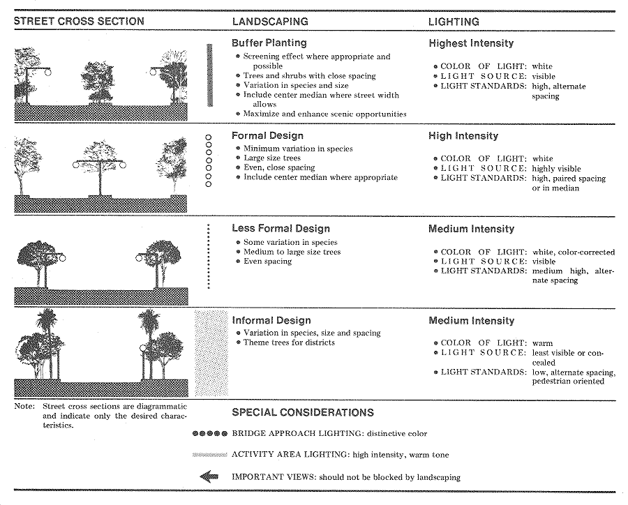
Indicate the purposes of streets by means of a citywide plan for street landscaping.
One type of feature that can be readily adjusted to the street system is landscaping. Accordingly, a plan should be put into effect for street landscaping that indicates the relative importance of streets by the degree of formality of tree planting and the species and size of the trees. In addition to differences in traffic-carrying functions, the plan recognizes the width and visual importance of certain streets, the special nature of various activity areas, and the need for screening or buffering of residential uses along streets carrying heavy traffic. Special consideration is also required for major intersections, and for important views that should not be blocked by landscaping.
POLICY 1.12
Indicate the purposes of streets by means of a citywide plan for street lighting.
The same considerations that apply to street landscaping under Policy 10 apply to street lighting as well. A plan similar to that for landscaping should therefore be carried out with respect to lighting, with the design and placement of lighting fixtures and the type of illumination determined by street type and other relevant factors.
Conservation
Human Needs
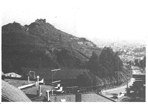
In the intensely urban environment of San Francisco, there are things that have not changed. These features provide people with a feeling of continuity over time, and with a sense of relief from the crowding and stress of city life and modern times. As the city grows, the keeping of that which is old and irreplaceable may be as much a measure of human achievement as the building of the new. Certainly, the old should not be replaced unless what is new is better.
Natural areas are one such irreplaceable resource. Few examples remain of the original sand dunes, hills, cliffs and beaches that once characterized the peninsula, and fewer still are the examples of natural ecology. Reduction of such areas by development has continued until recent time, and the city can be seen to have reached an irreducible minimum if it is to keep a sense of unspoiled nature for future generations.
The natural areas answer human needs for rest, quiet, escape from the city's pace and freedom from confinement. They provide places to view the city from afar, but just as often they can turn the viewer's attention to the secluded interior of the area or to the expanses of the Ocean or the Bay.
The Bay is itself a resource of nature, although it has been encroached upon by filling and by barriers that prevent access to much of its present shoreline. Hardly any of the original shoreline remains, but the water of the Bay is still a natural area that can be seen and used by the city's residents as an important part of their lives.
The parks and other open spaces developed by man are also resources that change little over time. These areas often approach a natural state, and even as pure open space they would have value for recreation and relief from city congestion. Creation of substantial new open space is both financially and physically difficult, and therefore existing open space has even greater public value as time goes on.
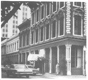
Older buildings, too, lend a sense of permanence and pleasant contrast. They are links with past history, and with earlier styles of development and of living. Buildings that endure maintain a continuous culture and may set standards of excellence with which contemporary development can be compared. In some cases certain buildings may be identified with specific people or events or with great architects. Such buildings are resources for education, recreation and other human enjoyment.
Historic buildings, and in fact nearly all older buildings regardless of their historic affiliations, provide a richness of character, texture and human scale that is unlikely to be repeated often in new development. They help characterize many neighborhoods of the city, and establish landmarks and focal points that contribute to the city pattern.
The work of San Francisco's Landmarks Preservation Advisory Board has been notable as a dedicated effort to gain recognition for the city's heritage of older buildings. A number of landmarks have been designated, but many others are threatened and even those designated will not be permanently retained without the cooperation of their owners. Of equal importance to the designation of individual buildings is the recognition and protection of whole block frontages and areas that exemplify early architectural styles and a high quality of design character. The retention of many of the traditions of San Francisco is dependent upon an expansion of preservation efforts in the future.
There are other developed areas which, though they may not contain individual buildings that are historic or otherwise outstanding, have a special character worthy of preservation. These areas have an unusually fortunate relationship of building scale, landscaping, topography and other attributes that makes them indispensable to San Francisco's image. Threats to the character of these areas are sure to be met with intense concern by their own residents and by the public at large.
The city's streets are a further resource to be conserved. Their value is not merely in the carrying of traffic. Streets are important in perception of the city pattern, since they make visible the city's outstanding features and its points of orientation. Streets also help regulate the organization and scale of building development, spacing out buildings and giving continuity to their facades.
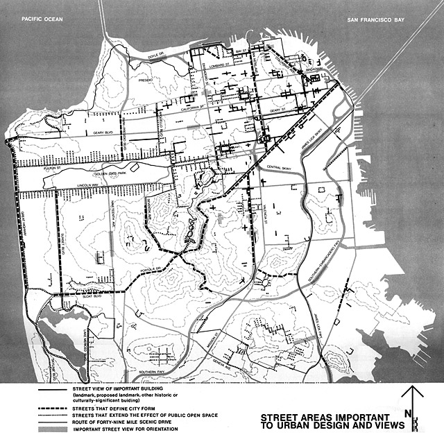
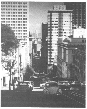
Good views are another product of the street system. A majority of the city's streets may be said to have pleasing views of the Bay, the Ocean, distant hills or other parts of the city. Where good views are not available, streets can still function as open space for use by neighborhood residents and for landscaping to bring some sense of nature to the area.
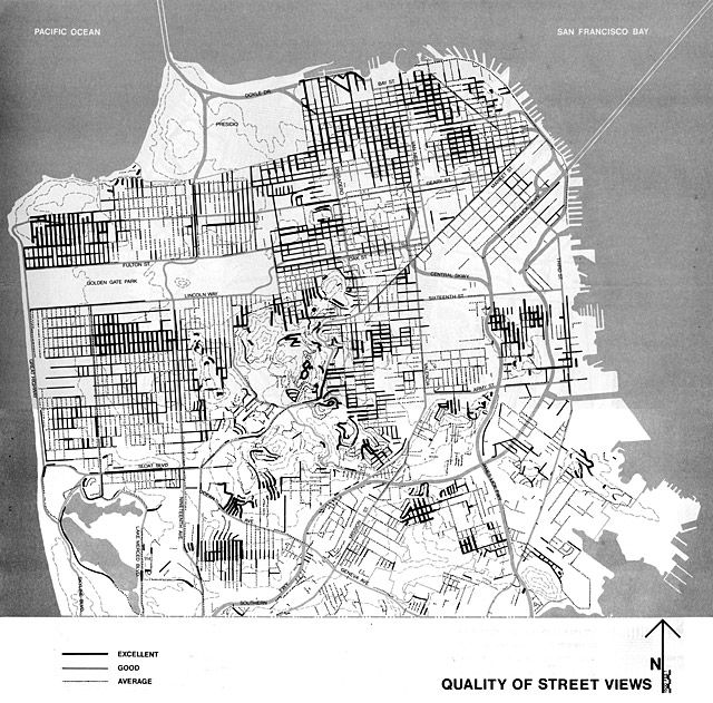
Where the intensity of development is high, streets may even be necessary to maintain decent levels of light and air for residents and for pedestrians. In these areas, streets are the "breathing space" that permits buildings to reach high density on private properties. In other functions, streets also carry a complex of utility lines and provide access for truck deliveries and police and fire protection.
With this great variety of public values in the street system, it is necessary that clear policies be established to determine when streets must be retained in their present state, and when, under exceptional circumstances, street areas may be released for other uses consistent with the public interest.
OBJECTIVE 2
CONSERVATION OF RESOURCES WHICH PROVIDE A SENSE OF NATURE, CONTINUITY WITH THE PAST, AND FREEDOM FROM OVERCROWDING.
If San Francisco is to retain its charm and human proportion, certain irreplaceable resources must not be lost or diminished. Natural areas must be kept undeveloped for the enjoyment of future generations. Special care should be taken to recognize, express and, in some cases, maintain, the distinctive character of individual neighborhoods, as well as notable buildings, recognizing that accommodating new buildings that are taller or denser than adjacent existing buildings is necessary to meet the evolving needs of the city and its population. Street space must be retained as valuable public open space in the tight-knit fabric of the city.
Fundamental Principles for Conservation
These fundamental principles and their illustrations reflect the needs and characteristics with which this Plan is concerned, and describe measurable and critical urban design relationships for conservation.
| 1. |
Natural areas and features such as sand dunes, cliffs, hills and beaches--particularly where a relatively undisturbed natural ecology exists--are irreplaceable and of special public value and benefit within an intensely developed city. A: The function and beauty of natural areas aresignificantly diminished by the intrusion of trafficways, parking lots and buildings. These facilities detract less when located in areas that have already been built upon or otherwise developed. B: Development for human activity within these areas,such as pathways and service buildings, must be carefully located and designed if it is not to damage the natural landscape. C: The value of natural areas can be diminished by views of buildings, parking lots and trafficways in adjacent areas. |
|
| 2. | New development can enhance and preserve SanFrancisco's distinctive qualities if it is designed with consideration for the prevailing design character and the effect on surroundings. | 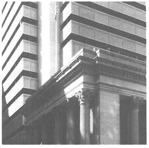 |
| 3. |
External details in building facades, entries, stairways, retaining walls and other features provide visual interest and enrichment and are consistent with the historic scale and texture of San Francisco. A: Richly detailed facades enhance the character of the street by giving it greater visual variety. Such detail often reduces building facades and textures to a more human scale and makes the street a more pleasant place to be. |
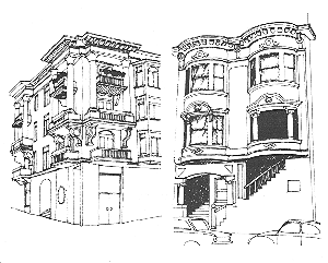 |
B: Even blank walls may possess visual interest if they are textured and scaled. |
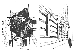 |
|
| 4. | To conserve important design character in historic or distinctive older areas, some uniformity of detail, scale, proportion, texture, materials, color and building form is necessary. | |
| A: Large buildings impair the character of older, small scale areas if no transition is made between small-scale and large-scale elements. | 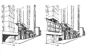 |
|
| B: New blank facades introduced into areas of older, more detailed buildings detract from neighborhood character. | ||
| C: New buildings using textured materials with human scaled proportions are less intrusive in older areas characterized by fine details and scale. | 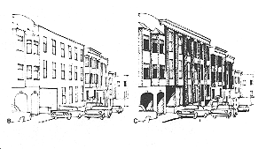 |
|
| D: Visually strong buildings which contrast severely with their surroundings impair the character of the area. | 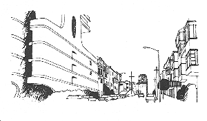 |
|
| 5. |
Preservation of San Francisco's strong and continuous downtown street facades will insure maintenance of that area's distinctive character and spatial quality. A consistent commercial facade on neighborhood shopping streets will give definition to these areas and promote activity. |
|
| 6. | New construction can have a positive effect on the area around it if it reflects the character of adjacent older buildings of architectural merit. | 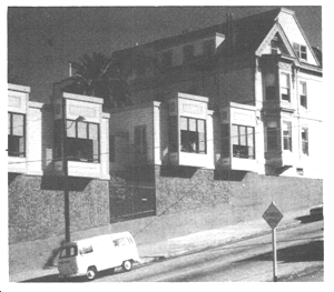 |
| 7. |
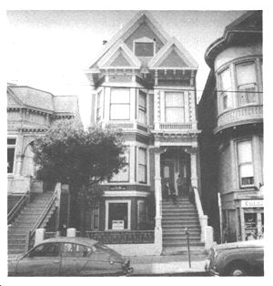
Renovation and restoration of older, well-designedbuildings can preserve the character and interest of the streetscape if the original building design is respected in use of materials and details. On commercial buildings, signs that fit within the architectural order of the facade do not obscure or damage the building's integrity. COMMENT: Renovation of the old White House building includes signs that fit the building's facade. The architectural order of the Lincoln Building is almost totally obscured by signs. |
 |
| 8. |
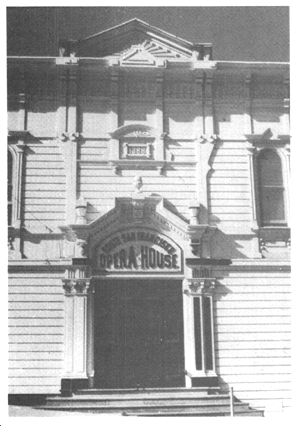
Historic buildings represent crucial links with past events and architectural styles and, when preserved, afford educational, recreational, cultural and other benefits. A: Historic buildings often serve as landmarks and focal points for interest, or orientation and add to a neighborhood's visual image. B: Relatively homogeneous groupings of buildings of architectural and historic merit, such as in Jackson Square, are especially rare and irreplaceable. |
 |
| 9. | Historic buildings and grounds often provide necessary visual open space or passive recreation areas. Open space in the city can be supplemented by enhancing the semi-recreational functions of historic areas.Historic buildings and grounds open to the public can function as a recreational resource. | |
| 10. | Preservation of some older, low and small-scaled buildings and grounds amidst larger building towers will help conserve unique cityscape character, maintain a sense of openness and green space, and produce a more livable environment. | |
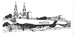
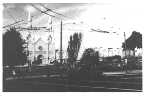
| 11. | Building of parking garages under parks can seriously lessen their natural qualities when the access ramps, air vent and elevator structures and other changes in the park's surface intrude upon the landscape. |
|
| 12. |
Street space provides an important form of public open space, especially in areas of high density that are deficient in other amenities. COMMENT: Alleys and streets in Chinatown and in the Mission district often serve as recreation places. Building in the street would remove this important resource. |
|
| 13. |
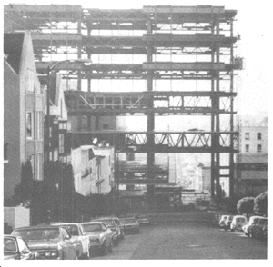
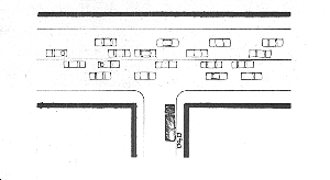
Street space provides light, air, space for utilities and access to property. COMMENT (a): Building development in or over street spaces can reduce light and air. COMMENT (b): Alleys and small street spaces are often one of the few means for trucks and other service vehicles to stop out of the main stream of traffic. Vacation of them could add to the congestion of other city streets. |
|
| 14. |
Street space services as a means to control and regulatethe scale and organization of the future development by: a. protecting against the accumulation of overly large parcels of property under single ownership on which massive buildings could be constructed; and b. indirectly controlling the visual scale and density of development, as well as maintaining continuity of facades. COMMENT: Once vacated, a street space could be built upon to allowable densities. In some critical areas of the city, the addition of dwelling units or floor space on vacated street areas might be acutely felt. |
|
| 15. |
Traditional street patterns and spaces can often be essential to maintaining an appropriate setting for historical and architectural landmarks or areas. COMMENT: Development in the street space abutting historic buildings would destroy the setting. |
|
| 16. | Views from streets can provide a means for orientation and help the observer to perceive the city and its districts more clearly. | |
| 17. | Blocking, construction or other impairment of pleasing street views of the Bay or Ocean, distant hills, or other parts of the city can destroy an important characteristic of the unique setting and quality of the city. | 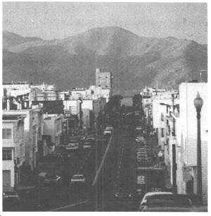 |
Natural Areas
POLICY 2.1
Preserve in their natural state the few remaining areas that have not been developed by man.
Natural areas in the city that remain in their original state are irreplaceable and must not be further diminished. Significant development should not take place in these areas, and facilities necessary to aid in human enjoyment of them should not disturb their visual feeling or natural ecology. Accordingly, parking lots and service buildings should be confined to areas that are already developed, and access pathways should be designed to have a minimum effect upon the natural environment. Where possible, the interior of these natural areas should be out of sight of the developed city.
Lands in public ownership, primarily those of the City and Federal governments, constitute the bulk of these natural areas. Coordinated programs for conservation of both land features and ecology should be carried out, with high priority given to such management functions. Where natural areas are in private ownership, either special incentives or public acquisition should be used to assure a similar degree of preservation.
POLICY 2.2
Limit improvements in other open spaces having an established sense of nature to those that are necessary, and unlikely to detract from the primary values of the open space.
The recreation and open space values of parks and other open and landscaped areas developed by man ought not to be reduced by unrelated or unnecessary construction. These resources are not expected to be increased substantially in future time, whereas the public need for them will surely grow.
Facilities placed in these areas should be of a public nature and should add to rather than decrease their recreation and open space values. Facilities that can be accommodated outside of established parks and open spaces should be placed at other appropriate locations. Where new facilities are necessary in these parks and open spaces, they should be sited in areas that are already partially developed in preference to areas with a greater sense of nature.
Through traffic, parking lots and major buildings should be kept out of established parks and open spaces where they would be detrimental to recreation and open space values. Parking garages and other facilities should not be placed beneath the surface in these areas unless the surface will retain its original contours and natural appearance. Realignment of existing trafficways in these areas should avoid destruction of natural features and should respect the natural topography with a minimum of cutting and filling. The net effect of any changes in parks and open spaces should be to enhance their visual qualities and beneficial public use.
POLICY 2.3
Avoid encroachments on San Francisco Bay that would be inconsistent with the Bay Plan or the needs of the city's residents.
The filling of San Francisco Bay over more than a century has already reduced the size of the Bay and the quality and extent of its natural shoreline below acceptable limits. Further filling and replacement of filled areas should be severely limited to cases in which there are strong public purposes to be served and clear opportunities for increased public use and enjoyment of the Bay and its shoreline. These basic policies have been established on a regional basis by the San Francisco Bay Plan.
Development on the Bay shoreline should be related both to the water of the Bay and to the uses and activities that occur inland. Specific plans for sectors of the shoreline adopted by the City should govern the urban design aspects of detailed development, and should emphasize access to the Bay by the city's residents.
Access to the Bay should be considered as a total system in which a maximum of communication with the water is made possible consistent with other shoreline uses. Access includes physical contact with the water and the shore at recreation areas, and it also includes visual contact through views of the water and of water-related activities. The system of access requires careful review of development and land use at the water's edge, and similar review of projects further inland that will affect physical and visual contact with the water.
Richness of Past Development
POLICY 2.4
Preserve notable landmarks and areas of historic, architectural or aesthetic value, and promote the preservation of other buildings and features that provide continuity with past development.
Older buildings that have significant historical associations, distinctive design or characteristics exemplifying the best in past styles of development should be permanently preserved. The efforts of the Landmarks Preservation Advisory Board should be supported and strengthened, and a continuing search should be made for new means to make landmarks preservation practical both physically and financially.
Criteria for judgment of historic value and design excellence should be more fully developed, with attention both to individual buildings and to areas or districts. Efforts for preservation of the character of these landmarks should extend to their surroundings as well. Preservation measures should not, however, be entirely bound by hard-and-fast rules and labels, since to some degree all older structures of merit are worthy of preservation and public attention. Therefore, various kinds and degrees of recognition are required, and the success of the preservation program will depend upon the broad interest and involvement of property owners, improvement associations and the public at large.
POLICY 2.5
Use care in remodeling of older buildings, in order to enhance rather than weaken the original character of such buildings.
Although the Landmarks Preservation Advisory Board and other agencies have certain powers relative to the exterior remodeling of designated landmarks, the problem of detrimental remodelings is far broader. The character and style of older buildings of all types and degrees of merit can be needlessly hidden and diminished by misguided improvements. Architectural advice, and where necessary and feasible the assistance of public programs, should be sought in order to assure than the richness of the original design and its materials and details will be restored Care in remodelings should be exercised in both residential and commercial areas. Along commercial streets, the signs placed on building facades must be in keeping with the style and scale of the buildings and street, and must not interfere with architectural lines and details. Compatible signs require the skills of architects and graphics designers. In commercial areas as well as residential neighborhoods, the interest and participation of property owners and occupants should be enlisted in these efforts to retain and improve design quality.
POLICY 2.6
Respect the character of older development nearby in the design of new buildings.
Similar care should be exercised in the design of new buildings to be constructed near historic landmarks and in older areas of established character. The new and old can stand next to one another with pleasing effects, but only if there is a similarity or successful transition in scale, building form and proportion. The detail, texture, color and materials of the old should be repeated or complemented by the new.
Often, as in the downtown area and many district centers, existing buildings provide strong facades that give continuous enclosure to the street space or to public plazas. This established character should also be respected. In some cases, formal height limits and other building controls may be required to assure that prevailing heights or building lines or the dominance of certain buildings and features will not be broken by new construction.
POLICY 2.7
Recognize and protect outstanding and unique areas that contribute in an extraordinary degree to San Francisco's visual form and character.
All areas of San Francisco contribute in some degree to the visual form and image of the city. All require recognition and protection of their significant positive assets. Some areas may be more fortunately endowed than others, however, with unique characteristics for which the city is famous in the world at large. Where areas are so outstanding, they ought to be specially recognized in urban design planning and protected, if the need arises, from inconsistent new development that might upset their unique character.
These areas do not have buildings of uniform age and distinction, or individual features that can be readily singled out for preservation. It is the combination and eloquent interplay of buildings, landscaping, topography and other attributes that makes them outstanding. Furthermore, the participation of neighborhood associations in these areas in a cooperative effort to maintain the established character, beyond the scope of public regulation, is essential to the long-term image of the areas and the city.
Special Characteristics Of Outstanding And Unique Areas
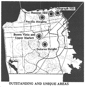
TELEGRAPH HILL
-
A hilltop park with the highly visible green of trees from which Coit Tower rises above all else.
-
Low, small-scale buildings having predominantly flat roofs and light pastel colors, hugging the topography in a highly articulated form which contrasts with the power of downtown construction.
-
Cliffs and complex stairs and walkways on the east side above the waterfront, with buildings perched precariously along the slope and trees interspersed.
-
Intimate pedestrian scale and texture of streets and housing, with sudden and dramatic views of the Bay and downtown through narrow openings.
RUSSIAN HILL
-
A harmonious, balanced relationship of low, small-scale older buildings and tall, slender towers. Increasing height of buildings toward the top that emphasizes the hill form and sets Russian Hill apart from other high areas to the south and west.
-
Varied and well-tended landscaping in parks, yards and streets that provides a rich background for the buildings and a cascading effect on the slopes.
-
Highly detailed buildings and many retaining walls that articulate the hill and provide warmth of color.
PACIFIC HEIGHTS
-
A sequence of building heights rising steadily up the north slope to the top of the ridge. Emphasis of this sequence, and of the contrasts of low and high buildings, by the dark colors of trees and houses at the base of lighter apartment towers.
-
Outstanding Bay views down streets and across the formally landscaped grounds of detached houses.Spacious and distinguished residences with richness of detail and materials, including works of outstanding architects and excellent examples of the Victorian period.
-
Well-landscaped and well-proportioned street areas, with building setbacks and fine details in stairways, fences and paving patterns.
BUENA VISTA AND UPPER MARKET
-
Exceptional variety produced by differences in street patterns across an uneven chain of hills, and a diverse mixture of building styles and roof types.
-
A finely scaled building pattern of small wall surfaces and pastel colors, with highly visible planting on steep slopes.
-
Hilltop parks easily seen from below, with excellent views of the city from a central location.
-
Houses of varied sizes and individual forms having interesting setbacks, cornices and bay windows, many of notable architectural quality.
DOLORES HEIGHTS
-
A uniform scale of buildings, mixed with abundant landscaping in yards and steep street areas.
-
Rows of houses built from nearly identical plans that form complete or partial block frontages, arranged on hillside streets as a stepped-down series of flat or gabled roofs.
-
Building setbacks with gardens set before Victorian facades and interesting entryways.
Street Space
POLICY 2.8
Maintain a strong presumption against the giving up of street areas for private ownership or use, or for construction of public buildings.
Street areas have a variety of public values in addition to the carrying of traffic. They are important, among other things, in the perception of the city pattern, in regulating the scale and organization of building development, in creating views, in affording neighborhood open space and landscaping, and in providing light and air and access to properties.
Like other public resources, streets are irreplaceable, and they should not be easily given up. Short-term gains in stimulating development, receipt of purchase money and additions to tax revenues will generally compare unfavorably with the long-term loss of public values. The same is true of most possible conversions of street space to other public uses, especially where construction of buildings might be proposed. A strong presumption should be maintained, therefore, against the giving up of street areas, a presumption that can be overcome only by extremely positive and far-reaching justification.
The best example of an extremely positive justification may be where below grade public rights-of-way could be used for housing-related utilities. In cases where the typical provision of housing-related utilities within a building would reduce space for housing and deaden streetlife, consider allowing the use of the below ground public rights-of-way in a manner consistent with the public interest.
POLICY 2.9
Review proposals for the giving up of street areas in terms of all the public values that streets afford.
Every proposal for the giving up of public rights in street areas, through vacation, sale or lease of air rights, revocable permit or other means, shall be judged with the following criteria as the minimum basis for review:
a. No release of a street area shall be recommended which would result in:
-
Detriment to vehicular or pedestrian circulation;
-
Interference with the rights of access to any private property;
-
Inhibiting of access for fire protection or any other emergency purpose, or interference with utility lines or service without adequate reimbursement;
-
Obstruction or diminishing of a significant view, or elimination of a viewpoint; industrial operations;
-
Elimination or reduction of open space which might feasibly be used for public recreation;
-
Elimination of street space adjacent to a public facility, such as a park, where retention of the street might be of advantage to the public facility;
-
Elimination of street space that has formed the basis for creation of any lot, or construction or occupancy of any building according to standards that would be violated by discontinuance of the street;
-
Enlargement of a property that would result in (i) additional dwelling units in a multi-family area; (ii) excessive density for workers in a commercial area; or (iii) a building of excessive height or bulk;
-
Reduction of street space in areas of high building intensity, without provision of new open space in the same area of equivalent amount and quality and reasonably accessible for public enjoyment;
-
Removal of significant natural features, or detriment to the scale and character of surrounding development.
-
Adverse effect upon any element of the General Plan or upon an area plan or other plan of the Department of City Planning; or
-
Release of a street area in any situation in which the future development or use of such street area and any property of which it would become a part is unknown.
b. Release of a street area may be considered favorably when it would not violate any of the above criteria and when it would be:
-
Necessary for a subdivision, redevelopment project or other project involving assembly of a large site, in which a new and improved pattern would be substituted for the existing street pattern;
-
In furtherance of an industrial project where the existing street pattern would not fulfill the requirements of modern industrial operations;
-
Necessary for a significant public or semi-public use, or public assembly use, where the nature of the use and the character of the development proposed present strong justifications for occupying the street area or air space, such as a public pedestrian connection from the Transbay Transit Center rooftop park to adjacent buildings, rather than some other site;
-
For the purpose of permitting a small-scale pedestrian crossing consistent with the principles and policies of The Urban Design Element; or
-
In furtherance of the public values and purposes of streets as expressed in The Urban Design Element and elsewhere in the General Plan.
POLICY 2.10
Permit release of street areas, where such release is warranted, only in the least extensive and least permanent manner appropriate to each case.
In order to avoid the unnecessary permanent loss of streets as public assets, methods of release short of total vacation should be considered in cases in which some form of release is warranted. Such lesser methods of release permit later return of the street space to street purposes, and allow imposition of binding conditions as to development and use of the street area.
Mere closing of the street to traffic should be used when it will be an adequate method of release. Temporary use of the street should be authorized when permanent use is not necessary. A revocable permit should be granted in preference to street vacation. And sale or lease of air rights should be authorized where vacation of the City's whole interest is not necessary for the contemplated use. In any of these lesser transactions, street areas should be treated as precious assets which might be required for unanticipated public needs at some future time.
Major New Development
Human Needs
Much of the characteristic pattern of San Francisco has remained the same, and yet change is continuous. New development stands out because it is new and because it is different — sometimes quite different from what the city has known before. The effect upon the pattern of the city and its neighborhoods is often auspicious, but at times it is not. As rebuilding occurs, there may be changes in the city's essential qualities.
The fitting in of new development is, in a broad sense, a matter of scale. It requires a careful assessment of each building site in terms of the size and texture of its surroundings, and a very conscious effort to achieve balance and compatibility in the design of the new building. Good scale depends upon a height that is consistent with the total pattern of the land and of the skyline, a bulk that is not overwhelming, and an overall appearance that is complementary to the building forms and other elements of the city. Scale is relative, therefore, since the height, bulk and appearance of past development differ among the districts of the city.
People in San Francisco are accustomed to a skyline and streetscape of buildings that harmonize in color, shape and details. Much effort has been made in the past to relate each new building to its neighbors at both upper and lower levels, and to avoid jarring contrasts that would upset the city pattern. Special care has been accorded the edges of distinct districts, where transitions in scale are especially important. By tradition in San Francisco, as in other great cities of the world, unusual building forms and monumental scale have been reserved for buildings with the greatest significance to the community. These buildings characterize the mood and institutions of the city, and by their quality and nature express the city's aspirations to the world at large.
In questions of scale, the height of buildings haws received the greatest and most continuous public attention. San Francisco has established the most extensive system of legislated height controls in any American city, expressing its concern over building height in this manner since as early as 1927. Nevertheless, a citywide plan for building height has not existed prior to this time, and both residents and visitors have experienced stress and concern at the prospect that the appearance of the skyline may continue to change rapidly without further direction.
Tall buildings are a necessary and expressive form for much of the city's office, apartment, hotel and institutional development. These buildings, as soaring towers in a white city, connote the power and prosperity of man's modern achievements. They make economical use of land, offer fine views to their occupants, and can permit efficient deployment of public services. In recent times, however, new pressures upon the design of these buildings have been produced by increases in technical construction capabilities, in demands for large blocks of floor space, in the breadth of financing methods, and in the image-consciousness of major business firms. As each building becomes larger and the whole city becomes more intensively developed, the challenges for urban design are multiplied.
Exceptional height can have either positive or negative effects upon the city pattern and the nearby environment. A building that is well designed in itself will help to reinforce the city's form if it is well placed, but the same building at the wrong location can be utterly disruptive.
If properly placed, tall buildings can enhance the topographic form and existing skyline of the city. They can orient the traveler by helping to clarify his route and identify his destination. Building height can define districts and centers of activity. These advantages can be achieved without blocking or reduction of views from private properties, public areas or major roadways, if a proper plan for building height is followed. Such a plan must weigh all the advantages and disadvantages of height at each location in the city, and must take into account appropriate established patterns of building height and scale, seeking for the most part to follow and reinforce those patterns. Such a plan must also be applied with recognition of the functional and economic needs for space in major centers for offices, high density apartments, hotels and institutions providing public services.
The remaining aspect of building scale to be considered is that of bulk, or the apparent massiveness of a building in relation to its surroundings. A building may appear to have great bulk whether or not it is of extraordinary height, and the result can be a blocking of near and distant views and a disconcerting dominance of the skyline and the neighborhood. The users of modern building space may find these bulky forms more efficient, and the forms may seem logical for combining several uses in a single development, but such considerations do not measure the external effects upon the city. Neither height limits nor limits upon the amounts of floor space permitted will directly control excessive bulk, and therefore specific attention to this problem is called for.
The apparent bulk of a building depends primarily upon two factors: the amount of wall surface that is visible, and the degree to which the structure extends above its surroundings. Accordingly, a plan seeking to avoid excessive bulkiness must consider the existing scale of development in each area of the city and the effects of topographic form in exposing building sites to widespread view.
The largest potential building sites present the greatest problems and challenges for moderation of building form. On these sites, normal controls over the form and intensity of construction that are intended primarily for smaller sites have less precision, and the external effects of large developments upon the surrounding area and upon the city may be far greater. The stakes are high for both the developers and the future of the city, with a resulting tendency toward controversy and frustration, and unfortunate divisive effects in the community. For these reasons, the larger sites require separate and more intensive consideration in policies relating to building form.
OBJECTIVE 3
MODERATION OF MAJOR NEW DEVELOPMENT TO COMPLEMENT THE CITY PATTERN, THE RESOURCES TO BE CONSERVED, AND THE NEIGHBORHOOD ENVIRONMENT.
As San Francisco grows and changes, new development can and must be fitted in with established city and neighborhood patterns in a complementary fashion. Harmony with existing development requires careful consideration of the character of the surroundings at each construction site. The scale of each new building must be related to the prevailing height and bulk in the area, and to the wider effects upon the skyline, views and topographic form. Designs for buildings on large sites have the most widespread effects and require the greatest attention.
Fundamental Principles for Major New Development
These fundamental principles and their illustrations reflect the needs and characteristics with which this Plan is concerned, and describe measurable and critical urban design relationships in major new development.
| 1. |
The relationship of a building's size and shape to its visibility in the cityscape, to important natural features and to existing development determines whether it will have a pleasing or a disruptive effect on the image and character of the city. A. Tall, slender buildings near the crown on a hill emphasize the form of the hill and preserve views. B. Extremely massive buildings on or near hills can overwhelm the natural land forms, block views, and generally disrupt the character of the city. C. Low, smaller-scale buildings on the slopes of hills, at their base and in the valleys between complement topographic forms and permit uninterrupted views. D. Low buildings along the waterfront contribute to the gradual tapering of height from hilltops to water that is characteristic of San Francisco and allows views of the Ocean and the Bay. Larger buildings with civic importance, as evidenced by a vote of the people, providing places of public assembly and recreation may be appropriate along the waterfront at important locations. E. Larger, taller buildings can blend pleasantly with small-scaled areas if the change in scale is not excessive and if their form or surface pattern is articulated to reflect the existing scale. |
|
| 2. |
Building siting and massing with respect to street pattern influence the quality of views from street space. A. Tall buildings on the tops of hills allow clear views down streets. B. Tall buildings on slopes of hills severely restrict views from above. |
 |
| 3. | Clustering of larger, taller buildings at important activity centers (such as major transit stations) can visually express the functional importance of these centers. |
|
| 4. | The relationship between areas of low, fine-scaled buildings and areas of high, large-scaled buildings can be made more pleasing if the transition in building height and mass between such areas is gradual. | |
| 5. | Taller or more visually prominent buildings can provide orientation points and increase the physical distinction, variety and contrast of large areas with similar streets and buildings, particularly areas of unrelieved monotony. |
|
| 6. |
When highly visible buildings are light in color, they reinforce the visual unity and special character of the city. 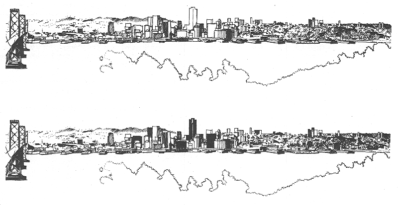
|
|
| 7. | Buildings which meet the ground and reflect the slope of the hill relate to the land form. | |
| 8. | The use of unusual shapes for tall office, hotel or apartment buildings detracts from the clarity of urban form by competing for attention with buildings of greater public significance. The juxtaposition of several such unusual shapes may create visual disorder. | |
| 9. |
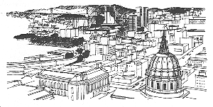
Unique building forms can appropriately signify major community facilities. COMMENT: The distinctive forms of City Hall and St. Mary's Cathedral clearly indicate their public importance. |
 |
| 10. |
Major public buildings of symbolic importance may be appropriately located in highly visible settings. COMMENT: Major public buildings have traditionally been placed at the focus of axial street views, provided they do not block city views. |
|
| 11. |
A building situated in a visually dominant position, whose exterior is blank and uninteresting, does not relate to surrounding development and tends to repel the observer's attention. COMMENT: The exposed location and extensive, uninterrupted mass of the San Francisco College for Women dormitory produce a discordant form relationship to other college buildings, to the hill and top of the immediate vicinity. |
|
| 12. |
A long or wide building becomes excessively bulky in appearance when its height significantly exceeds that of buildings in the surrounding area. COMMENT: While the Federal Office Building is similar in length and width to many large buildings nearby, it exceeds the prevailing building heights and is a discordant element in the skyline. |
|
| 13. | A bulky building creates the most visual disruption when seen from a distance as the dominant silhouette against a background and/or foreground of much smaller structures. | 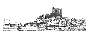 |
| 14. |
Bulky buildings that intrude upon or block important views of the Bay, Ocean or other significant citywide focal points are particularly disruptive. COMMENT: The Fontana Apartments, near the waterfront, block many public and private views of the Bay and Marin County. |
|
| 15. |
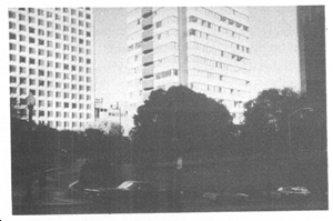
Plazas or parks located in the shadows cast by large buildings are unpleasant for the user. A. Large buildings can be oriented to minimize shadows falling on public or semi-public open spaces. B. The height and mass of tall, closely packed buildings can be shaped to permit sunlight to reach open spaces. |
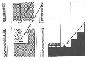
|
| 16. | Corner plazas can be pleasing if the streets are not excessively wide and if surrounding properties are developed with buildings that define the space well. | |
| 17. | Elevated pedestrian levels in large developments, if they relate visually and functionally to the street-level pedestrian system, are easy to find and use and contribute to the consistency of development. A clearly expressed transition from an elevated pedestrian system to the sidewalk ties the two systems together visually and functionally. |
|
| 18. |
Buildings of a uniform height provide good spatial definition of larger public squares or plazas. Larger public open spaces surrounded by irregular buildings are poorly defined. |
 |
Visual Harmony
POLICY 3.1
Promote harmony in the visual relationships and transitions between new and older buildings.
New buildings should be made sympathetic to the scale, form and proportion of older development. This can often be done by repeating existing building lines and surface treatment. Where new buildings reach exceptional height and bulk, large surfaces should be articulated and textured to reduce their apparent size and to reflect the pattern of older buildings.
Although contrasts and juxtapositions at the edges of districts of different scale are sometimes pleasing, the transitions between such districts should generally be gradual in order to make the city's larger pattern visible and avoid overwhelming of the district of smaller scale. In transitions between districts and between properties, especially in areas of high intensity, the lower portions of buildings should be designed to promote easy circulation, good access to transit, good relationships among open spaces and maximum penetration of sunlight to the ground level.
In new, high-density residential areas outside of the downtown core where towers are being contemplated as part of comprehensive neighborhood planning efforts, such towers should be slender and widely spaced among buildings of lesser height to allow ample sunlight, sky exposure and views to streets and public spaces. It is thus to be expected that some tall buildings will be located adjacent to buildings of significantly lower height. This, does not in itself, create disharmony or poor transitions, but is in fact necessary in order to achieve important neighborhood-wide livability goals. Because these areas are outside of the downtown core, stricter standards than exist in the downtown core for tower bulk and spacing should be established to minimize the bulk of towers and set minimum tower spacing. It is especially important that towers have active ground floors and that lower stories are highly articulated at and below the podium height and engage the pedestrian realm, with multiple building entrances, townhouses, retail, and neighborhood services. (See Map 4.)
POLICY 3.2
Avoid extreme contrasts in color, shape and other characteristics which will cause new buildings to stand out in excess of their public importance.
Large buildings are most consistent with the visual unity of the city when they are light in color. The characteristics of San Francisco's climate and the varied effects of sunlight through the day in clear and fog-filled skies make bright but subtle hues a life-giving element in the skyline. Prominent new buildings should reflect this pattern.
Buildings of unusual shape stand out in the skyline. They call attention to themselves and correspondingly reduce the visual significance of other features in the city pattern. Such buildings may also create a jarring disharmony that counteracts the traditional blending of regular rectilinear forms in the San Francisco skyline. Unusual shapes, especially in large buildings, should therefore be reserved for structures of broad public significance such as those providing community-wide services.
POLICY 3.3
Promote efforts to achieve high quality of design for buildings to be constructed at prominent locations.
Certain buildings will achieve prominence, whatever their design, because of their exposed locations. Among such locations are those at tops of hills; those fronting on permanent open space such as the Bay, parks, plazas and areas with height limits; those facing wide streets or closing the vista at the end of a street; and those affording a silhouette against the sky, a muted background or a formal order such as in the Civic Center.
At locations of such prominence, the quality of building design is of special significance, and special efforts should be made to promote the best architectural solutions in both public and private buildings. In such solutions, the positive potentials of the site should be emphasized.
Height and Bulk
POLICY 3.4
Promote building forms that will respect and improve the integrity of open spaces and other public areas.
New buildings should not block significant views of public open spaces, especially large parks and the Bay. Buildings near these open spaces should permit visual access, and in some cases physical access, to them.
Buildings to the south, east and west of parks and plazas should be limited in height or effectively oriented so as not to prevent the penetration of sunlight to such parks and plazas. Larger squares and plazas will benefit, in addition, from uniform facade lines and cornice heights around them which will visually contain the open space.
Large buildings and developments should, where feasible, provide ground level open space on their sites, well situated for public access and for sunlight penetration. The location and dimensions of such open space should be carefully considered with respect to the placement of other buildings and open spaces in the area, and with respect to the siting and functioning of the building with which it is provided. Where separation of pedestrian and vehicular circulation levels is possible in provision of such open space, such separation should be considered.
POLICY 3.5
Relate the height of buildings to important attributes of the city pattern and to the height and expression of existing development.
The height of new buildings should take into account the guidelines expressed in this Plan. These guidelines are intended to promote the objectives, principles and policies of the Plan, and especially to complement the established city pattern. They weigh and apply many factors affecting building height, recognizing the special nature of each topographic and development situation.
Tall, slender buildings should occur on many of the city's hilltops to emphasize the hill form and safeguard views, while buildings of smaller scale should occur at the base of hills and in the valleys between hills. In other cases, especially where the hills are capped by open spaces and where existing hilltop development is low and small-scaled, new buildings should remain low in order to conserve the natural shape of the hill and maintain views to and from the open space. Views along streets and from major roadways should be protected. The heights of buildings should taper down to the shoreline of the Bay and Ocean, following the characteristic pattern and preserving topography and views.
Tall buildings should be clustered downtown and at other centers of activity to promote the efficiency of commerce, to mark important transit facilities and access points and to avoid unnecessary encroachment upon other areas of the city. Such buildings should also occur at points of high accessibility, such as rapid transit stations in larger commercial areas and in areas that are within walking distance of the downtown's major centers of employment. In these areas, building height should taper down toward the edges to provide gradual transitions to other areas.
In areas of growth where tall buildings are considered through comprehensive planning efforts, such tall buildings should be grouped and sculpted to form discrete skyline forms that do not muddle the clarity and identity of the city's characteristic hills and skyline. Where multiple tall buildings are contemplated in areas of flat topography near other strong skyline forms, such as on the southern edge of the downtown "mound," they should be adequately spaced and slender to ensure that they are set apart from the overall physical form of the downtown and allow some views of the city, hills, the Bay Bridge, and other elements to permeate through the district.
The city's downtown skyline should be crafted to resemble a distinct and elegant hill form with the tallest and most prominent building rising as it's "crown." As the geographic epicenter of downtown, as well as the front door of the Transbay Transit Center, the "Transit Tower" should be the tallest building in the city's skyline. The Transit Tower represents the City's commitment to focusing growth around a sustainable transportation hub, as well as the apex of the downtown skyline. The Transit Center District Sub-Area Plan contains specific details related to urban form and design for this area.
The prevailing height limits for the "fabric" of most residential neighborhoods in the City should generally range from four to six stories dependent on location. Parcels lining commercial and transit corridors and in denser mixed-use areas should generally be permitted at a minimum of six to eight stories. Parcels with certain conditions may warrant buildings at the higher ends of these ranges, such as wider streets, proximity to more significant transit infrastructure, being located on a corner, being larger than standard sized parcels, or other conditions. Buildings taller than eight stories should be considered along segments of certain major transit corridors, the intersection ofmaior corridors, and closest to major centers of employment and community services which themselves produce significant building height, and at locations where more height will encourage social and commercial activity and achieve visual interest consistent with other neighborhood considerations. At outlying and other prominent locations, the point tower form (slender in shape with a high ratio of height to width) should be used in order to avoid interruption of views, casting of extensive shadows or other negative effects. In all cases, the height and expression of existing development should be considered.
The guidelines in this Plan express ranges of height that are to be used as an urban design evaluation for the future establishment of specific height limits affecting both public and private buildings. For any given location, urban design considerations indicate the appropriateness of a height coming within the range indicated. The guidelines are not height limits, and do not have the direct effect of regulating construction in the city.
POLICY 3.6
Relate the bulk of buildings to the prevailing scale of development to avoid an overwhelming or dominating appearance in new construction.
When buildings reach extreme bulk, by exceeding the prevailing height and prevailing horizontal dimensions of existing buildings in the area, especially at prominent and exposed locations, they can overwhelm other buildings, open spaces and the natural land forms, block views and disrupt the city's character. Such extremes in bulk should be avoided by establishment of maximum horizontal dimensions for new construction above the prevailing height of development in each area of the city.
The guidelines for building bulk expressed in this Plan are intended to form an urban design basis for such regulation. These guidelines favor relatively slender construction above prevailing heights, but would not limit the horizontal dimensions of buildings below those heights. Generally speaking, the guidelines would not limit the total floor space that could be built, but would help to shape it to avoid negative external effects. If two or more towers are to be built on a single property, their total effect should be considered and a significant separation should be required between them. The precise form of the building or buildings would in large measure be left to the individual developer and his architects under these guidelines.
The guidelines of this Plan for building bulk are only minimum guidelines, and they are not intended to reduce the necessity for other expressed policies pertaining to height, visual harmony or other factors. Even with building bulk kept within these guidelines, efforts should be made to articulate and soften building surfaces to reduce the massiveness of appearance to a great degree.
Maximum Plan Dimension: The greatest horizontal dimension along any wall of the building, measured at a height corresponding to the prevailing height of other development in the area.
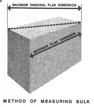
Maximum Diagonal Plan Dimension: The horizontal dimension between the two most separated points on the exterior of a building, measured at a height corresponding to the prevailing height of other development in the area.
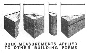
Large Land Areas
POLICY 3.7
Recognize the special urban design problems posed in development of large properties.
The larger a potential site for development, the greater are apt to be the size and variety of the urban design questions raised. Larger sites may mean greater visual prominence of development and greater impact upon the city pattern. As more land area is included in a single project, the possibilities are increased that the public resources in natural areas, historic buildings and street space will be affected. Larger developments also have substantial requirements for public services, including transportation.
Under normal land use controls, most large development is governed by a "floor area ratio", which permits floor space to be built in each project in proportion to the amount of land area available. The floor area ratio limit tends to be geared to development of sites of small and moderate size, but not to take account of the impact of occasional developments that take up one or more whole blocks of land. Such developments, under this type of formula, may have a single building of truly massive proportions, or a series of building forms constructed in one or more phases.
These differences in nature and impact require that large sites be given close consideration in urban design planning.
POLICY 3.8
Discourage accumulation and development of large properties, unless such development is carefully designed with respect to its impact upon the surrounding area and upon the city.
The height and bulk guidelines of this Plan will help to some extent in reducing the negative effects of development on large sites. They will not, however, deal with all the special problems raised or guarantee good quality of design.
Other measures are available and may be necessary. In some cases, ordinary zoning restrictions might be tightened, or rezoning to permit a large development might be deferred in the absence of adequate assurances of compatible development. New standards might be added to require open space in large projects, and floor area ratios might be reduced or made less advantageous for larger sites.
Because government involvement often occurs as larger sites are developed, through marketing of the site itself, through redevelopment powers, through vacation of streets or in some other manner, the government role might be made more restrictive in such involvement.
There is no substitute, however, for early and frequent communication as to the merits and design of a proposed project between the developer and his architects on the one hand and public urban design professionals and interested citizens on the other. Such communication will give an early and more reasoned assessment of the positive and negative effects of the project upon the city and the surrounding area, and will reduce the chances of later delays and controversies. Processes toward these ends should be employed for all major projects in the city.
POLICY 3.9
Encourage a continuing awareness of the long-term effects of growth upon the physical form of the city.
Development of large properties, by condensing growth and change in certain areas of the city, emphasizes the effects that long-term growth and change can have upon the physical makeup of San Francisco. There is nothing in the nature of cities that will guarantee the continued livability of this or any other city. The citizens of San Francisco have an uncommon awareness that the environment is finite, and that the advantages of greater size and intensity may have ultimate limits.
That awareness is healthy and progressive and should be fostered. It should be given new outlets to help shape the physical form of the city. As in this Urban Design Plan, it can identify the attributes of the city that need to be protected and enhanced. Good planning, supported by an interested public, can channel growth to the right places in the city, build growth around previously established transportation systems and other services, cause other public costs to be borne in part by the developers who benefit from them, and hold in place the natural regulators of growth such as streets and open spaces. Above all, it can and should control the form of individual buildings so that they will be compatible with the character of the city.
More should be known as to the long term effects of growth in San Francisco. These effects and the means for moderating them should be studied in a rational manner through the normal processes of planning, and none of the important factors should be overlooked. Ultimately, certain limits upon total growth may prove to be necessary if the integrity of the city is to be preserved.
Neighborhood Environment
Human Needs
The people of San Francisco are the city's reason for being and its hope for the future. Most residents live in areas that can be characterized as distinct neighborhoods, and the quality of these neighborhoods has a strong effect upon their personal outlook. Neighborhood quality is of overriding importance to the individual, since the most basic human needs must be satisfied close to home. The long-term future of the city's entire physical environment may also depend upon good neighborhoods, because only when they find satisfaction in their own areas can residents freely turn their attention to matters affecting the larger community.
There is no great difference of opinion as to what makes a neighborhood a good place to live from an urban design standpoint: people wish to have a tolerable and comfortable living environment, safe and free from stress, and the elements that make up such an environment are easily described. People also wish to know that their neighborhoods will be guarded against physical deterioration, and that any elements they consider deficient are likely to be improved. Because neighborhood quality is defined in the residents' own terms, the neighborhood environment will be better if residents participate in the planning of local improvements.
Studies show that the outstanding concerns of people today in their neighborhood environment are matters of health and safety. Traffic is the leading issue, with automobiles moving through residential areas in large volumes and at high speeds, producing noise and pollutants and putting pedestrians in constant danger. With each increase in traffic the streets become less a part of the living environment and more a world of their own. Residents find the streets unsafe and unpleasant, and try to shut them out.
The quality of neighborhood maintenance is also of major concern. A sense of pride and satisfaction requires that all parts of the local environment be well maintained: streets, parks, public buildings, neighbors' properties, and especially one's own house and yard. When the area is well kept and has visual qualities that distinguish it from other areas, a resident has a feeling of neighborhood that gives him a sense of being at home though he may be a block or more from his dwelling.
Another element of good neighborhoods is the presence of open space and recreation opportunities. The most satisfying recreation space is close by and visible, with a feeling of nature and a variety of facilities for all age groups. Such recreation space may be found on private properties, in neighborhood parks, along the sidewalks and in undeveloped street areas. On a citywide scale, larger recreation facilities that require travel away from home provide an even greater variety of opportunities. On this larger scale, the shoreline of San Francisco Bay has a potential that is not fully used.
There are many other elements that can bring amenity to the neighborhood environment. Planting in streets and yards, well designed and well cared for, adds immeasurably to the visual quality of an area, softening and complementing the hard appearance of pavement and buildings. Continuous building facades and generous sidewalks with interesting details establish a pleasant mood for the pedestrian. Freedom from the clutter of open parking lots, large signs and overhead wires can also make the difference between an agreeable living environment and one that is disquieting or even blighted.
With respect to the many improvements in environment that can be made by public and private actions, the needs of the city's neighborhoods are by no means uniform. Some neighborhoods have serious deficiencies in one or more elements affecting neighborhood quality, while others are more fortunate. Some neighborhoods have greater needs because their residents live in conditions of greater density, or because the residents include more children and older people who tend to live within a smaller world in which the resources close at hand are the most important. People of low income, too, especially renters who have little direct role in maintaining their own physical environment, have special needs that characterize certain neighborhoods where the danger of physical decline is already very apparent.
These differences in neighborhoods point up the need to establish priorities in the programs that will stabilize and improve the local environment. Where serious physical deficiencies already exist, and where the density, age and economic status of residents indicate special needs, the neighborhoods require immediate and continuing assistance. Of equal importance, however, are many other areas that may be on the verge of physical decline. These other areas require priority because the residents' fear of change may contribute as much as any other factor to real deterioration, and such fear can be overcome by visible efforts to stabilize the neighborhood. Once lost, the existing resources in any neighborhood can be restored only through great expense and dislocation. The programs relating to neighborhood environment should, therefore, be designed both to hold neighborhood quality at its present levels and to improve deficient areas that do not enjoy the fine attributes of other parts of San Francisco.
OBJECTIVE 4
IMPROVEMENT OF THE NEIGHBORHOOD ENVIRONMENT TO INCREASE PERSONAL SAFETY, COMFORT, PRIDE AND OPPORTUNITY
San Francisco draws much of its strength and vitality from the quality of its neighborhoods. Many of these neighborhoods offer a pleasant environment to residents of the city, while others have experienced physical decline and still others have never enjoyed some of the amenities common to the city as a whole. Measures must be taken to stabilize and improve the health and safety of the local environment, the psychological feeling of neighborhood, the opportunities for recreation and other fulfilling activities, and the small-scale visual qualities that make the city a comfortable and often exciting place in which to live.
Fundamental Principles for Neighborhood Environment
These fundamental principles and their illustrations reflect the needs and characteristics with which this Plan is concerned, and describe measurable and critical urban design relationships in the neighborhood environment.
| 1. | The livability, amenity and character of residential areas are greatly enhanced by trees, more so than by any other single element. |
|
| 2. | In areas where houses have no front yards, a sense of nature can be provided by planting in the sidewalk area. COMMENT: Front yards (setbacks) are not required in many parts of the city. This results in rows of buildings adjacent to the sidewalk. At times it creates a pleasing sense of enclosure; but the result can be rather bleak and monotonous when the street is unrelieved by landscaping or the buildings lack visual interest. A few large trees or other street landscaping can add a needed sense of nature and variety. |
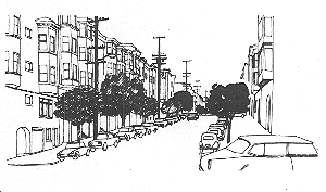 |
| 3. |
The use of appropriate plant material, and careful consideration of environmental factors in the design of landscaping and open space, contribute to a neighborhood's identity and improve its environmental quality. COMMENT (a): Areas of poor environmental quality can often be improved by the addition of benches, trees, shrubs, and textured paving. A "vest-pocket" park in a dead-end service court in Chinatown is one potential form for such improvement. COMMENT (b): Landscaping can screen residences from commercial or industrial activities, such as by reducing the glare of lights at gas stations and parking lots. COMMENT (c): Windbreaks can make open spaces more pleasant and usable in windy areas. The sunning area at Phelan State Beach is a good example. COMMENT (d): A consistent and attractive neighborhood landscaping theme can be established, such as the flowering street trees on Edgewood Avenue. COMMENT (e): Open space that contains facilities desired by the residents, and that is designed when possible with local participation, is more likely to be used and cared for by local residents. |
|
| 4. | Open space and landscaping can give neighborhoods an identity, a visual focus and a center for activity. COMMENT (a): Dolores Street has a special identity because its median is consistently planted with large, distinctive palm trees. |
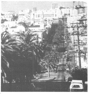 |
| 5. | COMMENT (b): Mission Park and Washington Square are examples of open spaces that are both centers for activity and features giving identity to the surrounding area. Street rights-of-way on hills too steep for cars or not needed for traffic use are useless for people if covered with concrete. They can be modified to provide useful and attractive open space. |
|
| 6. |
Wide, generous sidewalk areas provide opportunities for outdoor recreation and pedestrian amenities. A. Portions of wide sidewalks can be turned into children's play areas, and sitting areas for adults. B. In intensive shopping areas, wide sidewalks allow free pedestrian movement, and provide room for benches for resting and shelters for transit patrons. |
|
| 7. | Interesting details in the design of street furniture, paving and other features in pedestrian area can increase the amenity and character of streets. | |
| 8. | Wide streets can be narrowed at the intersections and landscaped to provide sitting areas and visual amenity. | 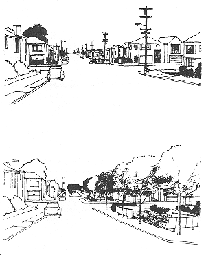 |
| 9. |
Open, unlandscaped parking areas are dull and unattractive, and generally have a deleterious effect upon their surroundings. A:. Parking lots next to the street, such as those for supermarkets and diners, detract from street life and impair definition of street space. Placement of buildings adjacent to the street, with the parking behind, can improve this condition. B. Parking lots along the street in housing developments neither define the street nor contribute visual interest. C. Parking under buildings or in an inside court allows the building to help define the street and avoids the blighting visual effects of an exposed parking lot. |
|
| 10. |
Parking garages lack visual interest if they have extensive rows of doors, blank walls or exposed vehicles. Extensive curb cuts prevent planting and other enhancement of the street, eliminate curb-side parking and are potentially dangerous to pedestrians. A. Arcades create some visual interest where long garage facades or multiple driveways cannot be avoided. B. Restricting entry and exit points minimizes curb cuts. C. A basement garage one-half level down brings the building closer to street level and increases visual interest for pedestrians. D. The inclusion of stores at ground level maintains continuity of pedestrian activity on what would otherwise be a sterile street frontage of parking garages in a commercial area. |
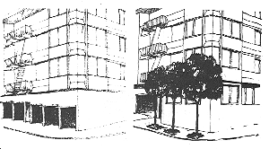 |
| 11. |
Fast and heavy traffic on residential streets makes them unattractive for pedestrian activities, and generates irritating dirt and noise. COMMENT: Widening of residential streets or making them one-way can increase traffic-carrying capacity at the expense of the environment for fronting residences. |
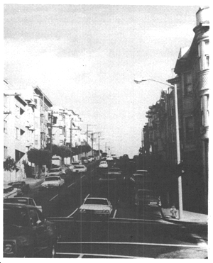 |
| 12. |
Excessive speeds and amounts of traffic in residential neighborhoods can be reduced by a variety of design techniques, including narrowing of streets or intersections, landscaping, diversion of traffic and closing of streets. A. Visually narrow street spaces assist in reducing the speed of traffic. Most drivers tent to reduce speed in confined spaces, since confinement narrows the field of vision and creates a sense of rapid movement. B. Diversion of cars from a straight path in a residential neighborhood is an effective way of discouraging through traffic. C. Modifying long, wide, straight sections of street eliminates the opportunity or temptation for vehicles to speed. |
|
| 13. |
Intensive landscaping, walls and other screening devices can insulate residential and pedestrian areas from the adverse effects of heavily used trafficways. A. Buffer planting can effectively screen adjacent residences from heavy traffic. B. Park areas and smaller open spaces can be protected from the noise and sight of traffic if well screened by berms, changes in level, and landscaped barriers. C. Even small-scale landscaping can ameliorate the effect of heavy traffic on adjacent areas. |
|
| 14. |
Vehicle-free or pedestrian-priority spaces contribute to pedestrian comfort and the public life of the city. Pedestrians can be given primacy in certain areas of the city by prohibiting traffic from certain streets, either permanently or temporarily, or through the design of shared public ways that prioritize pedestrian travel but accommodate small numbers of slow-moving vehicles. |
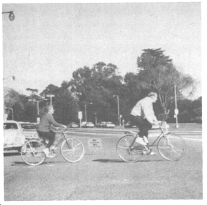 |
| 15. |
In the design of new pedestrian areas, changes of level can add greatly to interest and amenity if a reasonable relationship between levels is maintained. Most important is the visual connection between levels, which enhances the experience of being on one level through awareness of the other level(s). COMMENT (a): A space slightly above street level gives a sense of overlook and advantage to its occupants, while the passerby retains visual connection and interest. COMMENT (b): A space slightly below street level gives a sense of intimacy and enclosure to its occupants, as well as a sense of overlook and advantage for the passerby on the sidewalk. COMMENT (c): A space too far above street level loses visual contact with the street. COMMENT (d): A small space too far below street level is uncomfortable to its occupants and suitable only as a place of movement or access. |
|
| 16. |
Continuity of interest and activities at ground level in commercial buildings adjacent to pedestrian ways creates rich street life and enhances pedestrian experiences. A. Stores contribute both visual interest and activity to the street in downtown and district shopping areas and are the principal generators of street life. B. Office lobbies usually lack interest for the passerby, and they can detract from a good shopping environment. C. Major office buildings contribute more to street life if they have commercial activity at ground level. |
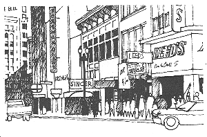 |
| 17. | Arcades provide continuous covered access to buildings and greatly increase pedestrian comfort in inclement weather. | |
| 18. |
lleys and small streets which are usable as part of the general network of pedestrian and service ways are potential areas of activity and interest. COMMENT: Large new projects that provide mid-block pedestrian and service shortcuts similar to those that now exist would continue and improve upon a workable pattern. |
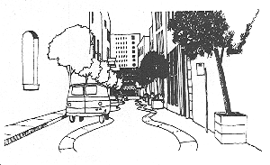 |
| 19. |
Planting and paving treatment in alleys, coupled with active uses in the adjacent buildings, form, in effect, a commercial promenade. COMMENT: The intimate pedestrian scale offers a welcome contrast to the wider streets around. |
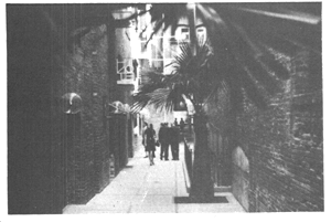 |
| 20. |
Dignified and well-maintained signs designed with respect for the scale and character of the street can enhance commercial areas. When signs do not relate to the area, when they reach excessive size, and when they feature blatant and discordant designs, they reflect poorly upon the overall quality of a commercial area. |
|
| 21. | Pedestrian scale can be achieved at the base of large vertical building surfaces by the use of arcades, emphasis of horizontal divisions, texture and other architectural details. | |
| 22. | The undergrounding of overhead utility wires enhances the appearance of streets and neighborhoods. | |
| 23. | Attractive and well-maintained public buildings, streets and parks can stimulate private improvements. | |
| 24. |
Public buildings can contribute to neighborhood appearance if they are well-designed, attractively painted and generously landscaped. COMMENT (a): Chain link fencing used around many school grounds is unattractive. The growing of ivy on such fencing can ameliorate its effect somewhat. COMMENT (b): Lack of landscaping and total asphalting make school playgrounds a negative rather than a positive feature in many neighborhoods. COMMENT (c): Use of bright and lively colors in painting drab public buildings could enhance many neighborhoods. |
|
| 25. | Parks on hillsides can be developed for sitting areas with views, and for unusual recreational facilities that take advantage of the hill, such as a long slide for children. | |
| 26. |
Private lands that are landscaped or developed as open space contribute to the visual and recreational resources of the city. COMMENT (a): Private landscaping or developed as open space contribute to the visual and recreational resources of the city. COMMENT (b): As the city becomes increasingly built up and acquisition of public open space more difficult, privately developed open spaces become more important. Open spaces at the Crown-Zellerbach Building and St. Francis Square are good examples of such private development. |
|
| 27. | Improved and diverse means of transportation can increase the value and use of parks. The ease with which pedestrians and motorists locate parks can be increased by improved signs or special roadway treatment. |
|
| 28. |
If auto traffic and parking in parks are discouraged, recreational use can be increased. COMMENT: A large park such as Golden Gate Park can be made more usable by a special transportation system that links various facilities and encourages motorists to leave their vehicles outside the park or in peripheral parking areas. |
|
| 29. |
Waterfront development that maximizes the interface between land and water increases the opportunities for public access to the water's edge. A. Finger piers create a greater variety of possible ways to experience the water and the city. B. Commercial and residential uses oriented toward the water and designed to create varied public spaces can add visual interest to the waterfront. |
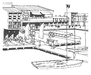 |
| 30. | Open space along the water provides opportunities for maximum public use of the waterfront. | 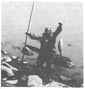 |
| 31. | Street rights-of-way carried through to the water allow views directly to the waterfront and provide a sense of contact with the water. | 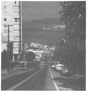 |
Health and Safety
POLICY 4.1
Protect residential areas from the noise, pollution and physical danger of excessive traffic.
In order to reduce the hazards and discomfort of traffic in residential neighborhoods, a plan for protected residential areas should be put into effect. Such a plan is intended to prevent or discourage heavy, fast and through traffic from using residential streets, and to put such traffic on arterial streets where the impact upon residential areas will be less disruptive. Although development of further traffic-carrying capacity on some arterials may be warranted, the local streets should remain as they are or have their capacity reduced.
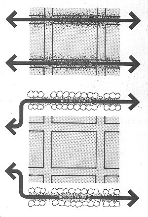
The speed and volume of traffic on protected streets should be limited by all practical means. Such means include making streets discontinuous to divert traffic from a straight path, narrowing streets and intersections, creating the appearance of narrowness through landscaping and other improvements, and prohibiting access from arterial streets by signs and barriers. Such changes in streets should be so designed that they will not limit the access of vehicles for police and fire protection and other emergency purposes in the protected areas. The total effect of these changes in residential streets should be to give the dominant position to residential qualities and pedestrians rather than to vehicles.
Land uses throughout the city should be regulated in such a way that heavy traffic will not be drawn through protected streets by large commercial, industrial and institutional traffic generators. Traffic for these generators should be channeled as much as possible on arterial streets. High traffic speeds should be discouraged on non-residential streets where the traffic on those streets is destined for protected residential streets.
POLICY 4.2
Provide buffering for residential properties when heavy traffic cannot be avoided.
When arterials and other streets having heavy traffic must go through residential areas, steps should be taken to screen dwellings from the noise, fumes and other adverse effects of traffic. Heavy landscaping at the sides of streets and in center islands may provide an effective barrier, as can walls, differences in elevation and the setting back of dwellings from the roadways.
Dwellings along streets with heavy traffic should, where possible, have the main orientation of their living space and access away from the traffic. In some cases further measures such as soundproofing may be required. Business and industries that attract or produce heavy traffic, such as service stations and trucking terminals, should be screened from nearby residential areas. Screening should be provided, as well, for all open parking lots within or adjacent to residential areas. All of the aforementioned considerations should apply to recreation areas as well as to dwellings.
Plan for Protected Residential Areas
Illustrated below are some of the means by which the speed and volume of traffic can be reduced on residential streets. The designs shown are simple prototypes. When used in combination and adapted to specific streets, such methods can significantly discourage heavy, fast and through traffic and divert vehicles to arterial streets. In many cases, too, these designs can improve the visual quality of residential neighborhoods provide usable open space for landscaping, playgrounds and sitting areas.
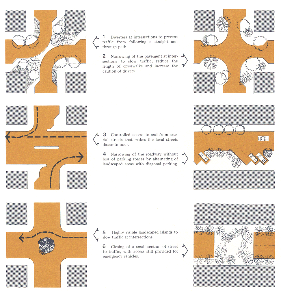
POLICY 4.3
Provide adequate lighting in public areas.
In order to reduce the hazards of traffic at night, and to provide security from crime and other dangers, public areas should have adequate lighting. Although the need for lighting is general, special attention should be given to crosswalks and to pathways in parks and around public buildings. Care should be taken to shield the glare of any such lighting from residential properties.
POLICY 4.4
Design walkways and parking facilities to minimize danger to pedestrians.
Pedestrian walkways should be sharply delineated from traffic areas, and set apart where possible to provide a separate circulation system. Where necessary and practical, the separation should include landscaping and other barriers, and walkways should pass through the interiors of blocks. Walkways that cross streets should have pavement markings and good sight distances for motorists and pedestrians.
Driveways across sidewalks should be kept to a practical minimum, with control maintained over the number and width of curb cuts. Barriers should be installed along parking lots to avoid encroachments on sidewalks, with adequate sight distances maintained at driveways. Truck loading should occur on private property rather than in roadways or on the sidewalks, and sidewalk elevators should be discouraged. Residential parking should be as close as possible to the dwelling served, with adequate lighting along the walking route from the parking to the dwellings.
Feeling of Neighborhood
POLICY 4.5
Provide adequate maintenance for public areas.
In view of the importance attached to the cleaning, paving and other maintenance of streets as an index of neighborhood upkeep, and as a stimulant to private improvements, these types of programs should be carried on continuously and effectively.
The same degree of maintenance should be accorded to parks, buildings and other public facilities. In both the initial design and the upkeep of these facilities, the image of government and of its role in the community should be made attractive and inviting. Special attention should be given to the landscaping of public buildings.
POLICY 4.6
Emphasize the importance of local centers providing commercial and government services.
Local centers for shopping, government services and congregation of people should stand out in their areas. Landscaping, distinctive pavement and other features will help to emphasize these centers. Along shopping streets pedestrian interest should be maintained by continuous store frontages. Government services for the local area, such as offices and libraries, should occupy the same center as the commercial activities.
POLICY 4.7
Encourage and assist in voluntary programs for neighborhood improvement.
Neighborhood participation in programs for the physical improvement of residential and shopping areas assures an additional measure of pride and satisfaction in the results, and helps to stimulate continuous maintenance of the improvements. Such stimulation of neighborhood interest may be unnecessary or more drastic action for upgrading of the area at some future time.
Programs that can make use of both voluntary work and government assistance include street tree planting and development of small parks and other recreation facilities. Where possible, significant public improvements in street areas should be accompanied by financial and design assistance to property owners under programs such as the Federally Assisted Code Enforcement Program which assure the coordinated upgrading of an entire neighborhood.
Opportunity for Recreation
POLICY 4.8
Provide convenient access to a variety of recreation opportunities.
As many types of recreation space as possible should be provided in the city, in order to serve all age groups and interests. Some recreation space should be within walking distance of every dwelling, and in more densely developed areas some sitting and play space should be available in nearly every block. The more visible the recreation space is in each neighborhood, the more it will be appreciated and used.
Recreation space at a greater distance should be easily accessible by marked driving routes, and where possible by separated walkways and bicycle paths. Larger recreation areas should be highly visible. San Francisco Bay is included among the major recreation resources of the city, and visual and physical access to the Bay should be increased, with a maximum interface of land and water made available in new developments having public access.
All possible means of providing recreation facilities should be explored. Some historic buildings and their sites have such a potential. Many commercial areas have a semi-recreational aspect, and this aspect should be recognized and strengthened. Where possible, new facilities such as parking garages in more intensively developed parts of the city should have recreation space placed above them.
POLICY 4.9
Maximize the use of recreation areas for recreational purposes.
Parks provide their greatest service to the community when they bring a sense of nature to city residents. Recreation facilities suited to each park and its neighborhood should be installed and maintained, while facilities not primarily intended for recreation or not requiring a park location should be placed outside the park system.
Automobile traffic in parks should be minimized, and where possible means of transportation other than automobiles should be provided in larger parks. Automobile parking should occur at the edges of parks, preferably outside the park boundaries. Parking lots and other visually distracting uses should be screened from the areas devoted to recreation.
POLICY 4.10
Encourage or require the provision of recreation space in private development.
As the city grows more intensive, much of the new area for recreation will have to be provided on private property, whether for individual developments or for the public at large. This recreation space may be of many types.
Recreation space should be provided in large developments, especially in areas of high population and building density. In the downtown area, well-designed plazas with public access and good exposure to sunlight serve this function. In apartment developments, some of the recreation needs of the occupants should be satisfied on the site itself, if necessary by joint use of space by several properties in the block. New developments along the shoreline of the Bay should whenever possible provide recreation space or general public access to the Bay.
POLICY 4.11
Make use of street space and other unused public areas for recreation, particularly in dense neighborhoods, such as those close to downtown, where land for traditional open spaces is more difficult to assemble.
Walking along neighborhood streets is the common form of recreation. The usefulness of streets for this purpose can in many cases be improved by widening sidewalks and installing simple improvements such as benches and landscaping. Such improvements can often be put in place without narrowing traffic lanes by use of parking bays with widened sidewalks at intersections and at other points unsuitable for parking.
Streets that have roadways wider than necessary, and streets that are not developed for traffic because of their steepness, provide exceptional opportunities for recreation. This is particularly applicable in new neighborhoods like Transbay and Rincon Hill, where traditional open spaces are more difficult to assemble because of higher densities and lack of available sites to acquire for parks. This excess street space can be developed with playgrounds, sitting areas, viewpoints and landscaping that make them neighborhood assets and increase the opportunities for recreation close to the residents' homes.
Visual Amenity
POLICY 4.12
Install, promote and maintain landscaping in public and private areas.
Trees and other landscaping are a recurring theme in these policies, for they add to nearly any city environment. Both public and private efforts in the installation and maintenance of landscaping should be increased.
In residential areas, side yards and setbacks provide the best opportunities for landscaping visible in public areas. If no such space exists, then trees should be placed in the sidewalk area, preferably in the ground. Care should be taken to select species of trees suitable to each location. The most visible points, such as street intersections, should be given special attention.
Other unused opportunities for landscaping exist on exposed banks, usually along roadways. Where it is feasible, these should be planted and maintained by the public or private owners of the land. Portions of parks that are unlandscaped should also be considered for new planting, especially when the areas are visible from nearby neighborhoods.
POLICY 4.13
Improve pedestrian areas by providing human scale and interest.
In addition to landscaping, other features along the streets add to the comfort and interest of pedestrians. Sidewalk paving and furnishings, if designed in a unified way, make walking more pleasurable. Gentle changes in level have the same effect. In commercial areas, continuous and well-appointed shop windows and arcades are invitations to movement. Little-used alleys can be improved as walkways, and new promenades put through blocks in new development. Greater comfort should also be provided at transit stops, where benches and shelters can be placed on sidewalks and on private property.
POLICY 4.14
Remove and obscure distracting and cluttering elements.
No other element in the street environment is more disrupting than exposed parking. Parking lots and open parking decks break the building facades and stand as large voids in visual interest. Exposed vehicles clutter the pedestrian's view and reduce the sidewalk to a narrow corridor between rows of automobiles. Parking should, wherever possible, be placed beneath or behind buildings or else screened from view by landscaping, walls or fences. The screening should be designed to restore to the street some of the visual interest that has been taken away by the removal of buildings.
Signs are another leading cause of street clutter. Where signs are large, garish and clashing they lose their value as identification or advertising and merely offend the viewer. Often these signs are overhanging or otherwise unrelated to the physical qualities of the buildings on which they are placed. Signs have an important place in an urban environment, but they should be controlled in their size and location.
Other clutter is produced by elements placed in the street areas. The undergrounding of overhead wires should continue at the most rapid pace possible, with the goal the complete elimination of such wires within a foreseeable period of time. Every other element in street areas, including public signs, should be examined with a view toward improvement of design and elimination of unnecessary elements.
POLICY 4.15
Protect the livability and character of residential properties from the intrusion of incompatible new buildings.
Whatever steps are taken in the street areas, they may be lost in the changed atmosphere produced by new buildings. Human scale can be retained if new buildings, even large ones, avoid the appearance of massiveness by maintaining established building lines and providing human scale at their lower levels through use of texture and details. If the ground level of existing buildings in the area is devoted to shops, then new buildings should avoid breaking the continuity of retail space.
In residential areas of lower density, the established form of development is protected by limitations on coverage and requirements for yards and front setbacks. These standards assure provision of open space with new buildings and maintenance of sunlight and views. Such standards, and others that contribute to the livability and character of residential neighborhoods, should be safeguarded and strengthened.
The Future
This Urban Design Plan for San Francisco has been developed with the conviction that quality in the urban environment is an important and growing concern in this great city. The people of San Francisco have taken a leadership role among the citizens of the country in balancing conservation and change through new safeguards for cherished attributes of their city's character. This Plan is intended to reflect the people's needs and to improve the physical makeup of the city. As new needs and concerns arise in later years, this Plan will be added to and revised in the continuing process of comprehensive planning.
Amendments by Planning Commission Resolution 12040 adopted on 09/27/1990.
Amendments by Planning Commission Resolution 13917 adopted on 07/20/1995.
Amendments by Planning Commission Resolution 14400 adopted on 06/26/1997.
Amendments by Proposition F approved by San Francisco voters on 6/3/1997 permitting the construction and development of nonrecreational uses on park land within the Candlestick Point Special Use District.
Amendments by Planning Commission Resolution 14698 adopted on 09/17/1998.
Amendments by Board of Supervisors Ordinance 0209-01 adopted on 10/15/2001.
Amendments by Planning Commission Resolution 14900 adopted on 12/02/2004.
Amendments by Planning Commission Resolution 14906 adopted on 12/09/2004.
Amendments by Planning Commission Resolution 17009 adopted on 05/25/2005.
Amendments by Board of Supervisors Ordinance 0125-05 adopted on 06/21/2005.
Amendments by Board of Supervisors Ordinance 0072-09 adopted on 04/28/2009.
Amendments by Board of Supervisors Ordinance 0309-10 adopted on 12/07/2010.
Amendments by Board of Supervisors Ordinance 0092-11 adopted on 06/07/2011.
Amendments by Board of Supervisors Ordinance 0097-11 adopted on 06/14/2011.
Amendments by Board of Supervisors Ordinance 0143-11 adopted on 07/12/2011.
Amendments by Board of Supervisors Ordinance 0185-12 adopted on 07/31/2012.
Amendments by Board of Supervisors Ordinance 0145-13 adopted on 07/09/2013.
Amendments by Board of Supervisors Ordinance 0146-13 adopted on 07/09/2013.
Amendments by Board of Supervisors Ordinance 0151-14 adopted on 07/22/2014.
Amendments by Board of Supervisors Ordinance 0186-15 adopted on 10/27/2015.
Amendments by Board of Supervisors Ordinance 0207-15 adopted on 12/01/2015.
Amendments by Board of Supervisors Ordinance 0019-17 adopted on 01/31/2017.
Amendments by Board of Supervisors Ordinance 0020-17 adopted on 01/31/2017.
Amendments by Planning Commission Resolution 101193 adopted on 03/21/2017.
Amendments by Board of Supervisors Ordinance 0175-17 adopted on 07/25/2017.
Amendments by Board of Supervisors Ordinance 0227-17 adopted on 11/14/2017.
Amendments by Board of Supervisors Ordinance 0274-18 adopted on 11/13/2018.
Amendments by Board of Supervisors Ordinance 0064-20 adopted on 04/21/2020.
Amendments by Board of Supervisors Ordinance 0010-23 adopted on 01/31/2023.
Amendments by Board of Supervisors Ordinance 0057-24 adopted on 03/12/2024.
Amendments by Board of Supervisors Ordinance 0208-24 adopted on 07/23/2024.
Amendments by Board of Supervisors Ordinance 0199-25 adopted on 10/21/2025.
Amendments by Board of Supervisors Ordinance 0243-25 adopted on 12/09/2025.