Market and Octavia Area Plan
INTRODUCTION
The Market and Octavia Area Plan (The Plan) grew out of the Market and Octavia Neighborhood Plan (Neighborhood Plan) that in turn was the first plan to emerge from the City's Better Neighborhoods Program. This Area Plan is a summary of the topics covered in the neighborhood plan. The neighborhood plan was also adopted by the Planning Commission and should be referred to for further details and illustrations.
As one of three neighborhoods in the Better Neighborhoods Program, the Market and Octavia neighborhood offers a distinct set of opportunities for change sensitive to existing patterns, given its unique place in the city and the region. At the center of the city, it sits at a remarkable confluence of city and regional transportation. It is accessible from the entire Bay Area by BART, bus, and the regional freeway system. More than a dozen transit lines cross the Market and Octavia neighborhood, including all of the City’s core streetcar lines, which enter the downtown here. It is just west of the Civic Center, where City Hall and state and federal office buildings, Herbst Theatre, and other governmental and cultural institutions attract a wide range of people both day and night.
The Market and Octavia neighborhood sits at the junction of three of the city’s grid systems. The north of Market, south of Market, and Mission grids meet at Market Street, creating a distinct pattern of irregular blocks and intersections, and bringing traffic from these grids to Market Street. The surrounding topography of the Western Addition, Nob Hill, Cathedral Hill, and Twin Peaks flattens out in this area, creating a geography that makes the Market and Octavia neighborhood a natural point of entry to the downtown from the rest of the city. As a result of its central location, it has long been both a crossroads—a place that people pass through—as well as a distinctive part of the city in its own right.
The Market and Octavia neighborhood is a truly urban place, with a diversity of character and quality in its various parts. Local residents will tell you that the area is an “in-between ” place—a place that supports a variety of lifestyles, ages, and incomes. Its varied but close-knit pattern of streets and alleys, along with relatively gentle topography, make it very walkable and bikeable. It has excellent access to city and regional public transit and offers a good variety of commercial streets that provide access to daily needs. It has a rich pattern of land uses that integrates a diversity of housing types, commercial activities, institutions, and open spaces within a close-knit physical fabric.
The Market and Octavia neighborhood’s strengths as an urban place, an exciting “in-between” place, are fragile. Its role as a crossroads poses enormous challenges. Over the past 100 years, the imposition of large infrastructure and redevelopment projects have deeply scarred the area’s physical fabric. Whole city blocks were assembled for large redevelopment projects in the 1960’s and 1970’s. Large flows of automobile traffic are channeled through to the Central Freeway via major arteries such as Fell/Oak, Gough/Franklin, and Van Ness Avenue.
Street management practices meant to expedite these traffic flows have degraded the quality of its public spaces and conflicts between cars and pedestrians have made streets hostile to public life. Because large flows of automobile traffic and core transit lines converge here, there are competing needs for a limited amount of street space. Transit vehicles are often stuck in traffic, impacting transit service and reliability citywide and adding to traffic congestion. Parking requirements have led to buildings in recent years with long, dead, and undifferentiated facades that diminish the quality of the streets.
At the same time, there are tremendous opportunities for positive change in the Market and Octavia neighborhood—opportunities to build on its strengths as an urban place and to create a better future.
The Market and Octavia neighborhood is undergoing dramatic renewal since the Central Freeway was removed north of Market Street. With the passage of Proposition E in 1998, construction of a graceful and functional surface boulevard has replaced the structure and has freed-up over 7 acres of land for infill development that will help repair the divisions created by the Central Freeway. As part of this effort, there is an opportunity to rationalize regional traffic flows and minimize their negative effects on the quality of life of the area, as well as to plan for the reuse of several other large sites.
The Market and Octavia neighborhood can grow supported by its access to public transit. In addition to repairing its physical fabric, new development can take advantage of the area’s rich transit access to provide new housing and public amenities, and reduce new traffic and parking problems typically associated with growth. Because the Market and Octavia neighborhood’s location supports a lifestyle that doesn’t have to rely on automobiles, space devoted to moving and storing them can be dramatically reduced—allowing more housing and services to be provided more efficiently and affordably. Market and Octavia can capture the benefits of new development while minimizing the negative effects of more automobiles.
If planned well, new development will strengthen and enhance the Market and Octavia neighborhood. With the removal of the Central Freeway and construction of the new Octavia Boulevard, there is a strong desire here to repair damage done in past decades and realize its full potential as a vibrant urban place. There is potential for new mixed-use development, including a significant amount of new housing. With the added vitality that new housing and other uses will bring, the area’s established character as an urban place can be strengthened and enhanced.
The Market and Octavia neighborhood is at a critical juncture. Over the last 40 years, an imbalance in how we plan for the interrelated needs of housing, transportation, and land use has undermined our ability to provide housing and services efficiently, to provide streets that are the setting for public life, and to build on transit, bicycling, and walking as safe and convenient means of getting around our city. Nowhere is this imbalance clearer than here, where an elevated freeway, land assembly projects, and other well-meaning interventions have degraded the overall quality of the place.
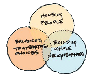
As we look forward, there is much that can be done. The Plan aims, above all, to restore San Francisco’s long-standing practice of building good urban places—providing housing that responds to human needs, offering people choice in how they get around, and building “whole” neighborhoods that provide a full range of services and amenities close to where people live and work. To succeed, The Plan need only learn from the established urban structure that has enabled the Market and Octavia neighborhood, like other urban places, to work so well for people over time.
If the Market and Octavia neighborhood’s tradition of public activism on these issues is any indication, this Area Plan will succeed by building on these strengths: enriching its critical mass of people and activities, enhancing the area’s close-knit physical pattern, and investing in a transportation program that restores balance between travel modes. The Plan addresses these issues holistically, as success with any one aspect depends on addressing the overall dynamic between them. To diminish any one aspect of The Plan is to diminish the opportunity presented by the whole.
Market Octavia is centered around three neighborhoods with high concentrations of Communities of Concern. Communities of Concern are defined as census tracts that have a concentration of both minority and low-income residents, or that have a concentration of low-income residents and any three or more of the following six disadvantage factors: persons with limited English proficiency, zerovehicle households, seniors aged 75 years and over, persons with one or more disability, single-parent families, and renters paying more than 50 percent of their household income on housing. The Communities of Concern adjacent to the Market and Octavia Plan Area include the Western Addition to the north, SoMa to the east, and the Mission to the south. Thus the positive and negative impacts of new development on these neighborhoods should be taken into consideration. Given the legacies of land use decisions, development patterns, and investments from past eras, such as elevated freeways and redevelopment, Planning should carefully consider the needs of these adjacent neighborhoods to advance the goals of sustainability, resiliency, equity, and economic diversity. It is particularly important that historically marginalized communities can benefit from investment and that burdens be avoided or mitigated to ensure more equitable outcomes and access to opportunity and investment. In addition, the City has made a commitment to racial and social equity a core tenet of our values, culture, and institutional practices. While the City has made inroads in advancing a more diverse and inclusive city over the last several years, much remains to be done to redress the systematic racial and social inequities that have long been part of our local and national history. Given this history, the City has a responsibility to work towards the reversal of such outcomes and plays a key role in changing structures and policies in achieving racially and socially equitable outcomes.
The Plan Framework
Figure 1: Plan Framework: Concept
The Market and Octavia neighborhood is at a critical juncture. Over the last 40 years, an imbalance in how we plan for the interrelated needs of housing, transportation, and land use has undermined our ability to provide housing and services efficiently, to provide streets that are the setting for public life, and to build on transit, bicycling, and walking as safe and convenient means of getting around our city. Nowhere is this imbalance clearer than here, where an elevated freeway, land assembly projects, and other well-meaning interventions have degraded the overall quality of the place.
As we look forward, there is much that can be done. The Plan aims, above all, to restore San Francisco’s long-standing practice of building good urban places—providing housing that responds to human needs, offering people choice in how they get around, and building “whole” neighborhoods that provide a full range of services and amenities close to where people live and work. To succeed, The Plan need only learn from the established urban structure that has enabled the Market and Octavia neighborhood, like other urban places, to work so well for people over time.
If the Market and Octavia neighborhood’s tradition of public activism on these issues is any indication, this Area Plan will succeed by building on these strengths: enriching its critical mass of people and activities, enhancing the area’s close-knit physical pattern, and investing in a transportation program that restores balance between travel modes. The Plan addresses these issues holistically, as success with any one aspect depends on addressing the overall dynamic between them. To diminish any one aspect of The Plan is to diminish the opportunity presented by the whole.
1. Land Use and Urban Form
Strengthening the Market and Octavia area requires a comprehensive approach to planning for all aspects of what makes the place work well for people. Housing alone does not make a place, although new housing, and the people it brings, will add life to the area. Providing adequate and appropriate space for a range of land uses that contribute to the function, convenience, and vitality of the place are encouraged as part of an integrated land use and urban design vision for the area.
Land Use
To reinforce and improve on the existing land use pattern, this plan establishes the following principles:
-
Require infill development to enhance the area’s established land use pattern and character. While the area’s physical fabric is well established, there are ‘holes,’ both large and small, where infill development can dramatically repair the fabric and provide new housing opportunities and neighborhood services. This kind of development should be actively encouraged and integrated into the prevailing pattern of uses, taking cues from existing development in the area.
-
Concentrate new uses where access to transit and services best enables people to be less reliant on automobiles. New development will be most successful where it minimizes the negative effects of additional automobiles, by building on the area’s superior accessibility on foot and by transit. To this end, the most intense new development should be linked directly to existing and proposed transit services, and concentrated where the area’s mix of uses supports a lifestyle less dependent on cars.
Significant change is envisioned for the Hub area, which lies between Market Street, South Van Ness Avenue, Mission Street and the Central Freeway. For more than three decades the city’s General Plan has proposed that this area become a mixed-use residential neighborhood adjacent to the downtown. This element of the plan carries this policy forward by encouraging relatively high-density mixed-use residential development in the Hub area. Element 7, “A New Neighborhood in the Hub,” proposes an bold program of capital improvement to create a public realm of streets and open spaces appropriate for the evolution of the public life of the area, and to serve as the catalyst for the development of a new mixed-use residential neighborhood.
Urban Form
The urban form and height proposals in this plan are based on the existing built form of the area and its surroundings, as follows:
-
Market and Octavia’s urban form should accentuate the city’s natural topography and emphasizes transit and important activity centers. The urban form of the Market and Octavia neighborhood is marked by the transition from small-scaled residential areas to the west, with the defining topography of Cathedral and Mint Hills, to the dramatic built form of the downtown that steps up around Civic Center, east of Franklin Street. New development should not change this form dramatically. Rather, it should reinforce it by concentrating height and bulk where core transit services converge and accentuating the natural landscape with individual buildings sidestepping up hills.
-
Buildings with a fine-grained character enhance the established physical fabric of the place and the value of streets as public spaces. The established pattern of development in the Market and Octavia neighborhood is one of individual buildings on small lots. There is much to be learned from this pattern; generally speaking, it shows us that when it comes to creating human-scaled places, smaller is better. Many individual shops with narrow frontages are preferably to one large storefront. The rhythm of individual stoops and bay windows creates visual interest along the street, as opposed to blank walls. New buildings should respond to this established pattern, especially where they interact with the public space of the street.
OBJECTIVE 1.1
CREATE A LAND USE PLAN THAT EMBRACES THE MARKET AND OCTAVIA NEIGHBORHOOD’S POTENTIAL AS A SUSTAINABLE MIXED-USE URBAN NEIGHBORHOOD.
The new land use and special use districts, along with revisions to several existing districts, implement this concept. These land use districts provide a flexible framework that encourages new housing and neighborhood services that build on and enhance the area’s urban character. Several planning controls are introduced, including carefully prescribed building envelopes and the elimination of housing density limits, as well as the replacement of parking requirements with parking maximums, based on accessibility to transit.
-
The Van Ness and Market Residential Special Use District (VNMR-SUD) will encourage the development of a walkable, transit-oriented, high-density, mixed-use neighborhood around the intersection of Van Ness Avenue and Market Street, adjacent to downtown. This district will still have the area’s most intensive residential uses, some office uses and neighborhood serving retail. Residential towers will be permitted along the Market / Mission Street corridor, provided they meet urban design standards. Residential towers, if built, would be clustered around the intersection of Market Street and Van Ness Avenue.
-
Transit-Oriented Neighborhood Commercial Districts (NCT) will encourage transit-oriented, mixed-use development of a moderate scale concentrated near transit services in the Hub, areas immediately adjacent to the downtown and along the Market Street corridor. Retail use is actively encouraged on the ground floor with housing above to enliven commercial streets. Along Market Street and in the Hub, a limited amount of office will be permitted. Complimenting a rich mix of neighborhood-serving retail and services with a dense residential populations in these districts, walking and transit will be the primary means of transportation and car-free housing will be common and encouraged.
In named NCT and NCT-1 districts, revised parking requirements and housing density controls will encourage housing above ground-floor retail uses. These districts otherwise remain unchanged. They include current Neighborhood Commercial Districts (Hayes-Gough, portions of the Upper Market, Valencia) and several parcels previously zoned NC-1.
-
Residential Transit-Oriented Districts (RTO) will encourage moderate-density, multi-family, residential infill, in scale with existing development. The high availability of transit service, proximity of retail and services within walking distance, and limitation on permitted parking will encourage construction of housing without accessory parking. Small-scale retail activities serving the immediate area will be permitted at intersections in RTO-1 districts and on all lots in RTO-C districts.
See Map 01. Generalized Land Use Districts
POLICY 1.1.1
Repair the damage caused by the Central Freeway by encouraging mixed-use infill on the former freeway lands.
With the removal of the Central Freeway and construction of Octavia Boulevard, approximately 7 acres of land has been made available for new development. Appropriate use and careful design of development on the former freeway lands will repair the urban fabric of Hayes Valley and adjacent areas. New development should conform with the neighborhood’s existing urban scale and character, and should maintain a strong connection to streets and public spaces.
POLICY 1.1.2
Concentrate more intense uses and activities in those areas best served by transit and most accessible on foot or by bicycle.
In keeping with the plan’s goal of prioritizing the safe and effective movement of people, the most intense uses and activities are focused where transit and walking are most convenient and attractive—along the Market Street / Mission Street corridor and at the intersection of Market Street and Van Ness Avenue. Concentrating transit-oriented uses in these locations will reduce automobile traffic on city streets and support the expansion of transit service in the area’s core urban center.
POLICY 1.1.3
Encourage housing and retail infill to support the vitality of the Hayes-Gough, Upper Market, and Valencia Neighborhood Commercial Districts.
There are significant opportunities for new mixed-use infill along neighborhood commercial streets in the plan area. In conjunction with proposals to encourage flexible housing types and to reduce parking requirements, new development along commercial streets should create new retail uses and services oriented to the street, with as much housing as possible on upper floors. New uses should maintain the overall pedestrian orientation of these streets.
POLICY 1.1.4
As the Hub evolves into a high-density mixed-use neighborhood, encourage the concurrent development of neighborhood-serving uses to support an increasing residential population.
There is a demonstrated need for neighborhood-serving uses in the Hub area. As its residential population increases, adequate space for retail activities and other services are encouraged as part of the overall mix of uses in the area. While some amount of office uses will be permitted, it will not be allowed to dominate the ground floor in areas where significant new housing is proposed.
POLICY 1.1.5
Reinforce the importance of Market Street as the city’s cultural and ceremonial spine.
Market Street has historically been the city’s most important street. New uses along Market Street should respond to this role and reinforce its value as a civic space. Ground-floor activities should be public in nature, contributing to the life of the street. High-density residential uses are encouraged above the ground floor as a valuable means of activating the street and providing a 24-hour presence. A limited amount of office use is permitted in the Civic Center area as part of the overall mix of activities along Market Street.
POLICY 1.1.6
Preserve and enhance the role of cultural, educational and arts organizations in the plan area.
Major cultural institutions such as City Hall, the Opera House, Herbst Theatre, and the SFLGBT Community Center are vital assets adjacent to the neighborhood and will retain their role as major regional destinations. In addition, consider how community-based art organizations can be incorporated into the ground floor of new development to serve neighborhood residents and support the broader civic center arts district.
POLICY 1.1.7
Encourage the creation of space dedicated to community services on Market Street within the Upper Market NCT.
In recent years, Upper Market Street has housed commercial space to important community-serving organizations offering aid for homeless, disadvantaged and/or those with special health needs. In part, this has been made possible due to the relatively low commercial rents. With the removal of the Central Freeway north of Market Street, the neighborhood may become increasingly expensive for some community service providers. These existing services should be fostered and new community-serving uses should be encouraged in larger, new development. There is much the Planning Department can do, primarily through the permitting process where land use issues are reviewed, to support proposals for new facilities and resist changes that may damage existing ones. These valuable community services should be kept within a convenient walking distance.
New development can significantly contribute to the neighborhood by including community serving uses in their proposals. Modern service delivery models link services to housing, and accordingly, many funding sources require on-site community service space. Proposals for a change of land use or other change would be encouraged to retain community services or facilities unless: (i) a suitable replacement service or facility is available within a convenient distance; or (ii) the use of the site/building for community service/facility purposes cannot be continued or be made viable in the longer term.
POLICY 1.1.8
Reinforce continuous retail activities on Market, Church, and Hayes Streets, as well as on Van Ness Avenue.
On the frontages indicated above, maximize neighborhood-serving retail activities on the ground floor for new development and substantial alterations, providing retail uses for at least 75 percent of the frontage on the ground floor.
See Map 2 Frontages Where Active Ground Floor Commercial is Required
POLICY 1.1.9
Allow small-scale neighborhood-serving retail and other community-serving uses at intersections in residential districts.
In the RTO district, allow retail uses up to 1,200 square feet. Limit the hours of operation for these uses to 7 AM to 10 PM.
POLICY 1.1.10
Recognize the importance of public land and preserve it for future uses.
As a considerable amount of publicly zoned land will be converted from a freeway to housing, it will increase the demands on the remaining public lands in the plan area. Publicly zoned land is crucial to the functioning of a healthy city and neighborhood. Publicly zoned lands provide opportunities for crucial facilities such as schools, firehouses, libraries, recreation centers, open space, city institutions and public utilities. Over time, acquiring public land has only become more difficult and more costly. When public land that is zoned “open space” becomes surplus to one specific public use, the General Plan states that it should be reexamined to determine what other uses would best serve public needs. The Open Space Element of the General Plan states that public land both designated as “surplus” and “open space” should first be considered for open space. If not appropriate for open space, other public uses should be considered before the release of public parcels to private development.
POLICY 1.1.11
Apply a racial and social equity lens to the community planning process.
Understanding why equity is important and incorporating practices of equity in all facets of planning is essential for equitable planning. The Planning Department has developed a Racial and Social Equity Tool to assess the impacts of development, who benefits and who is burdened, and mitigation strategies. This tool is a resource that can be used at various decision-making points to evaluate how a land use and urban design proposal may increase or decrease racial and social equity, understand the unintended consequences, and help to identify opportunities to advance racial and social equity.
OBJECTIVE 1.2
ENCOURAGE URBAN FORM THAT REINFORCES THE PLAN AREA’S UNIQUE PLACE IN THE CITY’S LARGER URBAN FORM AND STRENGTHENS ITS PHYSICAL FABRIC AND CHARACTER.
The plan’s urban form is based on enhancing the existing variety of scale and character throughout the plan area. The plan aims to achieve urban design goals and to maximize efficient building forms for housing, given building code, fire, and other safety requirements. The plan ensures that new development contributes positively to the urban form of the neighborhood and allows flexibility in the overall design and architecture of individual buildings.
POLICY 1.2.1
Relate the prevailing height of buildings to street widths throughout the plan area.
It is the height and mass of individual buildings that define the public space of streets. Building heights have historically been strongly related to the width of streets in the Market and Octavia neighborhood and elsewhere in the city. Where building heights are related to the width of the facing streets, they enclose the street and define it as a comfortable, human-scaled space with ample light and air.
The permitted heights should strengthen the relationship between the height of buildings and the width of streets.
POLICY 1.2.2
Maximize housing opportunities and encourage high-quality commercial spaces on the ground floor.
Height limits in neighborhood commercial districts should be set to maximize housing potential within specific construction types. Where ground floor commercial is most desirable, building height limits should permit generous ceiling heights on the ground floor of up to 15 feet.
It is also common in the Market and Octavia neighborhood, as with the rest of San Francisco, to provide housing above ground floor commercial spaces along neighborhood commercial streets. This not only provides much-needed housing close to services and, in most cases, transit, but also provides a residential presence to these streets, increasing their vitality and the sense of safety for all users.
POLICY 1.2.3
Appropriately sculpt building heights along the alleys in order to provide ample sunlight and air in accordance with the plan principles that relate building heights to street widths.
Given their narrow scale, building heights along alleys should be sculpted to maximize light and create a positive pedestrian experience.
POLICY 1.2.4
Encourage podium buildings of similiar height along each side of major streets.
Streets feel comfortable as public spaces when they are clearly defined by buildings of a similar podium height on both sides of the street.
POLICY 1.2.5
Mark the intersection of Van Ness Avenue and Market Street as a visual landmark.
The City’s height controls reinforce clusters of taller buildings on tops of some hills, in the downtown core, and along Market Street in the downtown. Heights increase at the Van Ness Avenue and Market Street intersection and taper down to surrounding low-rise areas.
POLICY 1.2.6
Mark the block of Market Street from Buchanan Street to Church Street as a gateway to the Castro.
The block of Market Street from Buchanan Street to Church Street marks the entrance to the Castro. At Buchanan Street, heights and form respond to Mint Hill and preserve views to the Mint from Dolores Street. At Church Street, building forms should accent this point, with architectural treatments that express the significance of the intersection. Special architectural features should be used at the corners of new buildings to express the visual importance of this intersection.
POLICY 1.2.7
Encourage new mixed-use infill on Market Street with a scale and stature appropriate for the varying conditions along its length.
Market Street is a uniquely monumental street, with buildings along its length that have a distinctive scale and stature, especially east of its intersection with Van Ness Avenue. West of Van Ness Avenue, new buildings should have a height and scale that strengthens the street’s role as a monumental public space.
POLICY 1.2.8
Encourage the development of slender residential towers above the base height in the Hub area along South Van Ness Avenue between Market and Mission Streets, and along the Market Street corridor.
Where residential towers are permitted above the width of the street (“street wall height”), establish zoning controls to ensure that tower forms allow adequate light and air to reach dwelling units and minimize shadow to streets and open spaces. To avoid a bulky appearance on the skyline, a tower’s floor plate will be regulated; floor plate size will be limited in proportion to tower height.
POLICY 1.2.9
Discourage land assembly where there is a pattern of individual buildings on small lots.
A close-knit pattern of individual buildings on small lots is what has made the Market and Octavia neighborhood successful as an urban place over time and is one of its chief assets. The neighborhood is built on a traditional fabric of lots that are small, narrow and deep, which provides for an enriching block face, diversity of buildings, and stimulating pedestrian experience. The small scale of development should be retained.
POLICY 1.2.10
Preserve midblock open spaces in residential districts.
Residential districts in the plan area have a well-established pattern of interior-block open spaces that contribute to the livability of the neighborhood. Care must be taken to sculpt new development so that light and air are preserved to midblock spaces. Upper Market NCT lots that abut residential midblock open spaces will be required to provide rear-yards at all levels.
2. Housing
Housing is an essential human need. No single issue is of more importance than how we provide shelter for ourselves. Housing is in chronically short supply in San Francisco, particularly for those with low and moderate incomes. The Market and Octavia neighborhood presents a unique opportunity, because new housing can build upon and even enhance its vitality and sense of place. This plan encourages housing as a beneficial form of infill development—new buildings at traditional scales and densities, reflecting the fine-grained fabric of the place.
In many respects, this plan does not diverge from established and continually evolving citywide policies and programs of housing affordability. It does not establish new inclusionary standards, new funding mechanisms, nor create its own solutions to homelessness in the city. On these matters, which cannot be affected on an area-by-area basis, The Plan defers to larger citywide solutions.
Existing sound housing stock is a precious resource and should be preserved and supported. No demolitions, removals, nor wholesale clearings as in redevelopment projects of old are proposed. Dwelling unit mergers are strongly discouraged.
The fundamental principles are:
-
Provide ample and diverse housing opportunities to add to the vitality of the place. Maximize the amount and types of housing in the neighborhood to serve a wide variety of people, including a range of incomes, ages, and household and family compositions. The Plan does so by looking to the prevailing built form of the area and carefully prescribing controls for building envelopes to emulate that form. Controls that limit building area by restricting housing are reduced in favor of well-defined height and bulk controls and urban design guidelines, encouraging building types more in keeping with the area’s established development pattern, and allowing greater flexibility in the type and configuration of new housing. In addition, residential buildings are also encouraged to include a mix of amenities that support the needs of families with children and sustainable transportation choices, such as social and play spaces and easily accessible storage for strollers, car seats, grocery carts, and bicycles.
-
Housing can be built more efficiently, affordably, and more consistent with neighborhood character if parking is not required. Because public transit, walking, and bicycling are convenient and attractive ways to get around in the Plan area, residents here often live with fewer cars, or without a car at all. The fact that they need to own, store, and maintain fewer cars not only enables residents to live more affordably, but will also allow new housing to capitalize on the area’s accessibility by other transportation modes. This will ensure that new housing adds life to the area without adding new cars to its streets, be more affordable both to developers and residents, and minimize the negative impacts of parking facilities on neighborhood streets.
The traditional housing stock in the Market and Octavia neighborhood supports a variety of living arrangements—individual homes, flats, apartments—some owned but mostly rented, including various forms of group housing and assisted living. While the living spaces in older buildings typically have a strong relationship to the street, expressed through stoops and bay windows, newer housing often has a weaker relationship to the street, largely because of the space consumed by blank walls and garage doors that parking presents to the neighborhood.
Creating housing for a diverse population includes housing people who are elderly or who have disabilities. Such people are confronted with multiple challenges in daily living. All housing types, including new affordable housing, new infill housing, and enhancements to existing housing should be mindful of these challenges and ease the burden where possible. It remains pivotal that the housing stock be as diverse as the city’s population.
OBJECTIVE 2.1
REQUIRE DEVELOPMENT OF MIXED-USE RESIDENTIAL INFILL ON THE FORMER FREEWAY PARCELS.
The removal of the Central Freeway and construction of Octavia Boulevard has created 22 publicly owned parcels, on about 7 acres of land. In keeping with the city’s existing policy of using surplus publicly owned land to house San Francisco residents, approximately one-half of these parcels have been earmarked for affordable housing, including a substantial amount of senior housing. In keeping with the mixed-use character of the neighborhood, commercial uses are encouraged on the ground floor of new development on the freeway parcels; commercial uses are required on parcels fronting Hayes Street and portions of Octavia Boulevard.
POLICY 2.1.1
Develop the Central Freeway parcels with mixed-use, mixed- income (especially low income) housing.
The increase in property values due to the public investments in Octavia Boulevard should be coupled with the development of affordable housing on the remaining freeway parcels so that the Market & Octavia area remains a socially sustainable, mixed-income neighborhood. Affordable housing should ideally be distributed among a variety of different housing types and levels of affordability, rather than concentrated in individual projects.
OBJECTIVE 2.2
ENCOURAGE CONSTRUCTION OF RESIDENTIAL INFILL THROUGHOUT THE PLAN AREA.
There are numerous opportunities for small-scale infill housing to be constructed throughout the plan area. Every effort should be made to make it attractive and viable to build housing. New units can be added to existing residential uses, and new housing can be built on small lots—providing essential housing within the area’s established urban fabric. The plan encourages more housing to be built close to transit and services, provided that it meets the urban design and transportation objectives outlined elsewhere in this plan.
POLICY 2.2.1
Eliminate housing density maximums close to transit and services.
While appropriate in less developed areas, density maximums unnecessarily constrain the housing potential of infill development in relatively dense, established urban neighborhoods like the Market and Octavia area. Carefully-prescribed controls for building height, bulk, light and air, open space, and overall design can successfully control a building’s physical characteristics while allowing the maximum amount of housing opportunity within it. Flexibility and creativity leads to new potential consistent with the traditional fine-grained character of the area.
POLICY 2.2.2
Ensure a mix of unit sizes is built in new development and is maintained in existing housing stock.
Greater unit density does not necessarily correlate to housing for more people. For new construction, the new policies are meant to allow flexibility to accommodate a variety of housing and household types, such as student, extended family, or artist housing, as well as development on small and irregular lots. For instance, the Octavia Boulevard parcels are narrow and irregular, and economically and architecturally reasonable projects will likely require more units and flexibility than earlier zoning would allow. Therefore, these controls balance the need for a flexible process that allows innovative and dense designs on irregular parcels, while also providing sufficient control so that existing housing stock and family-sized units are preserved. One goal of The Plan is to ensure the market does not produce only projects with small units. A unit mix requirement will apply to larger projects. Subdivisions will be permitted only when the resulting units retain some larger units.
POLICY 2.2.3
Eliminate residential parking requirements and introduce a maximum parking cap.
Minimum parking requirements are one of the most significant barriers to the creation of new housing, especially affordable housing, and transit-oriented development in the plan area. Providing parking as currently required reduces the total number of units that can be accommodated on a given site and increases the cost of individual units to residents.
The amount of off-street automobile parking provided can be tailored to achieve larger community goals such as mobility, convenience, and economic development. To meet the larger goals of this plan, the parking policies for the Market and Octavia area have been developed to support the plan’s highest priorities for good place making:
- Maximize the provision of housing.
- Maximize the affordability of that housing consistent with creating a healthy, mixed income neighborhood.
- Minimize the disruptive effect of traffic, particularly peak-period commute traffic.
- Build on the neighborhood’s accessibility by transit, bicycle, and on foot
- Support the creation and retention of small retailers and other commercial businesses, especially locally serving retail.
POLICY 2.2.4
Encourage new housing above ground-floor commercial uses in new development and in expansion of existing commercial buildings.
Several stories of housing above ground-floor commercial uses is typical on neighborhood commercial streets throughout San Francisco. This pattern links housing directly to the services on the street, provides a variety of housing types (typically more studio and one-bedroom units) and encourages a 24-hour presence of people living, shopping, and working on the street.
POLICY 2.2.5
Encourage additional housing units in existing buildings.
New housing can be provided incrementally without significant changes to the physical form of the area by adding accessory units to existing buildings. Because these units are typically smaller and directly attached to existing units, they are an ideal way to provide housing for seniors, students, and people with low-income or special needs. Additions to existing buildings and conversions of ground floor spaces that create new housing units are allowed and encouraged. Encourage the addition of units to existing residential buildings throughout the area. Encourage the conversion of garage spaces to housing units and the restoration of on-street parking spaces. Where such a conversion would remove off-street parking, require the removal of the curb cut and the planting of at least one new street tree.
POLICY 2.2.6
Where possible, simplify zoning and planning controls to expedite the production of housing.
Planning code policies and project review procedures can sometimes create uncertainty and ultimately raise the costs of new housing. For projects that respond to the goals and meet the standards of this plan, the permitting process should be simple and easy to administer. With clear zoning controls and urban design guidelines in place, discretionary actions requiring a Planning Commission hearing will be avoided where possible. Consistency with the policy and intent of this plan should be the primary factor in deliberations.
POLICY 2.2.7
Without rendering new projects infeasible, increase affordable housing or other requirements on market rate residential and commercial development projects to provide additional affordable housing.
Increase affordable housing or other requirements on market rate residential and commercial development projects to provide additional affordable housing, where the Market and Octavia Plan’s zoning controls have significantly increased a site’s permitted development potential, if additional requirements would not jeopardize the financial feasibility of a proposed market rate housing or commercial development.
OBJECTIVE 2.3
PRESERVE THE AFFORDABILITY OF EXISTING HOUSING STOCK AND STRENGTHEN TENANT PROTECTION PROGRAMS.
Preservation of existing housing affordable to vulnerable populations and tenant protections are two effective strategies to reduce displacement and mitigate its impacts on vulnerable populations.
POLICY 2.3.1
Support citywide efforts to strengthen tenant protection and eviction prevention programs.
Existing tenant protection programs provide a variety of tools including tenants’ rights education, counseling, mediation, and most recently a new Tenants Right to Counsel to provide legal representation to tenants facing eviction. The programs include eviction protection and relocation assistance as well. Citywide efforts to strengthen those programs through additional funding and better monitoring should be supported at neighborhood level.
POLICY 2.3.2
Prohibit residential demolitions unless they would result in sufficient replacement of existing housing units. Even when replacement housing is provided, demolitions should further be restricted to ensure affordable housing and historic resources are maintained.
The City’s General Plan discourages residential demolitions, except where it would result in replacement housing equal to or exceeding that which is to be demolished. This policy will be applied in the Market & Octavia area in such a way that new housing would at least offset the loss of existing units, and the City’s affordable housing, and historic resources would be protected. The plan maintains a strong prejudice against the demolition of sound housing, particularly affordable housing.
Even when replacement housing is provided, demolitions would be permitted only through conditional use in the event the project serves the public interest by giving consideration to each of the following: (1) affordability, (2) soundness, (3) maintenance history, (4) historic resource assessment, (5) number of units, (6) superb architectural and urban design, (7) rental housing opportunities, (8) number of family-sized units, (9) supportive housing or serves a special or underserved population, and (10) a public interest or public use that cannot be met without the proposed demolition. Certain local and state laws may offer or require an additional layer of approvals criteria, processes, and requirements, including the requirement in certain circumstances for replacement units, rent-restrictions and other provisions to limit or mitigate displacement of existing tenants.
POLICY 2.3.3
Discourage dwelling-unit mergers.
Dwelling-unit mergers reduce the number of housing units available in an area. If widespread, over time, dwelling unit mergers can drastically reduce the available housing opportunities, especially for single- and low-income households. This plan maintains a strong prejudice against dwelling unit mergers with the goal of maintaining the neighborhood housing stock and an appropriately balanced distribution of unit sizes.
OBJECTIVE 2.4
PROVIDE INCREASED HOUSING OPPORTUNITIES AFFORDABLE TO HOUSEHOLDS AT VARYING INCOME LEVELS.
In addition to preserving and increasing the supply of housing in the area, there is much that can be done to make housing more affordable and to reduce unnecessary costs associated with producing it. By building on the area’s existing strengths as an accessible, mixed-use neighborhood, housing costs associated with car ownership can be reduced, making housing substantially more affordable.
POLICY 2.4.1
Disaggregate the cost of parking from the cost of housing.
In much of the housing built under current parking requirements, the cost of parking is “bundled” into the cost of owning or renting a home, requiring households to pay for parking whether or not they need it. As part of an overall effort to increase housing affordability in the area, costs for parking should be separated from the cost of housing and, if provided, offered optionally. To support this, encourage parking provided in new residential developments to be made publicly available for lease. Encourage private developers to partner with carsharing programs in locating carshare parking in new buildings. Encourage shared use of private and public parking facilities to meet residential needs, including surplus parking available in the Opera Plaza and Civic Center Garages.
POLICY 2.4.2
Encourage lending institutions to expand the existing “location efficient mortgage (LEM) program” and allow residents to leverage the plan area’s advantages as a walkable, transit-accessible neighborhood.
As part of the burgeoning LEM program, these savings can enable residents to qualify for a larger mortgage for a home. Develop programs to highlight Market and Octavia as a “location-efficient” neighborhood as part of the LEM program.
POLICY 2.4.3
Encourage innovative programs to increase housing rental and ownership opportunities and housing affordability.
The city should encourage the development of a community land trust in the area, and support the exploration of other innovative approaches to reducing housing costs for homeowners and renters.
POLICY 2.4.4
Housing stock is monitored for changes in character.
As part of the monitoring system, the housing stock shall be monitored for changes to unit size, type of unit mix, density and general housing character. The types of housing opportunities are closely linked to the people who will be able to live in that neighborhood. Over time, the neighborhood is sure to change in some respects. Regular monitoring reports to the public can help provide opportunity for residents to become aware of change and direct changes to the benefit of the community at large. The monitoring report shall track new development, subdivisions, demolitions and condo-conversions, especially for effects to affordable housing and historic buildings.
3. Building With a Sense of Place and Sustainability
Today, a neighborhood’s positive sense of place and sustainability is dependent on its physical character, diversity of people and uses, and a resilient built environment. Buildings provide spaces to live, work, and play—they also define and frame a neighborhood’s public streets, sidewalks, plazas, and open spaces where people meet, gather, and interact intentionally or informally. Building height, setback, massing, and materiality impacts the quality and use of adjacent public spaces. These design elements also shape views and create “urban rooms” where public life can thrive, and affect the amount of sunlight and air that reaches the people on the ground. The uses of buildings and their relationships to one another also affect the activity, liveliness, and diversity of a place. Buildings with a mix of uses and human-scaled, interesting design contribute to attractive and inviting neighborhoods in their own right, and are vital to the creation of lively and friendly streets and public spaces. Finally, ecologically sustainable designs, including operating systems (e.g., heating, stormwater management), resource uses (e.g., renewable energy, water), and material selections (e.g., concrete, wood, plants) contribute to a healthy and climate resilient neighborhood for everyone.
OBJECTIVE 3.1
ENCOURAGE NEW BUILDINGS THAT CONTRIBUTE TO THE BEAUTY OF THE BUILT ENVIRONMENT AND THE QUALITY OF STREETS AS PUBLIC SPACE.
For all new buildings and major additions, ensure that fundamentals of good urban design are followed, while allowing for freedom of architectural expression. A variety of architectural styles (e.g. Victorian, Edwardian, Modern) can perform equally well. Proposed buildings should relate well to the street and to other buildings, regardless of style. In its architectural design and siting, new construction should reflect and improve on the scale, character, and pedestrian friendliness of the street and the neighborhood. Design should be consistent with the accompanying design guidelines; the guidelines do not address architectural style. The intent is to encourage buildings with a human scale that contribute to the establishment of inviting and visually interesting public places, consistent with the area’s traditional pattern of development.
Policy 3.1.1
Ensure that new development adheres to principles of good urban design.
New development will take place over time. Modest structures will fill in small gaps in the urban fabric, some owners will upgrade building facades, and large underutilized land areas, such as the former Central Freeway parcels, will see dramatic revitalization in the years ahead.
The following Fundamental Design Principles apply to all new development in the Market and Octavia area. They are intended to supplement existing design guidelines, Fundamental Principles in the Urban Design Element of the General Plan and the Planning Department’s Residential Design Guidelines, which apply to residential districts, and the Urban Design Guidelines, which apply to commercial, downtown, and mixed-use districts. They address the following areas: (1) Building Massing and Articulation; (2) Tower Design Elements; (3) Ground Floor Treatment, further distinguished by street typology, including (a) Neighborhood Commercial Streets, (b) Special Streets - Market Street, and (c) Alleys, and (4) Open Space. Proiects shall also conform to Citywide Design Standards and other adopted obiective standards.
OBJECTIVE 3.2
ENHANCE ENVIRONMENTAL SUSTAINABILITY THROUGH BUILDING DESIGN.
Everything built or renovated in San Francisco has the opportunity to enhance its own sustainability and resilience while contributing to neighborhood quality and health. The policies listed below and integrated throughout this Plan are intended to achieve healthy air, renewable energy, clean water, robust ecosystems, and zero waste throughout the community. They also support San Francisco’s citywide climate resilience and biodiversity goals: a net-zero emission city that is climate adapted to protect people from extreme heat, flooding, and poor air quality; where local plants and wildlife thrive; and people are connected to nature every day.
POLICY 3.2.1
Support healthy indoor and outdoor air quality.
Local carbon emissions create public health and environmental impacts. Often associated with outdoor pollution from roadway congestion, indoor air is increasingly toxic due to insufficient filtering, natural gas appliances, and chemicals found in building materials and furnishings. Therefore, development should be air-tight with high-quality filtration systems that can be upgraded during spare-the-air days. Interiors should be constructed with zero-VOC (volatile organic compounds) materials and finishes. Building managers should provide occupants with information on healthy furnishings and non-toxic cleaning products, and model said recommendations on site. Construction practices and back-up power systems should avoid diesel generators.
Healthier outdoor air quality is achieved through zero-emission buildings, sustainable transportation, and greening. After prioritizing walking, biking, and transit, remaining car and truck trips should use zero-emission vehicles. To support this fuel switch, electric vehicle charging is needed throughout onand off-street parking.
POLICY 3.2.2
Maximize energy efficiency and use of renewable sources.
Urban greening, such as trees, low plantings, living roofs, and community gardens enhance neighborhood quality with beauty, shade from extreme heat, pollution reduction and carbon sequestration, stormwater management, and the mental health benefits of connecting to nature daily. Climate appropriate plants are essential for supporting water conservation needs, and prioritizing local native species supports biodiversity by providing critical habitat for birds, the insects that feed them, pollinators, and other wildlife. As a guide, projects are encouraged to develop landscaped spaces equivalent to at least half of the site area, integrated in open spaces.
POLICY 3.2.3
Support biodiversity and connect people to nature.
To help stabilize the global climate crisis, cities need to pursue zero-emission buildings and transportation powered by renewable energy. To minimize the resource needs of renewable energy generation, buildings should pursue maximum energy efficiency through orientation and massing, allelectric mechanical systems and appliances; and smart technologies that optimize power supplies and uses. Buildings should also maximize on-site renewable energy generation and solar water heating on rooftops and facades, and install sufficient battery storage to maintain critical loads during emergencies and power shut-offs. Any remaining energy demand should be met through the purchase of 100% greenhouse-gas free electricity.
POLICY 3.2.4
Maximize water conservation, protect from flooding, and support local watershed health.
Given the increasing pressures on water resources from growth and the climate crisis, buildings should maximize water-conservation beyond efficient fixtures through smart technologies, such as irrigation and leak sensors, and on-site water recovery and reuse. Required in certain-sized projects, these nonpotable/recycled water systems collect graywater (rain, foundation drainage, showers/baths and laundry) and sometimes blackwater (sewer), conduct tertiary treatment, and reuse it for flushing, irrigation, and cooling. District-scale systems with adjacent properties may be considered to increase
efficiency and effectiveness.
To enhance flood protection and watershed health, projects are encouraged to maximize on-site stormwater management and prioritize green infrastructure solutions, such as bioswales and rain gardens. Leveraging these ecosystem-based methods benefits the San Francisco Bay’s water quality during rain events, as well as neighborhood beautification, biodiversity, and air quality. Minimizing impermeable surfaces through landscaping and block pavers also helps recharge groundwater.
POLICY 3.2.5
Support the City’s zero waste goal in building design and operation by prioritizing responsible materials, reduced consumption, and material recovery and reuse.
Prioritizing materials for construction and operations that are sustainably grown, harvested, and produced—and regionally sourced—protects environmental and worker health, minimizes waste, creates healthier interiors, and reduces emissions. Although San Francisco achieved the world’s highest rates of recycling and composting, a growing population, construction boom, and consumption culture have doubled the amount of refuse generated. Reducing waste is not only essential for mitigating human health and air/water quality impacts from garbage truck trips and landfills, it is also key to reducing climate changing emissions, because methane from decomposing trash is 80 times more potent than carbon dioxide. Buildings and the spaces between them should be designed and operated for occupants to maximize recycling and composting. And construction and demolition activities should include deconstruction practices that salvage reusable materials for reuse or resale, such as oldgrowth redwood and concrete aggregate.
OBJECTIVE 3.3
PROMOTE THE PRESERVATION OF NOTABLE HISTORIC LANDMARKS, INDIVIDUAL HISTORIC BUILDINGS, AND FEATURES THAT HELP TO PROVIDE CONTINUITY WITH THE PAST.
There are currently a number of known historically significant resources in the plan area. This includes the locally designated landmarks that are specified in Articles 10 and 11 of the Planning Code. Properties that have been listed or determined eligible for listing in the California Register of Historical Resources or the National Register of Historic Places, most commonly through the CEQA review process or adopted historic resource surveys, are also considered historic resources. Map 4 shows these known resources.
POLICY 3.3.1
Preserve landmark and other buildings of historic value as invaluable neighborhood assets.
Important historic properties cannot be replaced if they are destroyed. Many resources within the Market & Octavia area are of architectural merit or provide important contextual links to the history of the area. Where possible these resources should be preserved in place and not degraded in quality.
POLICY 3.3.2
Encourage rehabilitation and adaptive reuse of historic buildings and resources.
Whenever possible, historic resources should be conserved, rehabilitated or adaptively used. Over time, many buildings outlive the functions for which they were originally designed, and they become vacant or underused. Adaptive use proposals can result in new functions for historic buildings. Significant, character-defining architectural features and elements should be retained and incorporated into the new use, where feasible.
POLICY 3.3.3
The addition of garages to historic buildings should be strongly discouraged.
Garage doors disrupt the original architecture and diminish the quality of the sidewalk and street. Where garages have been added to historically significant buildings, seek to return the buildings to the original character. Policies throughout this plan regulate the installation of off-street parking. Those policies should be rigorously applied to historically significant buildings.
POLICY 3.3.4
Protect and preserve groupings of cultural resources that have integrity, convey a period of significance, and are given recognition as groupings through the creation of historic or conservation districts.
Designated historic districts or conservation districts have significant cultural, social, economic, or political history, as well as significant architectural attributes, and were developed during a distinct period of time. When viewed as an ensemble, these features contribute greatly to the character of a neighborhood and to the overall quality, form, and pattern of San Francisco. Historic districts can provide a cohesive vision back in time, allowing the City’s current residents to experience a larger context of the urban fabric, which has witnessed generations. The boundaries of recognized districts can be found on Map 4.
POLICY 3.3.5
Preserve resources in identified historic districts.
The following districts that have been identified within the Plan Area:
Duboce Park
The contributors to the National Register eligible Duboce Park Historic District are overwhelmingly residential. A few multiple-family residences within the district (typically located on corners) also include a commercial use at the street level. Additionally, nearly all of the buildings are of wood frame construction and clad in wood or stucco siding. Late Victorian and Edwardian era architectural styles predominate, with the Queen Anne style most widely represented. Construction dates for the vast majority of contributing resources within the District range from ca. 1897 to approximately 1905.
Duboce Triangle
The contributors to the California Register eligible Duboce Triangle Historic District are overwhelmingly residential. Multiple-family dwellings are the most prevalent, and largely consist of two or three story flats. A few residential buildings within the District (typically located on corners or near Market Street) also include a commercial use at the street level. Nearly all of the buildings are of wood frame construction and clad in wood or stucco siding. Victorian and Edwardian era architectural styles predominate, with the Classical Revival style most widely represented. As a consequence, bay windows and facades organized into multiple bays are common features throughout the District, as are properties exhibiting a high level of ornamentation and architectural detail. Most buildings within the district were constructed between ca. 1885 and 1910.
Hayes Valley Residential
The “residential” moniker given to California Register eligible Hayes Valley Historic District is indicative of the types of contributing resources that are prevalent throughout the area. The Hayes Valley Historic District focuses on Victorian and Edwardian houses built between 1860 and 1920. The contributing buildings are primarily of wood frame construction, with masonry and concrete construction in the minority. The earliest contributor dates to circa 1868, while the latest dates to circa 1920.
Hayes Valley Commercial
The Hayes Valley Commercial District is a locally-eligible historic district located within the Hayes Valley neighborhood of San Francisco. The primary building types consist largely of Victorian-era flats and dwellings, with commercial development and apartment buildings. The neighborhood may also be seen as representing two distinct, yet tightly woven eras: the pre-Earthquake Victorian city, as well as the post-Earthquake Edwardian era of reconstruction.
The “commercial” moniker given to the district is indicative of the types of contributing resources that are prevalent throughout the area. Primarily, these take the form of 1 - 3 story commercial buildings and mixed-use residential and commercial structures. A few industrial buildings are also located in the district—notably auto repair shops—but these are also considered contributing because of their quasi-commercial use. The contributing buildings are primarily of wood frame construction, with masonry and concrete construction in the minority. The earliest contributor dates to circa 1885, while the latest dates to 1927.
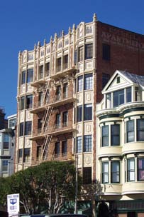
San Francisco State Teacher’s College Vicinity Apartments
The “apartments” moniker given to locally-eligible San Francisco State Teacher’s College Vicinity Apartments Historic District is indicative of the types of contributing resources. These take the form of four- to seven-story multiple-family residential structures, usually with a raised basement or parking garages at ground level. While one other apartment building of a smaller scale is also located within in the district, it does not contribute due to its later construction date. The contributing buildings are all constructed of reinforced concrete. The earliest contributor dates to 1927, while the latest dates to 1931.
San Francisco State Teacher’s College
The National Register District campus consists of five buildings location on two blocks bounded by Haight, Buchannan, Hermann, and Laguna. One of the significant features of the district is its long standing use as an educational facility beginning with the San Francisco State Normal School and most recently being used by the University of California-Berkeley and the French-American International School.
Upper Market Street
The historic themes of the California Register eligible Upper Market Street Historic District significance is derived from the advent of public transportation routes into the area, providing a connection with the city’s downtown core and encouraging residential development in the outlying neighborhoods such as Duboce Triangle and Eureka Valley. This, in turn, influenced the establishment of businesses along Upper Market Street, which echoed the commercial development further east on Market Street, and served the surrounding residential neighborhoods.
The properties fronting on Market Street are almost entirely commercial. Nearly all of the buildings are of wood frame construction and clad in wood or stucco siding. Other building types include concrete construction and brick masonry. Victorian-era and Classical Revival style the most prevalent, however International, Art Deco, and Art Moderne, are also present and help to illustrate the continual commerce-driven development of parcels along the prominent traffic corridor. In keeping with commercial stylistic conventions, rectangular, flat roofed structures are prevalent. Bay windows and facades organized into multiple bays are common features throughout the district.
Elgin Park-Pearl Street Reconstruction
The California Register eligible Elgin Park-Pearl Street Reconstruction Historic District is a medium-scale (generally two to three stories in height) residential enclave located within the northern Mission District. Contributing properties are typically residential flats; five single family dwellings and three mixed-use, residential-over-commercial buildings are also included. Contributors were erected between 1906 and 1913, during the period of reconstruction that followed the citywide disaster of 1906.
Jessie-McCoppin-Stevenson Streets Reconstruction
The California Register eligible Jessie-McCoppin-Stevenson Streets Reconstruction Historic District is a medium-scale (generally two to three stories in height) residential enclave located within the northern Mission District. Contributing properties are almost exclusively residential flats; one single family dwelling is included. Contributors were erected between 1906 and 1912, during the period of reconstruction that followed the citywide disaster of 1906.
Ramona Street
This district is eligible for both the National and California Register. It is a very early (1911-1923) urban, middle class subdivision, with a unified range of architectural styles and pattern of development encompassing integrated garages on the ground floor.
Guerrero Street Fire Line
The Guerrero Street Fire Line District is eligible for the National Register. The buildings embody the distinctive characteristics of balloon frame housing stock in San Francisco erected before 1906, as well as possessing high artistic values in their rich ornamentation.
Hidalgo Terrace
The proposed California Register Eligible District encompasses the single small cul-de-sac of buildings constructed between 1919 and 1925. The buildings are nearly all two-story stucco-clad single-family row houses, with the notable distinction that the two buildings that mark the entrance to Hidalgo Terrace from Dolores Street are three story apartment buildings. Most include a recessed garage door on the ground floor. There are front setbacks with small front greenspace on all buildings save for the two apartment buildings that form a gate into the small street.
These resources and any other potential districts identified through future survey efforts should be preserved, maintained and enhanced through rigorous review of any proposed changes within their boundaries.
POLICY 3.3.6
Pursue future preservation efforts, including the designation of historic landmarks and districts, should they exist, throughout the plan area.
A 1995/96 historic resources survey identified an historic district in the Hayes Valley area and the Inner Mission North Survey of 2004 identified three smaller eligible districts in the north Mission area. The Market and Octavia Historic Preservation Survey expanded one existing district and identified an additional 7 districts. The boundaries of these historic districts can be found on Map 4. The 2018/19 Hub Historic Resource Survey identified five new individual historic resources. Future survey findings should be incorporated as appropriate. In addition to the protection provided to these resources through planning and environmental review procedures, official designation should also be pursued when appropriate. Designation serves to more widely and publicly recognize important historic resources in the plan area.
POLICY 3.3.7
Ensure that changes in the built environment respect the historic character and cultural heritage of the area, and that resource sustainability is supported.
Historic resources are focal points of urban context and design, and contribute greatly to San Francisco’s diverse neighborhoods and districts, scale, and city pattern. Alterations, additions to, and replacement of older buildings are processes by which a city grows and changes. Some changes can enhance the essential architectural and historical features of a building. Others, however, are not appropriate. Alterations and additions to a landmark or contributory building in an historic district should be compatible with the building’s original design qualities.
Rehabilitation and adaptive use is encouraged. For designated resources, the nationally recognized Secretary of the Interior’s Standards for the Treatment of Historic Properties should be applied. For non-designated cultural resources, surveys and evaluations should be conducted to avoid inappropriate alterations or demolition.
POLICY 3.3.8
Encourage new building design that respects the character of nearby older development.
New buildings adjacent to or with the potential to visually impact historic contexts or structures should be designed to complement the character and scale of their environs. The new and old can stand next to one another with pleasing effects, but only if there is a successful transition in scale, building form and proportion, detail, and materials. Other polices of this plan not specifically focused on preservation—reestablishment and respect for the historic city fabric of streets, ways of building, height and bulk controls and the like—are also vital actions to respect and enhance the area’s historic qualities.
Policy 3.3.9
Promote preservation incentives that encourage reusing older buildings.
Preservation incentives are intended to encourage property owners to repair, restore, or rehabilitate historic resources in lieu of demolition. San Francisco offers local preservation incentive programs, and other incentives are offered through federal and state agencies. These include federal tax credits for rehabilitation of qualified historical resources, property tax abatement programs (the Mills Act), alternative building codes, and tax reductions for preservation easements. Preservation incentives can result in tangible benefits to property owners. Material deconstruction and re-use also supports the City’s air quality and climate-related emission reduction goals.
POLICY 3.3.10
Apply the “Secretary of the Interior’s Standards for the Treatment of Historic Properties” for all projects that affect individually designated buildings at the local, state, or national level.
The Secretary of the Interior’s Standards assist in the long-term preservation of historic resources through the protection of historical materials and features. Nationally, they are intended to promote responsible preservation practices that help to protect against the loss of irreplaceable cultural resources.
POLICY 3.3.11
Apply the Secretary of the Interior’s Standards for the Treatment of Historic Properties for infill construction in Historic Districts and Conservation Districts (designated at the local, state, or national level) to assure compatibility with the character of districts.
These standards should be applied in decisions involving infill construction within conservation or historic districts. These districts generally represent the cultural, social, economic or political history of an area, and the physical attributes of a distinct historical period. Infill construction in historic districts should be compatible with the existing setting and built environment.
POLICY 3.3.12
Preserve the cultural and socio-economic diversity of the plan area through preservation of historic resources.
Valuing the historic character of neighborhoods can preserve diversity in that older building stock, regardless of its current condition, is usually of a quality, scale, and design that appeals to a variety of people. Older buildings that remain affordable can be an opportunity for low-income households to live in neighborhoods that would otherwise be too expensive.
POLICY 3.3.13
To maintain the City’s supply of affordable housing, historic rehabilitation projects may need to accommodate other considerations in determining the level of restoration.
Where rehabilitation requirements threaten the affordability of housing, other accommodations may need to be emphasized such as: exterior rehabilitation which emphasizes the preservation and stabilization of the streetscape of a district or community or recognizing funding constraints, to balance architectural character with the objectives of providing safe, livable, and affordable housing units.
Fundamental Design Principles for Building Massing and Articulation
The way we experience a building is determined largely by its massing and articulation. Buildings in most San Francisco neighborhoods are no more than five stories tall, built on narrow lots, and have bay windows or other kinds of projections. This gives them a distinct rhythm and verticality, and breaks down the scale to that of the human activity taking place inside and around them. This further relates buildings to the human activities in the street. Proiects shall also conform to Citywide Design Standards and other adopted obiective standards.
1. Most new buildings should be built to all property lines facing public rights-of-way. In the Market and Octavia neighborhood, buildings commonly front directly onto the public realm - - streets and alleys - - and are set back only to accommodate elements.
1. Construct infill development to property lines
2. Taller buildings should include a clearly defined base, middle, and top. The middle of buildings should be clearly distinguished from the base and articulated with windows, projections, porches, and/or balconies. The roof, cornice, or parapet area should be well integrated with the building’s overall composition, visually distinctive, and include elements that create skyline interest. Roof forms should be drawn from the best examples in the area. Above five stories, top floor(s) should be incorporated into an appropriately scaled expression of the building’s top.
3. Use of setbacks to reduce mass. Upper-floor setbacks or other architectural techniques that reduce the overall massing should be considered where a building would exceed a height equal to the width of the facing street, or differ by one or more stories, from the prevailing height of adjacent buildings.
4. Building façades should include three-dimensional detailing; these may include bay windows, cornices, belt courses, window moldings, and reveals to create shadows and add interest. In most cases, a minimum window reveal of two inches should be incorporated and sliding windows or applied mullions should not be incorporated on windows facing the street or the public realm (streets, alleys and other publicly-accessible spaces). Windows and cornices are especially important elements contributing to the creation of a comfortable “urban room” and pedestrian environment. Upper floors may include smaller, vertically proportioned windows punched into walls, projections such as bay windows, or small balconies. Windows should typically be vertical to reflect traditional arrangements found throughout San Francisco. Other façade elements that contribute to visual interest may include awnings, canopies, projections, trellises, and detailed parapets.
5. Building façades that face the public realm should be articulated with a strong rhythm of regular vertical elements. There is a well-established pattern of individual buildings on 25- to 50-feet wide lots in the residential and neighborhood commercial areas of the Market and Octavia neighborhood. While buildings occupy larger frontages along the Market and Mission Street corridor, they are typically broken up with a regular rhythm of projections, changes in massing, wall planes, and rooflines.
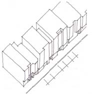
5. Individual buildings in the area are typically on 25 – 50 foot wide lots
6. The façades of new buildings should extend this pattern. New buildings should occupy narrow frontages and express a vertical orientation in their use of projections, windows, and other detailing. This is ideally achieved through individual buildings on narrow frontages. On wider lots, at the least, vertical elements should break down the visual scale of larger buildings and create a rhythm that visually minimizes overall massing, consistent with historic development patterns.
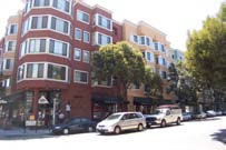
6. Although constructed on a large lot, this building façade replicates the traditional 25-50 foot-wide lot pattern through changes to the plane, color and roof line.
7. The façades of new buildings should extend this pattern. Highly-visible building facades along interior property lines, particularly adjacent to significantly shorter buildings, should incorporate a combination of articulations, setbacks, fenestration/windows and material detailing to mitigate large expanses of blank wall. There are cases where new buildings may be built adjacent to existing buildings that are substantially shorter (i.e. by two or more stories). Sometimes these adjacent buildings have historic merit, contain housing units, feature lower height limits, or are limited by other factors that make them unlikely to be re-developed in the foreseeable future with larger buildings that might mask the side facade of the proposed building. Large expanses of blank wall are unsightly and potentially blighting on a neighborhood. New buildings shall sensitively and creatively treat these prominent interior property line conditions, cognizant of the visibility of these facades from surrounding public spaces and buildings. Larger, wider buildings with greater amounts of street frontage shall also consider more significant articulations or partial upper floor setbacks along these property lines. Techniques for incorporating planted “living walls” can also soften the visual impact of exposed sidewalls and facades while providing ecological benefit.
8. Buildings on sloping sites should follow the slope to reinforce and accentuate the city’s natural topography and maintain a strong relationship to the street. One of the qualities most revered in San Francisco is streets and buildings that rise and fall in concert with topography. New buildings or additions should follow the slope of the street to accent and celebrate the natural topography and provide a vertical rhythm to the street. Where buildings fail to step up slopes, they adversely “flatten” the city’s natural topography.
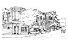
9. For buildings on slopes, the ground floor and building entries should step-up in proportion to the slope between façade segments.
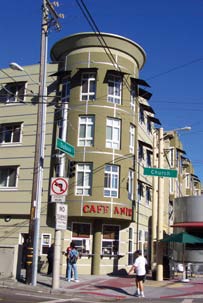
9. Corner tall tower / bay element establishes a visual landmark at an important street intersection
10. Special building elements and architectural features such as towers and special entries should be used strategically at street intersections and near important public spaces. Throughout the Market and Octavia neighborhood, buildings with these elements contribute to a building’s distinction as a landmark, help to define a gateway, draw attention to an important activity, or help define public gathering places and intersections.
11. High-quality building materials should be used on all visible façades and should include stone, masonry, ceramic tile, wood (as opposed to composite, fiber-cement based synthetic wood materials), precast concrete, and high-grade traditional “hard coat” stucco (as opposed to “synthetic stucco” that uses foam). Rich architectural detailing on individual buildings significantly contributes to the public realm. Detailing is encouraged to provide interest and create variation in wall planes; materials and level of detail should be drawn from the best examples in the area. Base and cornice materials should be balanced in material and color.
Fundamental Design Principles for Towers
Towers may be permitted above a base height of 85 - 140-feet in selected locations in the general vicinity of the intersections of Market and Van Ness and Mission and South Van Ness. Special urban design considerations are required for towers because of their potential visual impacts on the city skyline and on the quality and comfort of the street. Proiects shall also conform to Citywide Design Standards and other adopted objective standards.
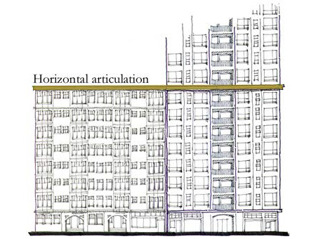
1. Horizontal articulation at the street wall height should be employed. Like all buildings, towers need to create an appropriate enclosure of the street. Some form of horizontal articulation is essential to mark the street wall height and frame the portion of the building’s façade that marks the pedestrian zone.
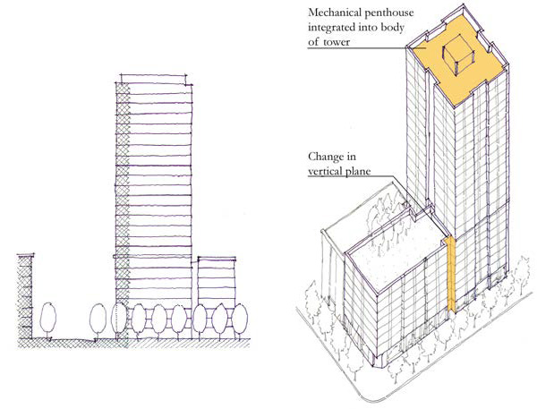
2. A change in vertical plane should differentiate a tower element from the rest of the building. A change in vertical plane differentiates the mass of the tower from that of adjacent buildings, focusing this massing on its base and setting it apart as a distinct building.
3. Provide pedestrian comfort from wind. There are significant winds in the Van Ness Avenue and the Market / Mission street corridor. Towers such as the Fox Plaza Tower channel winds down to the street level, resulting in unpleasant and potentially dangerous conditions for pedestrians. Redirected wind flows from new towers should not exceed 7 M.P.H. on Market Street and 11 M.P.H. on all other streets. Horizontal articulation, screens and other wind mitigation measures should be integrated into the overall massing, design and articulation of the building.
4. Towers should be light in color. For the most part, buildings in San Francisco are light in tone. The overall effect is that of a white city spread over the hills. To maintain continuity with this existing pattern, dark or disharmonious colors or building materials should be avoided. Highly reflective materials, particularly mirrored or reflective glass, should be avoided.
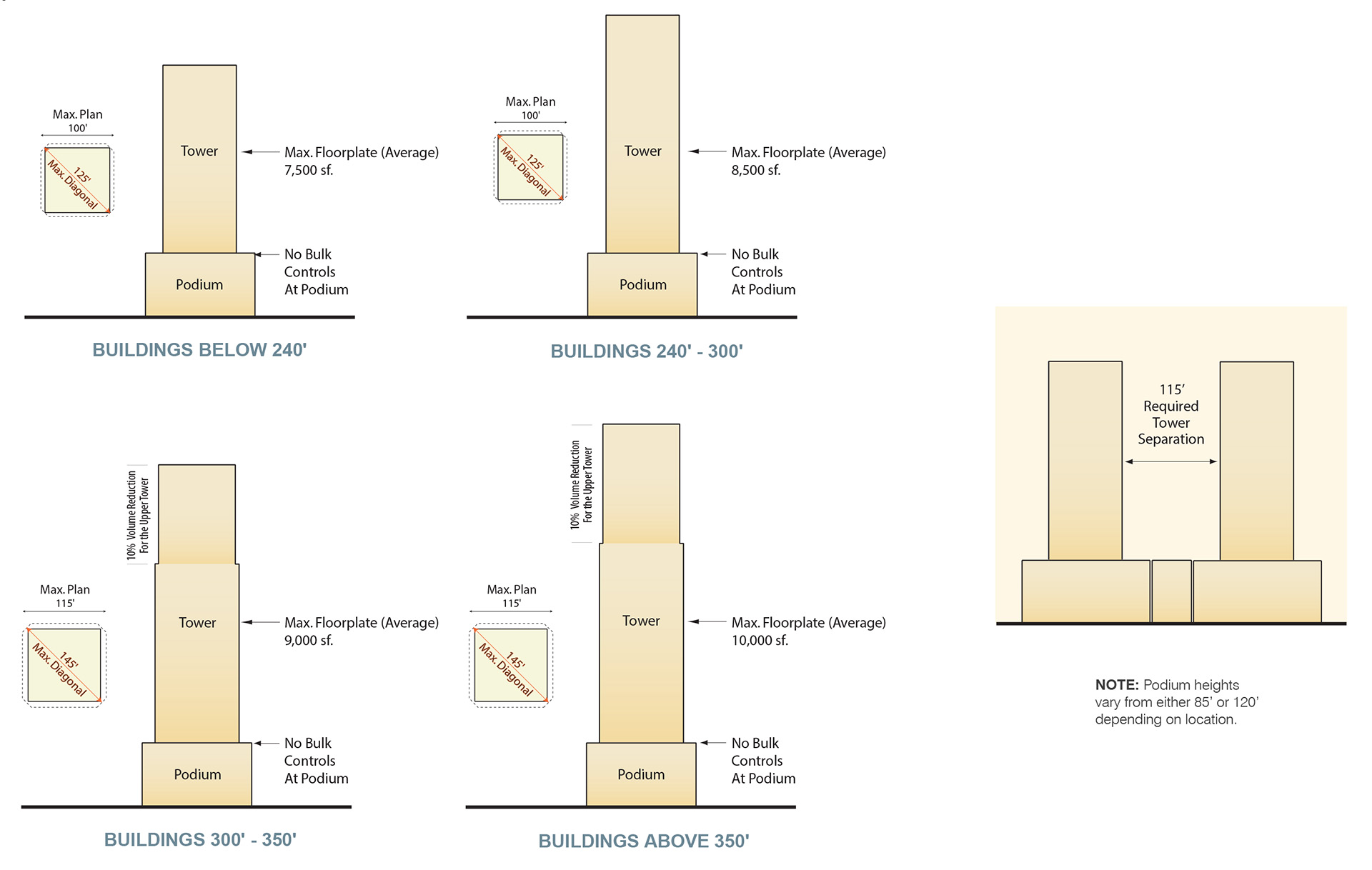
Fundamental Design Principles The Ground Floor
The design and use of a building’s ground floor has a direct influence on the pedestrian experience. Ground floor uses in the area are devoted to retail, service, and public uses in mixed-use buildings and to residential units and lobbies in apartment buildings. These uses provide an active and visually interesting edge to the public life of the street, which is especially important on neighborhood commercial streets. Parking, which has become a common street-facing use in more recent buildings, dilutes the visual interest and vitality of the street. This plan maintains a strong presumption against permitting surface-level parking as a street-facing use; rather, it encourages retail, residential, and other active uses facing the street. Proiects shall also conform to Citywide Design Standards and other adopted obiective standards.
1. Surface parking should not be permitted between the street-facing property line and the fronts of buildings in most instances. The use of setbacks for parking detracts greatly from the sidewalk character and pedestrian comfort. Parking should not be permitted at the front of buildings, except on parcels with 25 feet or less of frontage, where it is in a garage that is integrated into the structure of the building.
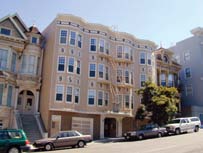
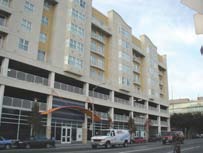
The buildings in the two images below both have a density of 100 units to the acre. The building in the first image, built before parking requirements, provides one parking space for every four units. The building in the second image provides one parking space for every unit. It is four stories taller than the first building. On the street level, it offers little except views of the parked cars within.
2. No more than 30 percent of the width of the ground floor may be devoted to garage entries or blank walls. This shall in no case require garage entries be less than 10 feet wide. Where curb cuts are expressly prohibited by this plan, garage entries are not permitted. No façade may feature garage entries that together total more than 20 feet in width. The building area immediately facing the street should support residential or commercial uses, have a human scale, and contribute active uses to the street. Large garage entries are extremely detrimental to a street’s design character and pedestrian safety,. Vehicular traffic crossing the sidewalk should be limited to the absolute minimum necessary to facilitate access to parcels. At least 70 percent of the width of the ground floor facing streets must be devoted to windows, entrances to dwelling units, store windows and entrances, landscaping or planters, and other architectural features that provide visual relief and interest.
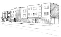
2. Excessively wide garage doors create a visually “dead” sidewalk.
3. Parking should be located at the rear of the site and setback from street frontages wherever possible.
4. Eight-foot-wide garage entries are preferred over wider entries.
5. Building entries and shop fronts should add to the character of the street by being clearly identifiable and inviting. Blank walls (absent windows, entries, or ornamentation) should be avoided. Display windows with unobstructed views into interior spaces and building entrances should line major streets. Service functions such as trash, utility, or fire rooms, should not be placed at the street front where possible.
6. Primary building entries may be set back from the street-facing property line, though no more than 5 feet from the street-facing façade; and if set back, should be no wider than 15 feet at the property line per individual entry. A recessed entryway provides transition space between the public sidewalk and the private interior of the building, and is common in this neighborhood for both commercial and residential uses.
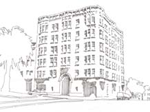
7. New buildings should adhere to the existing Planning Code limitations on signage. The character, size, and quality of signage projecting from buildings play an important role in the visual appeal and attractiveness of a street.
8. Building projections and recesses, along with variations in materials and color and other architectural design features, should be used to emphasize pedestrian entries and de-emphasize garage doors and parking.
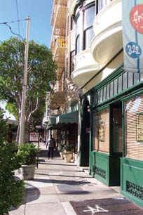
9. First-floor residential units are encouraged to be at least 3 feet above sidewalk level such that the windowsills of these units are above pedestrian eye level in order to maintain the units’ privacy. Successful ground floor residential units are often set slightly above the street grade, such that ground-floor living spaces look down on the street. Transitions between private space and the public space of the street, using stoops and other means, are encouraged.
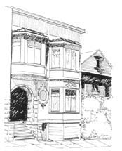
9. Stairs elevate first floor residential units above pedestrian eye level and provide a transition between public and private space
10. Residential units on the first to third floors should generally be directly and independently accessible from the sidewalk, rather than from common lobbies. Individual entries to residential units help to provide rhythm to a building façade, contribute activity, interest, and “eyes” on the street, and enhance the sense of connectedness between residential units and the public life of the street. Direct residential entries from the street are appropriate in most buildings where they do not conflict with ground floor retail uses.
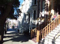
10. Flats have independent access to the street.
Fundamental Design Principles for Streets
Neighborhood Commercial Streets
Like most parts of San Francisco, neighborhood commercial streets in the Market and Octavia neighborhood provide a center for the life of the area. These streets are typically lined with individual retail storefronts that provide visual interest and have a scale that feels especially lively and organic. While not all new development on these streets need be mixed-use in character, it should contain active ground-floor uses and provide a façade that adds visual interest and a human scale to the street. Proiects shall also conform to Citywide Design Standards and other adopted obiective standards.
1. Where present, retail frontages should occupy no less than 75 percent of a building frontage at the ground floor. The interior of the retail space should be visible at pedestrian eye level to help activate the street. Retail spaces in the neighborhood typically provide ample transparency to the street. Businesses often use retail frontages to display goods and provide views to the interior. Dark or mirrored glass is not permitted. Solar consideration should be treated architecturally, through the use of recesses, eyebrows, or awnings.
2. Ground floor retail use should be directly accessible from the street at the grade of the sidewalk onto which it fronts. Storefronts located above or below grade often feel removed from the life of the street and are notoriously difficult to make successful. Steps up or down should be avoided. On sloping sites, taller retail spaces at the low end of the site are preferable to sinking a portion of the retail floor below sidewalk grade.
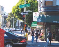
3. Ground-floor retail spaces should have at a minimum a 12-foot, ideally 15 feet, clear ceiling height. The most successful retail spaces in the Market and Octavia neighborhood and the city have uncramped ground-floor spaces with high ceilings. They often have clerestory windows.
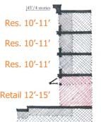
4. Horizontal architectural design articulation should be incorporated between the ground floor and second story levels. A minimum 6-inch projection is suggested. The human scale of the sidewalk is of paramount importance on neighborhood commercial streets. Architectural detailing, such as a belt course or cornice, at the ground floor ceiling height helps to frame the pedestrian space of the sidewalk.
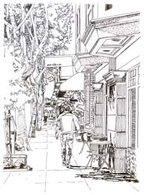
5. If provided, off-street parking should be accessed via side streets or alleys where that is possible.
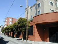
5. This mixed-use project retains contiguous retail along Gough Street by providing garage access on Hickory Alley.
6. Curb cuts should not be permitted on Market, Church, and Hayes Streets nor Van Ness Avenue where retail is explicitly encouraged. Commercial streets thrive where continuous storefronts are maintained and there is an active pedestrian environment uninterrupted by cross-traffic accessing off-street parking or dead spaces created by garage doors. Access to off-street parking should be discouraged on those frontages designated for retail use, as described in Policy 1.1.8. In retail areas, curb cuts reduce pedestrian safety, and discourage public use and enjoyment.
7. If provided, off-street parking located at or above grade must be setback at least 25 feet from the street-facing property line, including parking above the ground floor.
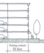
Special Streets - Market Street
Market Street is San Francisco’s premiere civic street—it is the focal point for the city’s commercial, ceremonial, and cultural life. Market Street is the backbone of the city and regional transit systems and is also the City’s busiest pedestrian and cycling street. Given its special role, buildings along Market Street, and the uses they support, should contribute to its vitality and life as a civic space. New buildings should have a human scale and character appropriate for a street of its scale and prominence.
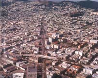
Market Street is no longer bisected by the Central Freeway and is the dominant street in the Plan Area.
Beyond the requirements for neighborhood commercial streets, described above:
1. Ground floor retail spaces should have at minimum a 15-foot clear ceiling height. Retail spaces along Market Street are grand, open, and inviting. Reflecting the scale of existing retail spaces on Market Street. New buildings should provide 15-foot ceiling heights on the ground floor. In this way, new construction will allow ample light and air to penetrate the ground floor. In combination with providing adequate fenestration, this would increase transparency of the building façade.
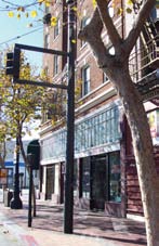
Alleys
Alleys are typically quieter, support primarily service and small residential uses, and have a more intimate scale than streets. They provide an important way of moving about for pedestrians and cyclists and offer relief from busy streets. Alleys vary widely in their use and character—some are lined with commercial loading docks and others with residential stoops and front doors. The plan area has an exceptional network of alleys. New buildings on alleys should respond to the unique conditions of alleys, reinforcing their intimate scale and character.
1. On alleys, parking and garage doors may occupy no more than 40 percent of a parcel’s total alley frontage, up to a total of 20 feet maximum, at ground level. In no case shall garage entries be restricted to less than 10 feet wide. Parking and garage doors, while necessary uses on alleys, should not dominate. Residential units, entries, loading docks, and other more active uses are preferable. Where parking and garage doors are permitted as an alley-facing use, they should be limited in their overall frontage, recessed, and otherwise screened from view.
2. Residential uses on the ground floor are encouraged on alleys. Residential uses on the ground floor are common on alleys in the plan area and bring active living space to street level.
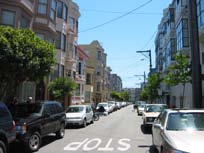
3. Consider making improvements to non-residential alleys that foster the creation of dynamic, mixed-use places. Non-residential alleys support new and existing commercial and institutional uses.
Encourage coordinated approaches to the design of these alleys so as to protect the intimate scale of alleys and yet create public spaces that contribute to and support the varied uses. Consider the following improvements, where appropriate:
-
Enliven the ground floor space with active uses where possible. Accommodate loading spaces in ways that add to the living character of the alley.
-
Non-residential alleys can benefit from “living street” improvements that provide public open space improvements that enhance the non-residential uses.
-
Encourage a visually coherent environment in the alley by using similar or complementary design details throughout.
-
Create flexible exterior spaces that can accommodate the growth and evolution of a variety of uses.
-
Non-residential alleys may provide for a number of different and often conflicting uses. Reduce the conflict by providing an uncluttered environment. Consider placing furnishings such as trash cans in a recessed area.
Institutional (School) Use at Hickory Alley and Gough Street
Fundamental Design Principles for Open Space
Residential buildings in San Francisco provide on-site open space for the use of the residents in a variety of forms. Different from parks, plazas, and other public spaces, private open spaces should be secure and should be easily accessed from the residential units. They are a valuable play space for children, a setting for backyard gatherings, and an extension of interior living areas. Creative design and siting of interior open spaces is encouraged in new buildings. Safe and comfortable interior open spaces compliment the area’s larger network of civic streets and open spaces.
1. In most instances, three- and four-bedroom units should be located within three stories of common open space, and accessible via stairs. For these spaces to be useful as children’s play spaces, they should have close proximity to the residential unit to facilitate parental/adult supervision. Generally speaking, open spaces that are more than three stories from a living space and require the use of an elevator for access are less likely to be actively used by families.
2. Street furniture and other public improvements should be provided in the vicinity of the project. In addition to private interior open space, the street provides a valuable public open space that residents and businesses use daily. Private open spaces should be strongly connected to the street. Tree-plantings, street furniture, and other enhancements should be provided to strengthen the street’s value as a open space.
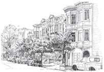
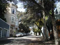
3. Encourage rooftop gardens as a form of common open space. Rooftop gardens are often overlooked as a means of providing common open space. These spaces typically have excellent sunlight access, are accessible to tenants/property owners and offer good views.
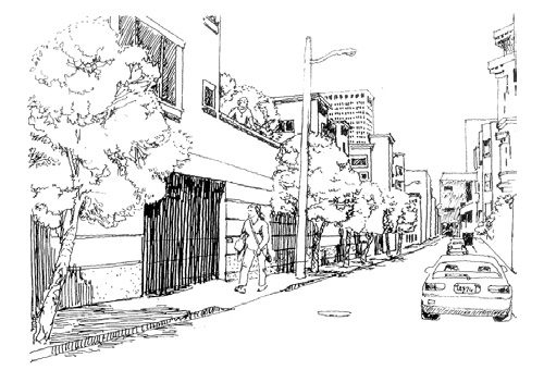
The rooftop terrace provides valuable open space to building residents.
4. Streets and Open Spaces
The System of Public Streets and Alleys
The Public Realm is the space between the buildings. A vibrant and successful public realm is comprised of well-designed public streets, sidewalks, parks, plazas, and open spaces. It includes the public places we walk, travel, sit, play, visit with friends, gather for events, experience nature and art, meet new neighbors, and build community. In San Francisco as a whole and in denser neighborhoods like Market and Octavia, streets are an important part of the public realm. We travel along public ways, to get from place to place, and to gain access to where we live, work, and shop. Public services—police, fire, deliveries of all sorts—depend on them. We locate our municipal hardware and utilities—water, sewage and electric lines, cables, and more—on them, above them, and mostly under them. But the public way system is much more than a utilitarian system of connections. It is where people walk, where they meet each other, where they socialize, where they take in the views, where they see what merchants have to offer, where people (or deliveries) load in and out of vehicles, where they get to know their neighborhood and their fellow neighbors first hand. Streets and sidewalks connect us socially and functionally, and can be categorized as safe or dangerous, places to behold or to stay away from. It is from this dual nature of streets and sidewalks as places of function (utility, transportation) and places of socializing and leisure that one of the main challenges of planning arises—how to allocate this most precious public resource to best meet functional requirements and aesthetic sensibilities.
The Market and Octavia neighborhood is within walking distance of Downtown, adjacent to Civic Center, the home of San Francisco’s most important main street (Market Street), and located where three of the oldest street grids come together. It is reasonably level (for San Francisco), which makes it great for walking and biking. Given its central location, it is one of those urban areas that most San Franciscans pass through in order to reach their destination. Whether by streetcar, bus, trolley, rapid transit, auto, bicycle, or on foot, many of the City’s movement systems rely on the neighborhood’s system of public ways. The challenge in Market and Octavia is no different than for planning in general: How do we accommodate the legitimate travel needs of the people using the many modes of movement through the area, while at the same time respecting and achieving the neighborhood’s legitimate desires for and expectations of safe, moderate-paced, attractive streets on which to move, socialize, walk, and lead an urban, face-to-face lifestyle, at least the equal to any in San Francisco. As in most urban neighborhoods, the goals in Market and Octavia are to accommodate a wide variety of travel needs on safe, attractive streets and sidewalks, and to encourage sustainable modes that help reduce the climate crisis.
A first step to meeting those goals is to restore a balance between the movement needs of competing travel modes, and to ensure that there is a balanced mix of travel modes with special attention to pedestrians and street life.
The plan recognizes that road capacity in San Francisco is a highly constrained resource, with decision-makers required to balance the requirements of cars, transit vehicles, freight, cyclists, and pedestrians. A common fear is that reducing the capacity available for cars will result in major increases in congestion. Much research rejects this logic and shows that people’s transportation choices are dynamic and respond to capacity, relative cost, time, convenience, and other factors. Crucially, we learn that movement of people is more than just movement of cars. This plan prioritizes the safe and effective movement of people. What follows are specific proposals for a myriad of improvements to streets.
See Map 5. System of Civic Streets and Open Space
Principle: Streets that support and invite multiple uses, including safe and ample space for pedestrians, bicycles, public transit, and nature, are a more conducive setting for the public life of an urban neighborhood than streets designed primarily to move vehicles.
The past 20 years have seen advances in ways to improve the livability of streets, be they major traffic carriers or local public ways. Closely planted street trees, sidewalk gardens and green infrastructure for stormwater management, pedestrian-scaled lights, well-marked crosswalks, widened sidewalks at corners, and creative parking arrangements are but a few of the methods used with success to achieve the kind of neighborhood that residents say they want. They are all addressed in the objectives and policies that follow.
Parks, Plazas and Open Spaces
Provision of public open space is necessary to sustain a vital urban neighborhood, especially one where new housing is to be added to an already dense urban fabric. This is especially so given the reality that there are few public parks or plazas in the Market and Octavia neighborhood. To be sure, there are public spaces nearby: Jefferson Square between Gough Street and Laguna Street, at Turk Street; Civic Center Plaza (with its children’s play areas) east of Polk Street; Dolores Park some blocks south of Market Street; Duboce Park, west of Steiner Street; and Koshland Park, which perhaps comes closest to what one thinks of as a local park, up on the hill, at Buchanan Street and Page Street. But all of these spaces are either “nearby,” close but not a part of, or are city-oriented rather than neighborhood-oriented. There is no central public square, park, or plaza that marks and helps give identity to this neighborhood.
At the same time that the neighborhood lacks community-focused open space, it is also largely built out, without significant or appropriate undeveloped land, except for that laid bare by the demolition of the Central Freeway. Most of this property is earmarked for much-needed housing.
In the Market and Octavia neighborhood, the streets afford the greatest opportunity to create new public parks and plazas. That is why streets are included in the discussion of public open spaces. This plan takes advantage of opportunities within public rights-of-way. Most noteworthy, Octavia Boulevard itself is conceived in part as a linear open space, as with all great boulevards, that will draw walkers, sitters, and cyclists. In addition, modest but gracious public open spaces are designated within former street rights-of-way that are availed through major infrastructure changes, along with a series of smaller open spaces, for the most part occurring within widened sidewalks areas. As well, housing development along the former freeway lands will create open spaces within private developments, contributing to the neighborhood as a whole.
Principle: A successful open space system is carefully woven into the overall fabric of a neighborhood’s public streets, taking advantage of large and small opportunities to create both formal and informal spaces for respite, gathering, and recreation.
While almost all of the Market and Octavia neighborhood is built out, there are a few opportunities to integrate new neighborhood open spaces into its existing physical fabric. There are several significant sites for potential new open spaces. Widened sidewalk areas, when provided with benches, nature, and shade that encourage lingering, can be effective small public spaces. This plan includes proposals for both kinds of open space.
-
A new public park, Patricia’s Green in Hayes Valley, has been created at the northern end of the new Octavia Boulevard, using the street right-of-way provided as the boulevard transitions to local traffic.
-
A widened sidewalk in the commercial section of Hayes Street should be studied as a linear open space for strolling under trees and for lingering, linked to the pedestrian promenade along Octavia Boulevard.
-
Street intersections along Market Street—at Dolores Street and at the freeway “touchdown,” for example—provide the opportunity to create small public plazas, and this plan proposes to take advantage of them. Likewise, traffic-calming initiatives on local streets provide opportunities for corner plazas, similar to those in the Duboce Triangle area to the west.
-
An intimate public square can be created in the new Hub neighborhood, along Brady Street, on land associated with a small BART utility structure and adjacent surface parking lot. This is an area of small streets that calls out for new, modestly-scaled housing that can be part of a mixed-use neighborhood. A new public square can serve as a focal point for this area.
-
There is an opportunity for a new open space in the McCoppin Street right-of-way, where the street no longer carries significant traffic flows and can be reclaimed as neighborhood open space. The triangular parcel immediately south of the McCoppin Street right-of-way, currently serving as a truck-rental office, could be part of a larger open space at this location, should it become available. Future open space opportunities should be considered in coordination with future development to activate the open space and enhance stewardship of the space.
-
Every new and enhanced public open space can help achieve the City’s policy goal to amplify nature in order to support biodiversity, climate resilience (reduce extreme heat, air quality, and flood impacts), and happiness. This includes trees, planted areas, green infrastructure solutions for stormwater management, and living roofs and walls. To best support local biodiversity and other sustainability goals, it is important to use drought tolerant and native plant species.
Areawide Improvements
Local streets like Laguna, Hermann, Octavia north of Hayes, Buchanan, and others should be reconfigured and enhanced where necessary to encourage walking and slow traffic movement. They are envisioned as gathering places that enhance neighborhood identity as well as public streets. The neighborhood’s alleys are major assets to be protected and, in places, enhanced.
OBJECTIVE 4.1
PROVIDE SAFE, COMFORTABLE, AND GREEN PUBLIC RIGHTS-OF-WAY FOR PEDESTRIAN USE AND IMPROVE THE PUBLIC LIFE OF THE NEIGHBORHOOD.
POLICY 4.1.1
Widen sidewalks and shorten pedestrian crossings with corner plazas and boldly marked crosswalks where possible without affecting traffic lanes. Where such improvements may reduce lanes, the improvements should first be studied.
On streets throughout the plan area, there is a limited amount of space on the street to serve a variety of competing users. Many streets have more vehicular capacity than is needed to carry peak vehicle loads. In accordance with the city’s Transit-First Policy, street rights-of-way should be allocated to make safe and attractive places for people and to prioritize reliable and effective transit service—even if it means reducing the street’s car-carrying capacity. Where there is excessive vehicular capacity, traffic lanes should be reclaimed as civic space for widened sidewalks, plazas, and the like.
Though it may not be possible to widen sidewalks along major traffic streets such as Market, Franklin, Gough, Oak, and Fell Streets, it is both possible and desirable to widen sidewalks by providing widened ‘sidewalk bulbs’ at corners. In addition, boldly marked crosswalks alert drivers that they are entering intersections where pedestrians are likely to be crossing. Sidewalk widening and improved pedestrian crossings should be implemented throughout the plan area as the most important means of improving pedestrian safety and comfort on the street.
See Map 6. Priority Intersections for Pedestrian Improvements
POLICY 4.1.2
Enhance the pedestrian environment by maximizing trees and gardens along sidewalks that connect people to nature, closely planted between pedestrians and vehicles.
Closely spaced and sizeable trees parallel and close to curbs, progressing along the streets to intersections, create a visual and psychological barrier between sidewalks and vehicular traffic, like a tall but transparent picket fence. More than any other single element, healthy street trees can do more to humanize a street, even a major traffic street. On many streets within the Market and Octavia neighborhood, successful environments can be created through consistent tree infill. For example, this can take place on Otis, Mission, Franklin, and Gough Streets north of Market Street. On other streets, such as Gough Street south of Market, Fell, and Oak Streets, and Duboce Avenue, it will require a major new tree planting program.
Robust tree plantings also make an important contribution to neighborhood identity, microclimate, and biodiversity. Different tree species can be used on different streets, or even different blocks of the same street, thereby achieving diversity on a broader basis; habitat supportive and low-water use species are preferred. If existing trees need to be removed for maintenance reasons, replacement tree species should be informed by observing the most successful species on the immediate and adjacent blocks.
See Map 7 Priorities for Street Tree Plantings
POLICY 4.1.3
Establish and maintain a seamless pedestrian right-of-way throughout the plan area.
Transit-oriented neighborhoods and pedestrian-friendly environments depend on good pedestrian access and ease of movement. Some intersections in the plan area do not permit pedestrian crossings, for example Fell and Gough, Hayes and Gough, and Gough and Otis. The signal cycles at these intersections should be adjusted to accommodate pedestrians . The City should also eliminate pedestrian “do not cross” signs as the sole means to resolve problems at high-traffic intersections where it may be done safely. Prohibitions on pedestrian crossings should be removed wherever these bans exist throughout the plan area.
POLICY 4.1.4
Encourage the inclusion of public art projects and programs in the design of streets, public spaces, and building facades fronting the public realm.
Public art plays an essential role in the civic life of our city. In urban places like the Market and Octavia neighborhood, where streets, parks, and plazas are where civic life unfolds, public art takes on a broad range of meanings that enriches the overall quality of public space. Funding and space for public art should be integrated into all proposals for the physical improvement of streets and open spaces.
POLICY 4.1.5
Prohibit the vacation of public rights-of-way, especially alleys; where new development creates the opportunity, extend the area’s alley network.
There are many existing alleys within the plan area, many of which are concentrated in Hayes Valley and in the larger blocks in the South of Market areas. In addition to being the location of considerable neighborhood housing, most of the alleys, by reason of their intimate scale, the diversity of buildings along them, in some cases their trees, and certainly their contrast with surrounding streets, are delightful, valuable urbane places. These alleys are an invaluable part of the neighborhood’s system of public ways and, like any public resource, should be protected against proposals to privatize them.
POLICY 4.1.6
Pursue the extension of alleys where it would enhance the existing network.
A number of alleys which were previously through streets have been truncated and are now dead-end alleys. As part of the effort to extend pedestrian connections, the City should purchase of the easternmost portion of Plum Alley that is in private ownership and further study the extension of Stevenson Alley from Gough Street to McCoppin Street as part of any proposal for demolition and new construction on Assessor’s Block 3504/030.
POLICY 4.1.7
Introduce traffic-calming measures on residential alleys and consider making improvements to alleys with a residential character to create shared, multipurpose public space for the use of residents.
Parking should be concentrated along the curbside with the fewest curb cuts (driveway breaks). New pedestrian-scaled lighting can be added, along with street trees and sidewalk gardens. Because alleys carry relatively little traffic, they can be re-designed to provide more public space for people—as a living alley with corner plazas to calm traffic, seating and play areas for children, with space for community gardens and the like. By prioritizing use by people over cars, the alley can become a common front yard for public use and enjoyment.
Working closely all City agencies should develop design prototypes for more extensive improvements to residential alleys. The City should establish a process for local residents to propose living-street improvements and participate actively in the design for their alley.
-
Develop prototypes for residential alley improvements, to be used as part of the “Livable Streets” traffic-calming initiative.
-
Develop a process whereby local residents can propose living- alley improvements and participate in the design and implementation of improvements to their alley.
See Map 8. Alleys for “Living Alley” Improvements, Figure 4. A Living Alley, and Figure 5 Linden Alley: Before and After
POLICY 4.1.8
Consider making improvements to non-residential alleys that foster the creation of a dynamic, mixed-use place.
Certain alleys support non-residential uses. Coordinated approaches to the design of these alleys should protect the intimate scale of these alleys and yet create public space that contributes to and supports the varied uses along them.
-
Enliven the ground floor space with active uses where possible. Loading spaces can be accommodated in ways that add to the character of the alley.
-
Non-residential alleys can benefit from “living alleys” improvements that provide public open spaces that enhance the commercial uses.
-
Encourage coordination throughout the alley by using similar or complementary details throughout.
-
Create spaces that allow for the growth and evolution of uses.
-
Non-residential alleys may provide for a number of different and often conflicting uses. Reduce the conflict of uses by providing an uncluttered environment. Consider placing furnishings such as trash and recycling cans in a recessed area.
Octavia Boulevard and Hayes Valley
OBJECTIVE 4.2
ACCOMMODATE REGIONAL THROUGH TRAFFIC ON SURFACE STREETS THAT ALSO SERVE LOCAL NEEDS, THEREBY REPAIRING AREAS DISRUPTED BY LARGE INFRASTRUCTURE PROJECTS OF THE PAST.
POLICY 4.2.1
Create new public open spaces around the freeway touchdown, including a plaza on Market Street and a plaza in the McCoppin Street right-of-way, west of Valencia Street.
Bringing the elevated freeway down to street surface at Market Street provides the opportunity to create two new small public open spaces: a plaza along Market Street west of the freeway touchdown, and a plaza or other form of small open space within the last block of McCoppin Street, as it comes to its terminus west of Valencia Street. The plaza on Market Street enhances the pedestrian experience of the street, and facilitates safer pedestrian crossings. Because of its prominent location at the end of the freeway and beginning of Octavia Boulevard, it has been designed to signal the end of the freeway and an entry to the city. The plaza should include seating, trees and other pedestrian amenities. The leftover space on McCoppin Street is an appropriate place to provide a community-serving open space, integrated into the overall “green street” treatments proposed for McCoppin Street east of Valencia Street, as well as the proposed bike path on the east side of the touchdown. The triangular parcel immediately south of the McCoppin Street right-of-way could be incorporated with it to provide a larger open space at this location. These new spaces should be designed in coordination with future development to ensure that the spaces are active, programmed, and maintained.
POLICY 4.2.2
Improve the pedestrian character of Hayes Street, between Franklin and Laguna Streets, by creating an unobstructed, linear pedestrian thoroughfare linking commercial activities along Hayes Street to the new Octavia Boulevard.
Hayes Street is a special commercial street within the neighborhood. It is at once locally-focused, with small cafes and restaurants, and oriented citywide, with numerous galleries and close proximity to cultural institutions in the Civic Center. It is often alive with pedestrian activity. Between Franklin and Laguna Streets, where traffic rerouting policies allow converting the street back to two-way traffic, the roadway is wider than it needs to be for vehicular traffic. In this area, the City should undertake a future study which would consider factors such as widening the sidewalk on the north side of the street, planting new trees, and installing new pedestrian-scaled light fixtures and benches to create a much needed public open space. Café seating should be allowed to spill out onto widened sidewalks. The sidewalk widening should not adversely affect turning movements for Muni buses.
See Figure 6. Hayes at Gough Intersections: Existing and Proposed
POLICY 4.2.3
Re-introduce a public right-of-way along the former line of Octavia Street, between Fulton Street and Golden Gate Avenue for use by pedestrians and bicycles.
Damage done to the San Francisco grid by land-assembly projects of the 1960’s and 1970’s can be partially repaired through the reestablishment of Octavia Street as a public right-of-way from Fulton Street to Golden Gate Avenue, providing improved pedestrian access to existing housing developments, helping to knit them back into the areas south of Fulton Street, and providing a “green connection” between the new Octavia Boulevard, Jefferson Park and Hayward Playground. Bicycle movement in a north-south direction would also be improved by this policy.
POLICY 4.2.4
Study further dismantling of the Central Freeway, similar to removal of the freeway ramps between Market and Hayes Streets.
In the long-term, the City should evaluate removing the Central Freeway west of Bryant Street, and to rebuilding Division Street as an extension of Octavia Boulevard. The success of Octavia Boulevard should be analyzed periodically in conjunction with a study of further dismantling of the Central Freeway.
Just as the north-of-Market Street Central Freeway ramps bisected the Market and Octavia neighborhood, the new Central Freeway ramp does the same thing to the south. The area under the freeway is dark and dank and Division Street and its surrounds are unpleasant at best. While pulling the Central Freeway back to Market Street allows the repair of Hayes Valley with minimal negative impacts to cross-town automobile traffic, it does nothing to address the damage done to the Mission District or the Hub. As important, it disgorges a large volume of high-speed automobile traffic onto Market Street, the most constrained street in the plan area. Market Street is the city’s signature street, its most important civic street and the most important for transit, bicycles, and pedestrians. The considerable damage the freeway touchdown has done to the city’s most important street is obvious, and the City should purposefully work to repair this damage.
South of Market Street, the Mission Street and South Van Ness Avenue freeway ramps are poorly placed, requiring motorists to make left turns through highly congested intersections to get to and from the Van Ness/Franklin/Gough corridor. These turning movements add delay in already constrained locations, particularly at the Mission/Otis/Duboce/13th intersection.
To take better advantage of the SoMa and Mission street grids – and particularly the extra capacity on Brannan, 11th, 12th, and northeast Mission Streets, the City should study removing the elevated Central Freeway to the fullest extent feasible, and rebuilding Division Street as a surface-level extension of Octavia Boulevard.
Market Street
Market Street, the City’s “Grand Diagonal,” will continue to be honored and protected as San Francisco’s visual and functional spine. Market Street has been reconfigured twice in major ways since a 1967 bond issue was approved by San Franciscans to improve it from the Central Freeway to the Ferry Building. This plan confines itself to a series of enhancements to make the street more pleasant to walk along, cross, and cycle upon in the plan area. Improvements to the overall street configuration should be made as part of a comprehensive redesign of the street, from The Embarcadero to Castro Street. Ultimately, the damage done to Market Street and the neighborhood by the poorly conceived freeway touchdown should be addressed and repaired.
OBJECTIVE 4.3
REINFORCE THE SIGNIFICANCE OF THE MARKET STREET STREETSCAPE AND CELEBRATE ITS PROMINENCE AS SAN FRANCISCO’S SYMBOLIC “MAIN STREET.”
POLICY 4.3.1
Recognize the importance of the entire Market Street corridor in any improvements to Market Street proposed for the plan area.
Market Street is unquestionably the City’s most memorable street. It is our primary ceremonial space, the heart of our downtown, and our most important transportation corridor. There are more demands placed on Market Street than any other street in the City: it accommodates streetcars, buses, trolleys, automobiles, bicycles, and pedestrians who use it as a major route to destinations and as a strolling street. With these heavy demands, it is in the impossible role of trying to be all things for all modes of travel.
A bold move on Market Street is needed. The City’s Better Market Street project makes this bold move. The project would prioritize transit, paratransit, taxis, and people walking and riding bicycles. It would create dedicated, safe spaces for bicyclists, create safe crossings for pedestrians, widen sidewalks, integrate boarding islands for seamless transit connectivity, improve transit speeds, and significantly enliven the street. Access would be restricted for private vehicles and trucks.
POLICY 4.3.2
Improve the visual appearance and integrity of Market Street within the plan area through more and better maintained trees and ecological features, de-cluttering sidewalks, and installing new pedestrian amenities.
While an appropriate redesign of the whole of Market Street is outside of the scope of this plan, significant improvements of moderate cost are possible and desirable to enhance the street within the neighborhood. The magnificent palm trees that march down the center of the street are spotty and noncontiguous in their spacing, and their impact is lost where they are experienced: on the street. There are many opportunities to both infill these trees and add new ones that provide shade and habitat value to connect people to nature; at times in double rows. Sidewalk gardens of low plantings also enhance neighborhood aesthetics and biodiversity, and as needed can be designed to manage stormwater. All plantings should receive the highest level of on-going care. Sidewalk infrastructure and amenities such as newspaper boxes, signs, refuse cans, and utility boxes could be clustered more attractively. Benches, bicycle racks, and pedestrian-scaled lighting fixtures should be provided on the street, particularly at corner plazas.
POLICY 4.3.3
Mark the intersections of Market Street with Van Ness Avenue, Octavia Boulevard, and Dolores Street with streetscape elements that celebrate their particular significance.
The designs for these principal intersections should include streetscape elements—such as special light fixtures, gateways, and public art pieces—that emphasize and celebrate the special significance of each intersection.
Market Street and Van Ness Avenue
The intersection at the heart of the Hub neighborhood is primarily a crossroads, with little to draw people and even less to make them stay. Few buildings activate the street, conflicts between different users are constant, space is highly contested, and there is nothing to define or identify the space. The intersection should be designed with prominent streetscape elements that signify the crossing of two important streets. This will break up the width of the street into three separate sections, thereby humanizing it and providing pedestrian refuges for people crossing. Widening, visually defining, and specially marking the crosswalks to more logically follow pedestrian desire lines will enhance the space for pedestrians. Additional greening will improve the pedestrian experience and pedestrian comfort, along with added wind canopies, street trees, and espaliers (green planted screens). Living alleys and pedestrian passageways should be integrated to help make the intersection feel more intimate. High-quality design should be leveraged to mark this location and create a sense of place. Buildings should be pulled back from the corner, and new entrances to the Van Ness MuniUNI Metro Station should be integrated within buildings when possible.
Market Street and Octavia Boulevard
The freeway touchdown added a new public plaza on its south side, west of the freeway touchdown, and wide sidewalk corners and medians on its north side. These spaces should be provided with prominent gateway elements that signify a major entry into the city. A statue, obelisk, light cannon, or other piece of public art should be considered for installation at the center of this intersection. Ultimately, the damage done to Market Street and the neighborhood by the poorly conceived freeway touchdown should be addressed and repaired, and these new public plazas given the civic role they ought to have.
Market and Dolores Streets
Dolores Street has special historic significance to the people of San Francisco and is one of the most visually memorable streets in the city, because of its palm tree lined central median. The intersection of Dolores Street and Market Street should be celebrated by extending the median to Market Street and creating a small paved plaza in front of the statue for people to meet, talk, and sit, and by announcing the presence of this significant city street, taking us to the location of Mission Dolores.
See Figure 7. Market Street at Dolores Street: Existing and Proposed
POLICY 4.3.4
Enhance the transit hub at Market and Church Street.
Church Street, from Market Street to Duboce Avenue, is one of the city’s most important transit centers. It is also a center of neighborhood activity, with large volumes of pedestrian and bicycle traffic around the clock. Despite its prominence, the area lacks all but the most basic pedestrian amenities. Relatively simple improvements would dramatically enhance pedestrian and transit rider comfort in the area, making transit a more attractive travel option.
The City should conduct a redesign study of Church Street, north of Market Street. The study should examine re-designing the street as a pedestrian-oriented transit boulevard (e.g., a transit conflict street) or other options that maximize pedestrian and transit connections. The city should also investigate the opportunity to install an enhanced streetcar-loading platform on Duboce Avenue, west of Church Street. The study should strive to ensure safe, convenient and comfortable pedestrian connections to transit facilities and to accommodate bicycle traffic on Duboce Avenue.
Church Street, south of Market Street, features wide sidewalks. Special light fixtures should be installed at this intersection, and the streetcar platform shelters could receive a special “Market Street” design.
See Figure 8. Market Street at Church Street: Existing and Proposed
Policy 4.3.5
Reclaim excess right-of-way around the Muni portal on Duboce Avenue, west of Market Street, to create a focal point museum that celebrates the reconstruction of historic streetcars.
East of Church Street, beyond the Muni Portal and beneath the Mint, Duboce Avenue is presently not much more than a utility yard (albeit one where colorful old streetcars are kept) and the site of an important, well-used bike path passing through. This site can be transformed into a museum that celebrates San Francisco’s streetcar history. An overhead shed-like structure would provide space for a working museum, while at the same time retaining a public path along its southern edge for bicycles and walkers. The new structure would provide a much friendlier edge to this public right-of-way than currently exists.
See Figure 9. Page Street at Buchanan Street: Existing and Proposed
POLICY 4.3.6
Improve BART and Muni entrances and exits to give them a sense of identity and make them less intrusive on sidewalk space.
The very wide BART and Muni entrances and the sidewalks behind them are presently somewhat moribund and hard to recognize. The city should investigate opportunities to create more visible BART/Muni entranceways on Market Street with modest vertical elements to better announce the entries. These areas should also provide small open spaces with sitting areas, integrated news-vending boxes, pedestrian lighting, and information and sales kiosks.
5. Balancing Transportation Choices
Historically, the Market and Octavia neighborhood has been an imminently walkable place with good access to public transit. Its dense fabric of streets and alleys, relatively gentle topography, and role as the gateway to downtown from neighborhoods to the west have made it an essential crossroads, supporting the development of strong residential districts interspersed by active commercial streets with good transit service.
Since the 1950’s, these qualities have become increasingly fragile. With the proliferation of private cars in San Francisco and the region, the Market and Octavia neighborhood’s role as a crossroads has led to the imposition of a major regional freeway and the channeling of large flows of auto traffic on Fell, Oak, Gough and Franklin Streets. Because space in the area’s dense physical fabric is limited, increasing auto ownership has meant more space dedicated to the movement and parking of automobiles.
This has resulted in less space for housing and civic life—resulting in inactive ground-floor spaces, overly-trafficked streets, and less room for safe sidewalks, bicycles and transit. Minimum parking requirements for new development, adapted from suburban jurisdictions and introduced in San Francisco in 1957, resulted in more space used for parking in the neighborhood, where driving has the most negative impact, and other ways of getting around are attractive and viable.
Today, the Market and Octavia neighborhood, and the city as a whole, is at a critical juncture. Over the last 40 years, this imbalance has created increased conflicts between cars and people, degrading the value of streets as the setting for public life, and crippling the potential of the sustainable modes needed to reduce emissions and the related climate crisis: transit, bicycling, and walking to provide safe and convenient means of getting around. Ultimately, we can provide adequate, affordable housing and vital, healthy neighborhoods only as we restore a balance between the transportation choices available to people. How we allocate space on city streets and along our curbs amidst today’s growth demands, air quality issues, and climate emergency become not just a matter of geometry: but of civic values and priorities. Where travel demand is greatest, the allocation of street space must prioritize transit and other modes that move people more efficiently, even if it means reducing space for private autos. While autos will continue to have a place, keeping our streets running means giving priority to ways of getting around that make more efficient use of increasingly limited street space, and limiting the traffic-generating effects of parking where it is most harmful. At base, what this means is going back to a model of city building that strengthens neighborhoods like Market and Octavia, in keeping with its best traditions as an urban place.
To this end, this plan proposes policies to strengthen the area’s accessibility by foot, bicycle, and transit, and to prioritize these modes as the long-term vision for how the area will grow. The plan discourages new parking facilities, recognizing that they generate traffic, consume space that could be devoted to housing, and have a negative effect overall on the neighborhood.
Principle: Prioritize the efficient movement of people and goods and minimize the negative effects of cars on neighborhood streets.
Responding to the “Transit-First” Policy means fundamentally changing the way we classify and plan for streets. This plan aims to make this change in the Market and Octavia neighborhood. In keeping with the “Transit-First” Policy, this plan aims to improve the reliability, frequency, and overall dignity of transit, bicycle, and pedestrian service and amenities in the area while managing the parking supply to provide efficient and equitable access to a variety of users.
Principle: Better management of existing resources is more effective in improving service than simply increasing capacity.
The easiest way to improve transit speed and reliability, for example, is to move existing transit vehicles faster by getting them out of traffic. A perceived lack of customer parking can be remedied by metering on-street spaces for short-term use. Management can effectively influence people’s choice of travel mode, as the region has demonstrated with tolls on the Golden Gate and Bay Bridges that support regional transit service. Management can also be used to balance parking supply and demand, as the city has shown with short-term pricing at the 5th and Mission Garage and other city garages, which discourage all-day commuter parking and encourage short-term customer parking.
Making Public Transit Work
Transit riders, like all travelers, are rational decision makers. They are transportation consumers, and they are looking at what is the best value for their needs. Any given traveler will not select a travel mode if it is more time consuming, less convenient, less reliable, and equally costly. The primary factors that influence mode choice are:
- time and cost,
- convenience, reliability, and flexibility, and
- availability of information.
To this end, the plan prioritizes the frequent and reliable operation of transit on the city’s core transit streets. The plan also calls for improving the function and design of essential transit facilities and nodes. As more people come to the neighborhood, we have to give them good reasons to come without a car.
OBJECTIVE 5.1
IMPROVE PUBLIC TRANSIT TO MAKE IT MORE RELIABLE, ATTRACTIVE, CONVENIENT, AND RESPONSIVE TO INCREASING DEMAND.
For transit to meet the needs of San Francisco’s population, it must offer travel times and reliability that compete well against the private automobile. Unfortunately, congestion has a disproportionate impact on transit relative to cars, given transit’s fixed routes and passenger boarding needs. Moreover, traffic-light systems that are timed to benefit autos often force transit vehicles to “bunch” together, decreasing reliability for passengers. These problems can be overcome by providing transit-preferential treatments, from traffic signal prioritization to creating dedicated transit rights of way, where buses and streetcars are removed from the traffic around them. If the goal of the transportation system is to maximize the movement of people, street improvements that give transit a clear priority over private vehicles are essential. In some cases this may require reallocating street space from automobiles to transit.
See Map 9. Proposed Transit Improvements
POLICY 5.1.1
Implement transit improvements on streets designated as “Transit Preferential Streets” in this plan.
Market Street
At the confluence of San Francisco’s three main grids, a significant share of all Muni lines converge on Market Street. At Market Street at Van Ness Avenue, five lines come together and run on average every two minutes in each direction, not counting subway service. Closer to downtown, thirteen Muni lines are scheduled every 40 seconds in each direction. With so many lines in one place, seemingly insignificant delays can quickly compound through the system. For example, a continuous one-minute delay for all Muni vehicles on Market Street at O’Farrell Street results in a cumulative 2,300-minute daily delay, significantly reducing reliability system-wide. That is equal to 38 hours of service, which over the course of a year is a significant cost to the city. Market Street’s importance to the success of the whole transportation system cannot be overstated.
In addition to urban design improvements to make Market Street more friendly to pedestrians, it is critically important that the operations of Market Street be improved to eliminate Muni delays. Two important ways of achieving this are by refining signal timing and creating enforceable transit-only lanes.
In order for signal timing to work without creating unnecessary red time for the cross streets, it is critical that other vehicles not impede Muni’s progress. Currently, so many cars use Market Street in the downtown that it often takes several light cycles (excess of 10-minute delays) for buses and streetcars to move to the next block. As the existing “bus only” lanes are not clearly marked nor generally enforced, they are thus ignored by motorists.
The City should consider the following means to improve transit speed and reliability:
- Changes to traffic signal timing.
- Transit lane delineation.
- Increased enforcement of existing rules against driving in the transit only lanes or raising fines and post them prominently.
- Designation of other routes for private automobiles.
Van Ness Avenue
Along with Market, Mission, Geary and Stockton Streets, Van Ness Avenue is one of the most critical links in the City and regional transit system. Besides the core Muni lines that run the length of it, it is also served by seven Golden Gate Transit lines, connecting San Francisco to points throughout Marin and Sonoma counties. It is also U.S. 101, a state highway and major auto route. As a result, it experiences severe peak period congestion, which in turn creates equally severe reliability problems and travel time impacts for the transit routes that serve it.
Van Ness should be thought of as part of the core Muni Metro system. While it is not a candidate for light rail at this time because of its lack of connectivity to the rest of the system, the high number of buses in this transit corridor suggest that it would be better developed with “bus rapid transit” (BRT): an at-grade, rubber-tire version of a subway line. Such systems have been highly successful all over the world. In North America, Ottawa has a network of high-quality buses that operate as subways, Los Angeles has implemented Phase 1 of such a program on the Wilshire/Whittier corridor, and AC Transit has recently decided to implement such a system on the Telegraph/Broadway/International Boulevard corridor in Berkeley and Oakland.
Mission Street
Another corridor of critical citywide importance, Mission Street serves the southeast corner of the plan area and connects to the Downtown, Mission District, the Excelsior, and Daly City. As a vital commercial street over its entire length, the operations of Mission Street are complicated by the need for extensive loading and customer parking. Transit functioning could be improved by a detailed study of Mission Street. A traffic study could provide analysis and suggest refinements to these ideas.
The study should encourage transit preferential treatments on designated TPS streets in the area.
Haight Street
Though secondary to critical streets such as Mission and Market Streets and Van Ness Avenue, Haight Street is a designated primary transit street with four lines serving it. Transit on Haight Street is delayed by congestion in the commercial sections and by stop signs placed along its entire length. Muni should study reducing these delays by removing stop signs and replacing them with preempted traffic signals if appropriate. In addition, MTA should consider reducing through-traffic on Haight Street and enforcing laws against double parking more strictly.
As with the 21-Hayes and the 5-Fulton buses, an additional transit-only signal phase should be considered where Haight Street meets Market Street. This would allow the eastbound Haight Street buses to avoid detouring at Laguna Street to Page Street.
Church Street
Like Haight Street, most of the length of Church Street is designated as a primary transit street, and transit suffers significant delays along portions of it due to congestion, stop signs, and signal timing, particularly at the Market Street intersection. Several improvements should be explored along Church Street - particularly the four-lane segment between Duboce and 16th Streets -- in order to make transit function better.
The Light Rail Network
Delays throughout the Metro light rail system affect the performance of the Muni Metro in the study area. Unlike most other cities in the world, San Francisco has most of its streetcars run in mixed flow with other traffic. Unlike buses, streetcars cannot turn to avoid backups, left-turning vehicles, or double-parked vehicles. This results in increased travel times and a reduced reliability.
The most cost-effective method to increase person capacity in the Muni Metro is to improve travel time on all light rail vehicles throughout the system. If the vehicles move more quickly, they can be turned around more quickly, increasing frequency at no additional cost. With increased frequency, more people can be served.
Future studies should consider ways to increase efficiency of the Muni Metro outside of this plan area, in coordination with the Transit Effectiveness Project (TEP), currently being developed by MTA and the Controller’s Office.
The performance of the subway itself may be able to be improved further with newer versions of the Advanced Train Control System (ATCS) installed in 2000. Additional capacity could also be created by adding more, or longer, Castro Shuttle ‘S’ trains, which were recently made permanent.
POLICY 5.1.2
Restrict curb cuts on transit-preferential streets.
To maintain transit running time, it is critical to limit the number of turning movements made by autos on transit-priority streets. Left turns into off-street parking areas, in particular, have a significant negative effect on transit. Therefore, the city should not allow new curb cuts on transit preferential streets. If off-street parking is necessary for a development project on a transit preferential street, access should be from the side street, back alley, or other adjacent street where possible.
See Map 10 Frontages Where Curb Cuts Are Not Permitted
POLICY 5.1.3
Establish a Market Octavia neighborhood improvement fund to subsidize transit, pedestrian, bicycle, and other priority improvements in the area.
Every effort should be made to maximize housing opportunities where there is fast and reliable transit, convenient access to neighborhood shops and services, and safe and attractive streets and open spaces designed for pedestrians and bicyclists. Adequate funding for the plan’s improvements is essential to this effort. The Planning Department should explore a range of revenue generating tools including impact fees, public funds and grants, assessment districts, and other private funding sources.
POLICY 5.1.4
Support innovative transit solutions that improve service, reliability, and overall quality of the transit rider’s experience.
In addition to improvements to individual Muni lines, system-wide improvements could improve transit service and should be considered. Improvements that increase transit running speeds, real-time passenger information systems, “proof-of-payment” policies that expedite ticketing and boarding, and other innovations should be explored and applied in the plan area.
Ideas for future study to improve transit service include but are not limited to the following:
-
dedicated bus lanes, including the possibility of bus rapid transit, on major transit corridors.e. (SFMTA, Caltrans).
-
transit preferential treatments, such as stop sign removal and signal preemption/prioritization, on bus route streets. (SFMTA)
-
enforceable transit-only lanes on transit preferential streets. (SFMTA)
-
transit preferential treatments outside the neighborhood along corridors outside the Plan Area to improve frequency and capacity within it. (SFMTA)
-
new transit services outside the neighborhood that will reduce the need to drive from the west side of the city into downtown. (SFMTA)
-
establishment of a Transportation Sustainability Fee to assist in funding the proposed transit improvements. The SFMTA shall be the implementing agency for this fee.
-
prohibition of new curb cuts on traffic-preferential streets and reduction or elimination of existing curb cuts where opportunities arise. The Planning Department shall be the implementing agency for this fee.
-
establishment of an impact fee for residential development that funds a range of transit, pedestrian, and bicycle improvements, and extend impact fees on commercial fees from the downtown to include the Market and Octavia neighborhood. Proceeds should go to an “Alternative Transportation Improvements Fund” for the Market and Octavia area. Funds should be used exclusively to implement the transit, pedestrian, and bicycle improvements outlined in this plan. The Planning Department shall be the implementing agency for this fee.
POLICY 5.1.5
Monitor transit service in the plan area as part of the one and five year monitoring reports.
Reliable information is a centerpiece of improvements to any system, including transit.
As part of the Market & Octavia monitoring process, the City should therefore acquire useful service performance statistics to measure changes in transit provision, and support the documentation of the need for additional transit capacity, reliability and connectivity. This effort should be coordinated with the development of the Downtown
Plan Monitoring Report, as well as the Commerce and Industry reports, which also rely on Muni performance data. Over time, these reports can track changes in transit demand and service through an ongoing analysis of the following indicators:
- level of crowding (load factors, pass-ups): access to available services;
- peak period ridership: patronage along specific lines;
- scheduled headway adherence: confidence in design headways;
- on-time performance by mode: reliability of different transit modes;
- provision of information to passengers: ability to disseminate relevant real-time
- transit information (e.g., delays).
Managing Parking
No great city is known for its abundant parking supply. The Market and Octavia neighborhood’s compact and walkable character has enabled it to work well for people for more than a century.
Every choice to give up scarce space in the neighborhood for parking comes at a cost - it dilutes the critical mass of housing and services that makes the place work well for people, and encourages more driving on streets that are reaching capacity and bogging down transit. While new development has often meant more cars on crowded neighborhood streets, this Plan requires new development to build on the area’s accessibility by foot, bicycle, and transit, and to discourage driving. To this end, the objectives and policies that follow limit parking in new development and call for the more effective management of existing parking resources. These objectives and policies, working together with the land use, housing, and public improvements proposed elsewhere in the plan, are the key to realizing Market and Octavia neighborhood’s potential as an urban place.
OBJECTIVE 5.2
DEVELOP AND IMPLEMENT PARKING POLICIES FOR AREAS WELL SERVED BY PUBLIC TRANSIT THAT ENCOURAGE TRAVEL BY PUBLIC TRANSIT AND ALTERNATIVE TRANSPORTATION MODES AND REDUCE TRAFFIC CONGESTION.
San Francisco’s Downtown Area Plan successfully implemented parking management strategies that discouraged auto dependence by limiting parking development, enabling the development of 14 million square feet of commercial space to be built and thrive on public transit and very little parking. Market and Octavia parking management strategies allow some neighborhood residents to choose a “car-free” or “car-reduced” lifestyle. In a center-city neighborhood such lifestyles reduce expensive transportation costs and encourage healthy modes of transportation such as walking and bicycling. Because the Market and Octavia neighborhood is one of the city’s best transit-served areas, it naturally supports transit-oriented living. In keeping with the “Transit First” Policy (City Charter, Section 16.102), every effort should be made to manage parking supply and pricing to encourage the use of public transportation and alternative ways of moving about.
POLICY 5.2.1
Eliminate minimum off-street parking requirements and establish parking caps for residential and commercial parking.
Eliminating parking requirements will support the creation of housing and increase the affordability of housing, as well as encourage new space for small-scale commercial uses and services, in keeping with the scale of existing commercial streets. Parking maximums should allow varying amounts of parking depending on a site’s proximity to transit and services and the overall intensity of use expected in the future.
POLICY 5.2.2
Encourage the efficient use of space designated for parking and amenities that support sustainable trips.
Often, space used for parking represents a lost opportunity to provide space for housing, commercial uses, or community benefits. Where it is provided, space dedicated to parking should be used as efficiently as possible and integrate conveniences for residents that do not own cars. Through the use of reduced parking minimums, tandem parking, valet services, car-share parking, and new parking technologies, the amount of space needed to park a car can be reduced dramatically. Every effort should be made to encourage efficient use of space and increase amenities.
-
Encourage innovative means of increasing the efficiency of space devoted to parking (parking lifts, valet parking, etc.).
-
Do not require individual parking and loading spaces to be independently accessible. Expand the planning code definition of a parking space to include tandem spaces, spaces in parking lifts, and valet parking spaces.
-
Do not permit the minimum dimensions for a parking space to be exceeded by more than 15 percent.
-
Include community storage spaces in parking areas for car seats and other equipment that supports residents not owning their own vehicles.
POLICY 5.2.3
Minimize the negative impacts of off-street parking on neighborhood quality.
Off-street parking, where it is above ground, detracts from the character and quality of neighborhood streets. Parking garages typically bring with them large expanses of blank walls with nothing of interest to the passerby, creating dead spaces that are almost always avoided and contribute little to the life of the neighborhood. By ensuring that parking is located below grade, or at the least lined with more active uses and activities, the negative effects of parking on the neighborhood can be kept to a minimum.
-
In districts with large lots and where more intensive residential development is possible, limit the use of above-ground space for parking to minimize large frontages devoted to parking and to maximize opportunities for housing and community-serving uses.
-
Where above-ground parking is permitted, require it to be setback from building facades that face public rights-of-way.
-
Maximize parking spaces outfitted with electric vehicle charging and reserved for zero-emission car share.
POLICY 5.2.4
Support the choice to live without a car.
More than 40 percent of the households in the Market & Octavia neighborhood live without a car. The area’s access to transit, local shopping, and downtown make it an ideal place to live with less dependency on private automobiles. In addition to retiring the minimum parking requirement, and ensuring that parking-free housing is available in the neighborhood, supportive services for sustainable trips (walking, biking, transit, carpool) should also be readily available, including sufficient amounts and types of bike parking, carshare, and transit shelters. The City should investigate the full costs to the public of parking in new developments; and should consider recovering these costs and using the proceeds to fund transit improvements and to increase the quality of streets for pedestrians.
POLICY 5.2.5
Balance the pedestrian experience with individual loading needs.
When developments are required to have off-street loading, consider the evolving needs of loading and building design. Minimize frontages devoted to services and parking access and integrate loading with the overall articulation and fenestration of the façade. Combine loading with vehicular access to minimize curb cuts.
POLICY 5.2.6
Make parking cost transparent to users.
The cost of parking is often aggregated in other costs, especially in rents for residential and commercial property. This forces people to lease parking, with no consideration of need or the availability of alternatives to driving. This could be avoided if, for all types of development, city policy was to require parking costs to be made visible and disaggregated from residential or commercial rents. Employer subsidies for employee parking should by limited as much as possible, and equal subsidies offered to employees who do not drive to work.
POLICY 5.2.7
Establish parking pricing in city-owned facilities that supports short-term use.
Parking policy is one of the City’s key traffic management tools under the city’s control.
The City should adopt a general pricing structure that benefits short-term users similar to that used for the city’s garage at Fifth and Mission Streets and most other city-owned garages. Make this type of pricing structure mandatory for city-owned parking facilities in the plan area.
POLICY 5.2.8
Strongly discourage construction of new public parking facilities.
In accordance with Section 8A.113 of the City Charter (1999), new parking facilities cannot be constructed if the garages will reduce the future citywide Parking Authority revenues below those obtained in fiscal year 1999-2000. Cheaper parking, or an oversupply of parking, would shift demand away from public transit, reducing ridership on Muni and regional transit providers.
Establish a clear Planning Commission policy discouraging new parking structures in the Market and Octavia Neighborhood Plan area. While new parking facilities are discouraged, there may be certain circumstances in which these facilities would be allowed as a last resort by a Conditional Use Permit. When considering additional public parking facilities, a full Transportation Demand Management (TDM) or other study should be done. This study should catalog and rank solutions to capacity and supply questions. Before approving additional parking facilities, the study should insure that the implementation of modern solutions will resolve identified transportation demand management problems. The study should consider at a minimum the following issues:
-
Section 8A.113 of the City Charter states new parking facilities can only be constructed if associated costs will not decrease the revenue dedicated to the Municipal Railway below that generated for fiscal year 1999-2000. Given this requirement, local demand would have to support prevailing downtown parking fees.
-
Employers, educational institutions, and cultural institutions should encourage alternative modes of transportation by providing discounted transit passes or discounted admission for use of alternative transit.
-
The Parking Authority should charge market prices for parking facilities.
-
Full utilization of existing parking supply includes: valet parking in garages, shared parking with neighboring facilities, both public and private, shuttles from other nearby parking facilities such as Polk Street.
-
Should a study indicate that an increased parking supply is imperative to meet daily trip demand, new or expanded facilities could be allowed with a Conditional Use permit at locations where the new facilities would be least disruptive to the surrounding neighborhood. An expansion to the Performing Arts Garage, as an existing facility, may be an example of a “less disruptive” expansion of parking capacity, if other conditions are met.
OBJECTIVE 5.3
ELIMINATE OR REDUCE THE NEGATIVE IMPACT OF PARKING ON THE PHYSICAL CHARACTER AND QUALITY OF THE NEIGHBORHOOD.
POLICY 5.3.1
Encourage the fronts of buildings to be lined with active uses and, where parking is provided, require that it be setback and screened from the street.
Throughout the plan area every effort should be made to maintain an active street front. Off-street parking and the dead spaces created by garage doors discourage use of the adjacent street and are uncomfortable to pedestrians.
OBJECTIVE 5.4
MANAGE EXISTING PARKING RESOURCES TO MAXIMIZE SERVICE AND ACCESSIBILITY TO ALL.
Existing parking resources should be optimized before considering any substantial increase in parking supply. Increasing supply is just one way, arguably the most costly and time-consuming, to increase the availability of parking. More effective pricing, more efficient management of supply, and better information can all result in dramatically improved parking availability in an area without adding a single parking space.
POLICY 5.4.1
Continuously refine the Residential Parking Permit (RPP) program to make more efficient use of the on-street parking supply and support the City’s Transit First Policy.
Many San Franciscans live in older neighborhoods where parking for existing residences and businesses is scarce and they rely on a limited amount of on-street parking. While requiring off-street parking spaces gives the appearance of a solution in the short-term, over time it only exacerbates the problem, which would be more directly addressed by limiting the issuance of parking permits based on the availability of parking spaces.
POLICY 5.4.2
Prioritize access to available publicly-owned parking (on- and off-street) based on user needs.
Access to public parking should be allocated based on need and should maximize accessibility to the most appropriate users. There is a clear, demonstrated need, for instance, for dedicated parking space for those with physical disabilities, for required deliveries, and for short-term users. A commuter parking space, by contrast, encourages peak-period driving trips, which negatively impact the street system when it is the most congested, and which could be most easily accommodated by transit.
The following priorities should be used to allocate on-street and public garage spaces, in this order:
-
Adequate parking space should be reserved at all times for people with disabilities and elderly people.
-
Sufficient high-turnover spaces for short-term shopping and errand-running trips should be made available at all times through the provision of time-limited, metered parking, and pricing policies that discourage all-day parking and support turnover.
-
Sufficient parking should be maintained for the major arts and educational institutions in the area, but these spaces should be priced at rates comparable to those in the Downtown, and these prices should be made visible to individual users. Access and personal safety improvements should be made to the Civic Center Garage to serve patrons of area cultural institutions.
-
Residential parking should generally be provided along the curb, and curbside parking should be managed by limiting the number of curbside parking permits.
-
Commuter parking should generally be discouraged and should only be provided to the extent that other goals are met. In any case, all commuter parking spaces should be priced according to the prevailing downtown rates, and these prices should be made visible to users.
POLICY 5.4.3
Permit off-street parking only where loss of on-street parking is adequately offset, and pursue recovering the full costs of new curb cuts to the city.
While the provision of new off-street parking may relieve some limited, private demand for on-street parking in the short term, the curb cuts required to access it usually require removing on-street parking spaces. The giving over of public parking for private parking should be carefully considered in every instance and permitted only where the new off-street parking spaces offsets the loss of public on-street parking.
A fee should be considered for all curb cuts. The curb cut fee should be sufficient to account for the long-term value of the street area no longer available for public use. The supporting fee study should consider delays to street traffic (auto, transit, bicycles), safety and aesthetic impacts on the pedestrian realm, loss of on-street publicly accessible parking, and program administration (costs and structure). This fee should be re-evaluated every five years, to capture increased costs and impacts. In general, new curb cuts should not be allowed where they would result in the removal of on-street parking and create fewer than two fully enclosed off-street spaces.
POLICY 5.4.4
Consider recovering the full costs of new parking to the neighborhood and using the proceeds to improve transit, bicycle infrastructure, and equity-focused transportation programs.
In keeping with the goal of moving more people through the overall transportation system, the costs of encouraging other users to shift to alternatives to driving should be borne by new parking facilities built in the plan area.
-
Consider establishing an impact fee for new residential and commercial off-street parking. Use the fund proceeds to improve transit access and pedestrian safety as part of the alternative transportation fund.
-
Consider pursuing parking benefits districts, in coordination with the SFMTA and the San Francisco County Transportation Authority (SFCTA).
-
Consider supporting transit subsidies for Muni including the Lifeline Pass for Muni rides.
POLICY 5.4.5
Improve the safety and accessibility of city-owned parking structures.
An extensive analysis of parking supply, demand, and management was undertaken in Spring 2001 to help develop the parking program for the Market and Octavia area. The study identified 1,040 off-street surface parking spaces in the initial study area, including 537 spaces on the parcels formerly covered by the Central Freeway. One of the primary findings of the study is that there is excess capacity in the Civic Center Garage during the evening - even when the Opera, Ballet and Symphony have simultaneous performances - and that the needs of the performing arts institutions can be accommodated even with the removal of parking and development of new housing on the Central Freeway parcels. There is also excess capacity in the Performing Arts Garage during the daytime, which could be better managed to address the parking needs of the neighborhood, shoppers, arts providers and commuters.
-
Offset parking demand by implementing bicycle, pedestrian, and transit improvements recommended elsewhere in this plan.
-
Improve personal security for evening parkers at the Civic Center Garage through significant urban design changes at Civic Center Plaza, and with security personnel stationed there during evening events.
-
In keeping with the city’s downtown parking policies, eliminate discounts offered at the Civic Center Garage.
-
Adjust pricing structures at the Civic Center and Performing Arts Garages in line with those at the 5th/Mission Garage, including the elimination of the early-bird rate offered at the Performing Arts Garage.
-
Optimize use of the City vehicle fleet more efficiently to decrease space needed for City vehicles and increase space available for public use.
-
Encourage the provision of parking cash-outs for all employees in the plan area, in lieu of parking subsidies.
-
Relocate and reduce reserved on-street parking around City Hall.
-
Implement real-time information regarding parking availability in area parking garages.
-
Introduce evening valet parking at the Civic Center Garage as appropriate.
-
Provide a parking shuttle to and from the Civic Center Garage and perhaps the 5th and Mission Streets Garage for events at cultural institutions in the area.
-
These actions should be considered before the City allows new parking in the area.
POLICY 5.4.6
Require permitting for surface parking as a temporary use.
Throughout the city, surface parking lots are routinely used as a temporary land use while waiting for real estate conditions to change. Surface parking should be permitted as a temporary use only and an annual fee should be established for it. New approvals for parking as a temporary use should have strict time limits associated with them.
- Require review of temporary use permits for surface parking. Permits should be for no more than two years.
Policy 5.4.7
Support innovative mechanisms for local residents and businesses to share automobiles.
Carsharing programs enable local residents to use a car for everyday needs without the need to own or maintain their own car. In recent years, carsharing programs have been introduced with tremendous success in San Francisco as well as several other cities, providing people with the freedom and mobility of a car when they need one, without the everyday burdens of owning a car in the city. As carsharing reduces the need for individual car ownership, it can be an effective tool in reducing the total number of cars in the area and freeing up on-street parking spaces.
Facilities for carshare programs should be encouraged in convenient, visible locations in the plan area for the use of local residents and businesses.
-
The City should exempt parking spaces dedicated to carsharing programs from parking maximums and parking impact fees throughout the area.
-
Where housing will be developed on publicly owned land, the City should: require the provision of car-sharing; identify on-street parking spaces with high-visibility for use by an organized carsharing program; work with MTA to arrange for these spaces to be dedicated on an annual basis, with carshare assuming responsibilities for facility set-up and maintenance as well as regular street sweeping at these locations.
-
The City should provide general guidelines for the location, signage and marketing of off-street carsharing facilities to project sponsors who wish to include carsharing in their development.
POLICY 5.4.8
Monitor parking supply in Time Series Monitoring reports.
The Market and Octavia Plan represents a new approach to parking management. As such, it is dependent on coupling parking maximum controls with City initiated on-street parking management strategies and private parking management strategies. Therefore, a publicly vetted parking supply report should be structured around the following policy goals:
-
Residential parking ratios average .5 spaces per unit across projects to roughly mirror the existing neighborhood character;
-
Commercial uses generally do not request conditional uses for parking increases;
-
City agencies implement on-street parking management strategies, such as:
-
Residential Parking Permit Reform
-
Parking Benefits Districts
-
Pricing of on-street parking permits at a rate closer to market value
-
-
Off-street parking management strategies are tested and encouraged, including shared parking, valet parking and shuttle service for events.
Improving the Area’s Bicycle Network
Bicycling offers a simple, inexpensive, and space-efficient means of getting from place to place, and requires nothing more than simple equipment and basic training. People have been bicycling for centuries. Human settlements developed compact, urban forms in order to facilitate fast and easy access to daily needs on foot. Like walking, biking harnesses our own muscle power to allow us to travel larger distances within this same compact urban form. Only relatively recently have motorized transportation technologies been developed, encouraging people to move around far more quickly, cover far greater distances, and in turn encouraging cities to spread out.
The urban fabric of the Market and Octavia neighborhood is well suited to bicycling, due to its central location, relatively level topography, and connections to the larger city bicycle network. As part of a comprehensive approach to transportation, this plan promotes bicycling as a safe, equitable, and convenient form of transportation that increases the neighborhood’s livability, enhances public life, and improves public and environmental health.
To this end, the plan calls for creating a network of safe and convenient bike lanes, bike routes, and calmed traffic streets. It proposes several new bike facilities that would connect established bike lanes into a more complete bike system. The plan also proposes improvements to several extremely dangerous conflict points between bicycles and vehicular traffic.
See Map 11 Bicycle Network
OBJECTIVE 5.5
ESTABLISH A BICYCLE NETWORK THAT PROVIDES A SAFE AND ATTRACTIVE ALTERNATIVE TO DRIVING FOR BOTH LOCAL AND CITYWIDE TRAVEL NEEDS.
POLICY 5.5.1
Improve bicycle connections, accessibility, safety, and convenience throughout the neighborhood, concentrating on streets most safely and easily traveled by bicyclists.
In addition to being a major crossroads for transit and automobile traffic, the Market and Octavia neighborhood includes several of the most important and well-used bicycle routes in the city. All streets in the study area should be designed to be safe for bicycles, the following corridors merit special attention:
Market Street
Bicycle lanes have been striped on Market Street from Castro Street to Octavia Boulevard, but they are discontinuous at several key intersections where bicycles are forced to merge with through traffic. Studies should determine if additional space can be created for bicycles by trimming back corner bulbouts, or if in some places, removal of one or two on-street parking spaces should be done.
In locations where right-turn lanes are provided and sidewalks are 15 feet or less, it is acceptable to have bicyclists travel straight from the right-turn lane rather than providing a separate bike lane on the near side of the intersection.
On Market Street east of Octavia Boulevard, bicycle lanes were recently approved between Octavia Boulevard and Van Ness Avenue. Further studies should explore extending the lanes as far east as 8th Street, where Market Street narrows and the sidewalks widen to accommodate the larger subway portals. Detailed planning work should be undertaken to arrive at a better design for the entire length of Market Street. While removing some on-street parking may be appropriate to better accommodate pedestrians, transit and bicycles, additional loading and disabled parking bays may be needed to serve businesses on these blocks.
Valencia Street and the Freeway Touchdown
Valencia Street’s bike lanes, including the bike path connection to Octavia Boulevard, should be retained, linking both north- and south-bound bicycle traffic. The new bike path should be well-lighted. A protected bicycle left-turn lane to this bike path should be created in the Valencia Street median.
Page Street
The entirety of Page Street has been designated a “Bicycle Priority Street,” and opportunities to treat this street as a bicycle boulevard should be studied. Bicycle boulevards with traffic calming devices should be considered.Some possibilities are illustrated at right.
Duboce Avenue
The existing Duboce Avenue bikeway should be maintained, but design improvements should be made to ensure that this important corridor does not become a magnet for antisocial activities. Set between the blank walls of the Mint and Safeway, there are currently no “eyes on the street” here to keep the bikeway safe at all hours, and street lighting is not what it should be. In addition, frequent buildup of trash (particularly broken glass and debris) pose hazards for bicycle tires. New pedestrian-scaled light fixtures should be installed, and, in order to allow street sweepers to clean Duboce Avenue on a regular schedule, existing barriers should be replaced with hand-operated, lock-down bollards or automated pneumatic bollards. The proposals elsewhere in this plan pertaining to improvements to the Duboce Avenue yard now used for the rehabilitation of trolleys would do much to activate this section of the street.
Howard Street
Traffic analysis should be preformed in the South Van Ness Avenue area. Among other issues, bicycle lanes and connections within the bicycle network should be studied on Howard Street at least as far as 11th Street.
South Van Ness Avenue
As part of the proposed extension of the Howard Street bike lanes, significant safety improvements to the intersection of South Van Ness Avenue and Division Street should be studied as part of the overall proposal to reconfigure South Van Ness Avenue as a surface boulevard. Innovative bicycle technologies such as colored bike lanes and cue jumps should be developed, analyzed, and applied where possible to maximize bicyclists’ visibility and minimize conflicts with large volumes of traffic.
POLICY 5.5.2
Provide sufficient, secure, and convenient bicycle parking throughout the area.
Providing ample and convenient bicycle parking is important to make cycling an attractive alternative to driving. In urban areas like San Francisco, bicycle parking must also be secure to reduce theft and provides a needed sense of security.
-
Building on SFMTA’s bicycle parking program, ensure that adequate bicycle parking is provided in centers of activity such as Hayes Street, Market Street, and the new Octavia Boulevard.
-
Require a minimum amount of easy-to-use bicycle parking on-site for all new development, considering unit size and number of bedrooms.
-
Include sufficient bicycle racks that are sized to accommodate larger cargo bicycles and adequate number of electric charging facilities.
POLICY 5.5.3
Support and expand opportunities for bicycle commuting throughout the city and the region.
In cities where bicycling is promoted and where a complete and safe network of bikeways is provided, such as Davis and Palo Alto, bicycling has been shown to have a measurable effect on reducing congestion. From a citywide and regional perspective, every effort should be made to support peoples’ commute by bicycle. The largest obstacle to bicycle commuting, aside from unsafe streets, is the difficulty in taking bicycles on regional transit and the lack of secure bicycle parking at transit facilities. To support bicycle commuting, bicycles need to be permitted on all city and regional transit operators at peak commute times and secure bicycle parking needs to be provided at regional transit stations.
-
Encourage SamTrans, Golden Gate Transit, and other regional bus transit operators to provide bicycle racks on their buses.
-
Study the feasibility of allowing bicycles on light rail vehicles, and of providing racks on all other Muni vehicles.
-
Encourage BART to study the possibilities of allowing bicycles at peak periods, including a “bike car” on peak-period trains and programs to encourage the use of folding bicycles. Develop the means to allow bicyclists to use the BART system without conflicting with other riders (e.g. dedicated locations for bicycle storage on trains, or dedicated “bike cars”.)
-
Encourage provision of secure, convenient, and supervised bicycle storage facilities at regional transit stations.
Improving Vehicular Circulation
OBJECTIVE 5.6
IMPROVE VEHICULAR CIRCULATION THROUGH THE AREA.
With the completion of Octavia Boulevard, there are important opportunities to improve vehicular circulation through the plan area. One project would eliminate the “jog” of one-way traffic on Fell and Oak Streets, thereby minimizing the negative effects of these major regional traffic flows on the plan area.
See Map 12 Major Routes for Vehicular Circulation
POLICY 5.6.1
Re-evaluate the larger street network in Hayes Valley.
Often, one-way streets encourage fast-moving traffic, disrupt neighborhood commercial activities, and negatively affect the livability of adjacent uses and the neighborhood as a whole. The one-way streets in the Plan Area are part of the larger network and changes within the Plan Area would impact the street network beyond the Plan Area. Now that Octavia Boulevard is built, it may be possible to reorganize and simplify existing traffic patterns. During the planning process, neighbors sought such reorganization in order to make street crossings for pedestrians safer, and return Hayes Street to a two-way local street, which is best suited to its commercial nature and role as the heart of Hayes Valley. In future studies, the City should weigh the total range of impacts of the current vehicular traffic configuration versus changes that may impact other City goals including
- reducing pedestrian conflicts and increasing pedestrian oriented facilities;
- eliminating confusing Z-shaped jogs of one-way vehicular traffic;
- maintaining transit service levels and associated travel times;
- ensuring that bicycles can be used as a primary means of transportation in the area;
- creating opportunities to increase street trees and plantings; and
- encouraging a public realm that supports the commercial and residential uses along the street.
While in the near-term westbound traffic may continue to use Hayes Street en route to Fell Street and points west, the City should seek to apply the larger goal of restoring the character of Hayes Street as a neighborhood commercial street west of Franklin, while maintaining its role as a regional traffic street between Franklin and Market Streets. Future studies should look at resolving larger traffic patterns and optimizing traffic and neighborhood character within the Plan Area.
6. Infill Development on Key Sites
Historically, the elevated Central Freeway ran through the center of the Market and Octavia area. Since the freeway structure was damaged in the Loma Prieta Earthquake, much interest and attention has been paid to the future of the freeway structure, resulting in the demolition of its northern portion shortly after the earthquake, demolition of the upper deck, and voter approval of Proposition E in 1998. This proposition called for the creation of a surface boulevard along Octavia Street, replacing the remaining portion of the elevated freeway north of Market Street. Now built, Octavia Boulevard provides a gracious and beautiful resolution to the large volumes of regional traffic that move through the area. The focal point of the boulevard lies at its end, between Fell and Hayes Street and is called ‘Patricia’s Green in Hayes Valley.’ It is a simple public open space or “green” that relates to the Hayes Street commercial area and to the surrounding residential community.
The Market Street Safeway and the University of California at Berkeley Extension sites are other important opportunity sites, where new housing and groundfloor commercial activities could strengthen the area. These sites span a variety of contexts, from the monumental scale of Market Street to the fine-grain of residential alleys in Hayes Valley. If designed well, new development on both the Central Freeway parcels and the Market Street Safeway could greatly enhance the vitality and character of the Market and Octavia neighborhood.
OBJECTIVE 6.1
ENSURE THAT NEW DEVELOPMENT IS INNOVATIVE AND YET CAREFULLY INTEGRATED INTO THE FABRIC OF THE AREA.
There are several large opportunity sites throughout the plan area, each of which poses a unique set of challenges. In keeping with the new Market and Octavia design guidelines and the existing Residential Design Guidelines, special care needs to be taken with large sites to address the specific physical conditions and challenges posed by these sites and present key strategies for their successful integration into the fabric of the area and the temporal context of the day. New buildings, if well designed, can significantly add to San Francisco’s architectural dialog, even in historic districts. To such end, the neighbors partnered with the Mayor’s Office and others to sponsor an international design competition which generated creative housing ideas for the sites formerly occupied by the freeway.
OBJECTIVE 6.2
ENCOURAGE NEW DEVELOPMENT ON THE CENTRAL FREEWAY PARCELS AND THE MARKET STREET SAFEWAY SITE TO HEAL THE PHYSICAL FABRIC OF THE NEIGHBORHOOD AND IMPROVE NEIGHBORHOOD CHARACTER.
At the center of this plan, the new Octavia Boulevard is the catalyst for a larger program of neighborhood repair and improvement. With the removal of the Central Freeway, approximately 7 acres of vacant land has been transferred to the city. Housing, particularly much-needed affordable housing, is the clear priority for these parcels. The Market Street Safeway site is another important opportunity site, where new housing above revitalized ground-floor commercial activities could strengthen the area.
These sites span a variety of contexts, from the monumental scale of Market Street to the fine-grain of residential alleys in Hayes Valley. If designed well, new development on both the Central Freeway parcels and the Market Street Safeway site could greatly enhance the vitality and character of the Market and Octavia neighborhood.
The Central Freeway Parcels
POLICY 6.2.1
Provide guidelines for new development that respond to the opportunities presented by the Central Freeway parcels.
The background document for this Area Plan titled “The Market and Octavia Neighborhood Plan” contains specific guidelines for each parcel that address the specific physical conditions and challenges posed by the Central Freeway parcels. They reiterate core ideas from these guidelines, as well as add new ideas as needed to respond to the particular challenges of these sites. The basic land use and height controls, along with recommended uses, are consistent with this Area Plan. This background document shall guide development of these parcels during both the initial development and into the future.
The Market Street Safeway Site
POLICY 6.2.2
Encourage the redesign of the Church and Market Street Safeway site with a mix of housing and commercial uses, supportive of Church Street’s importance as one of the city’s most well-served and important transit centers and integrated into the urban character of the area.
Block 3536, bounded by Market, Church and Duboce Streets, is a large opportunity site in a prominent location. It has been occupied for several decades by a supermarket. The triangular block is surrounded by a mix of large and small residential buildings, as well as small-scaled retail shops along Church Street and Market Street to the west. The structure housing the current supermarket is located at the rear of the site, with a large surface parking lot facing onto Market Street. Several small retail storefronts line the eastern side of the structure, fronting on the parking lot. This siting of the supermarket creates an 800-foot opening in the streetwall along Market Street and diminishes its quality as a distinct public space. While a supermarket-type of use is appropriate here, the configuration and low level of development is not appropriate to the level of transit service provided to this site and the area by the city nor to the level of importance and prominence of this key intersection. Given its size, location, and layout, the site presents an opportunity for a mixed-use housing and retail development that in the future could better support the urban character of the area.
The site has been the subject of much discussion as part of the community planning process. The potential for this site to create a stronger presence along Market and Church Streets is a clear goal of the community, as is better integrating it with the scale and character of the area. The potential for a new mixed-use development that incorporates a fully functional supermarket while improving the area cannot be overlooked; it is an excellent opportunity to strengthen Market Street and focus activity around the transit connections here. The supermarket is an important amenity to the area; any proposal for reuse of the site should feature it as an essential part of the site and maintain its viability. Future proposals for significant redesign or redevelopment of the site should also balance the operation of a supermarket with following goals:
-
Build to the street wall along Market and Church Streets, at a height appropriate for a street of its scale.
-
In keeping with the development pattern of the area, integrate the supermarket into a mixed-use program for the site, including a significant amount of housing on upper floors.
-
Ensure adequate transportation choices for the continued use as a supermarket: encourage the use of delivery vans, transit, taxis, and transportation alternatives where possible and supply an appropriate amount of parking necessary for supermarkets.
-
Respond sensitively to the view corridors of Buena Vista Park, the United States Mint, and the Saint Francis Lutheran Church.
Any large redesign of the site should occur in the context of a community planning process that involves both the community and other stakeholders, including the property owners and supermarket operators. Since the redesign of the current supermarket site will involve a voluntary proposal from the property owners, input from both the City and the neighbors, a future community planning process should produce a site-specific plan that follows the general principals established in the Market & Octavia Neighborhood Plan. The various objectives, policies, and other provisions of this Plan shall only apply to future proposals for significant redesign of the site.
The UC Berkeley Extension Laguna Street Campus
POLICY 6.2.3
Any future reuse of the UC Berkeley Laguna Campus should balance the need to reintegrate the site with the neighborhood and to provide housing, especially affordable housing, with the provision for public uses such as education, community facilities, and open space.
At 5.8 acres in size, this site is the largest property under single ownership in the plan area. The site is surrounded by a mix of small-scale, 2- and 3-story walk-ups and a scattering of larger apartment buildings, with significant retail and cultural uses to the south along Market Street. Any new development on the site should be carefully organized around a comprehensive master plan that responds to the unique challenges of such a large site surrounded by a relatively fine-grained urban fabric within a cluster of historic buildings.
7. A New Neighborhood in the Hub
Immediately south of Market Street between 10th Street and Duboce Avenue lies an area that relatively few San Franciscans know well. It is where the South of Market Street grid bumps awkwardly into and connects with the Mission grid. The area is currently characterized with an overhead freeway structure and a dank Division Street beneath, with freeway entrance and exit ramps, and with a wide variety of uses, considerable housing, and a handful of new residential developments.
There are tremendous opportunities for positive change in this area - what has come to be called “the Hub,” a name given to the neighborhood for its prominence at the intersection of four street car lines. The city’s General Plan envisions this area’s transformation into a vibrant, new, sustainable, and resilient mixed-use residential neighborhood, providing much-needed housing, a full range of neighborhood serving uses and vibrant streets and public spaces. This plan carries forward this vision and articulates it further, proposing new zoning that encourages substantial new mixed-use housing development, as well as a dramatic program for recreating the public realm of streets and open spaces to serve a new residential population. This is the one part of the Market and Octavia area where creating a new, truly high-density mixed-use neighborhood can be achieved and would bring tremendous benefit to the city as a whole.
Realizing this vision will be no small task. Creating a neighborhood here will take more than changing the zoning. A great deal of vehicular traffic, much of it freeway-bound, pushes through the area’s busy streets: South Van Ness, Mission, Duboce, and Division. As public spaces, these streets suffer from large unwelcoming areas of asphalt, awkward pedestrian islands, and high accident rates. Most are “no man’s lands” without the most basic comforts for pedestrians. There are major, problematic intersections, for cars and pedestrians alike, including intersections at Market Street and Van Ness Avenue, Market Street and Gough Street, and at South Van Ness Avenue and Mission Street. Most streets within the area are on the Vision Zero high-injury network, among the City’s most dangerous streets for all users.
New residential developments in the area attest to what this area could become. Major transit investments, planned for Van Ness Avenue and the Market / Mission Street corridors, add to the area’s potential for a dramatic new future. Ultimately, it can happen only if the city takes an active role in undertaking the improvements proposed here. It will be a large project, with the needed public realm improvements costing roughly $120 million in all. If the investment were made, it would set the stage for the creation of several thousand housing units as part of this new, high-density mixed-use neighborhood in an area that otherwise shows little promise or hope of realizing its position in the center of the city. There is an opportunity here, to encourage housing, and invest in its streets and public spaces, thereby setting the stage for a real neighborhood to emerge in the Hub.
OBJECTIVE 7.1
CREATE A VIBRANT NEW MIXED-USE NEIGHBORHOOD IN THE HUB.
While a small scattering of new housing is being built in the Hub, the area has a tremendous untapped potential for substantial new residential development, supported by a full range of neighborhood-serving shops and services. To realize this potential, the area’s existing zoning, which encourages large-scale commercial uses, will be changed to encourage a gradual transition to high-density residential uses with retail, services, and a limited amount of office uses on lower floors. Every effort should be made to encourage mixed-use housing development as part of a gradual conversion of the area with high-density residential uses above retail and commercial activities. Because the coarser, large-scale physical fabric of the area supports tall buildings in selected areas, residential towers should be encouraged as one part of the overall urban form vision for the plan area.
POLICY 7.1.1
Maintain a strong preference for housing as a desired use.
The Hub is unlike the smaller-scale residential areas of the rest of the plan area. Buildings here typically house commercial uses, are typically taller and more bulky, and sit on larger parcels. Where there are opportunities for new development, housing is a priority above all other uses to create a stronger residential presence in the area. To this end, the overall land use plan takes advantage of the unique scale of the Hub area to accommodate higher-density housing where there are opportunity sites close to transit and services. Retail and other uses that support new housing are encouraged on the ground floor as part of new development.
POLICY 7.1.2
Encourage residential towers on selected sites.
Residential towers should be permitted around the Market Street and Van Ness Avenue and Mission Street and South Van Ness Avenue intersections. Housing should be the primary use in these towers. Carefully control the tower form and bulk so they are not overly imposing on the skyline and do not produce excessive wind or shadows on public spaces.
-
Make housing the primary required use for all new construction and major additions.
-
Adopt special controls for residential towers to ensure a slender profile on the skyline, as described in Objective 3 of this plan.
OBJECTIVE 7.2
ESTABLISH A FUNCTIONAL, ATTRACTIVE, GREEN, AND WELL-INTEGRATED SYSTEM OF PUBLIC STREETS AND OPEN SPACES IN THE HUB AREA TO IMPROVE THE PUBLIC REALM.
High volumes of vehicular through traffic, much of it freeway-bound from areas north of Market Street and from the west, push through the Hub, creating congestion, air quality, and safety issues. Particularly Van Ness and South Van Ness Avenues, and Mission, Otis, Gough, Duboce, and Division Streets, are impacted by this traffic, and identified as Vision Zero high-injury corridors due to known injuries or deaths to pedestrians, cyclist, and motorists. Public transit moving through this area is often delayed and the area lacks protected bicycle facilities. Most of the neighborhood’s streets are uncomfortable and unsafe for pedestrians, in part because of the numerous large, complicated intersections that are difficult to cross.
As the residential population of the area expands, every opportunity should be taken to reduce and calm vehicle traffic and improve safety for people that walk and bicycle. New neighborhood open spaces should be provided through the creation of new parks and plazas, and by widening sidewalks; in part through reclaimed street spaces dedicated to pedestrian use. The following policies describe specific strategies to make these improvements.
See Map 12. Major Routes for Vehicular Circulation and the Hub Public Realm Plan.
POLICY 7.2.1
Street furnishings and landscaping provide important amenities for pedestrians by adding functionality and vitality to the pedestrian realm.
Throughout all new or redeveloped streets, sidewalks, and open spaces, increase public amenities such as street trees, sidewalk gardens, benches, bicycle racks, and multi-stream waste systems. Plantings should be climate appropriate species with a focus on natives to increase habitat value and support the City’s biodiversity policy.
POLICY 7.2.2
Advance a redesign of South Van Ness Avenue from Mission Street to Division Street as a surface boulevard welcoming to pedestrians and serving regional as well as local traffic.
A no-human’s land of wide expanses of asphalt and congested traffic, South Van Ness Avenue is a state highway partially under the control of Caltrans that is burdened by the considerable vehicular traffic it carries to the freeway. South Van Ness Avenue should be redesigned with the goal of supporting all the functions of a great street, prioritizing safety and transit, and creating a pleasant and safe environment for bicycles and pedestrians, while calmly and safely moving vehicular traffic. Support the Van Ness Bus Rapid Transit (BRT) system on South Van Ness and consider long-term improvements to South Van Ness Avenue that support and build on this significant public transit investment. A gracious, tree-lined boulevard with housing and wonderful views to the south, comfortable for autos, buses, pedestrians, and cyclists alike. Separating out local from regional travel lanes with green medians will calm traffic, enhance safety, make the neighborhood a better place to live, and significantly improve the public realm. From Mission Street to Howard Street and Division Street, redesign this long block with a boulevard design, similar to that found on Octavia Boulevard.
POLICY 7.2.3
Redesign Mission and Otis Streets from South Van Ness Avenue to Duboce Avenue.
Mission Street and Otis Street act as a one-way couplet making the transition from downtown to the Mission District and carrying freeway-bound traffic from Gough Street via Otis Street. Mission Street buses use this pair of streets as well. Otis Street is particularly unpleasant for pedestrians. Transitpriority improvements will improve the streets and make them more efficient for buses, but there is still a need to improve conditions for people walking. On Otis Street between Duboce Avenue and Gough Street, a single northbound lane could be added to enhance more direct vehicular access from the freeway. This would require additional study. This removal of the u-turn movement at Mission Street/Otis Street and South Van Ness Avenue would improve pedestrian safety at this intersection. Otis Street between Gough Street and South Van Ness Avenue carries far less vehicular traffic and there is more opportunity for improvement. A parking-protected bikeway and transit lane should replace two vehicular travel lanes, and the south sidewalk should be significantly widened for much of this block.
POLICY 7.2.4
Redesign the southern end of Gough Street between Otis Street and Market Street.
A new corner bulb-out should be built on the southwestern corner of the intersection of Gough, Otis, and McCoppin Streets to provide a buffer from vehicles and additional open space. This bulb-out should be built in coordination with the development of the adjacent property at 33 Gough Street. The east sidewalk of the local lane on Gough Street does not meet minimum Better Streets Plan standards and should be widened to at least 12 feet.
Stevenson Street between Gough Street and Brady Street should be converted into a two-way street, to accommodate vehicles travelling between Gough Street and Brady Street. Raised crosswalks should be added at the intersection of Gough and Stevenson Streets, 12th and Stevenson Streets, Brady and Otis Streets, and Brady and Market Streets, to calm traffic at the main vehicular entrances to this new neighborhood. A raised intersection at Brady and Colton Streets should be considered to highlight this key intersection and transition from different street spaces on all sides.
POLICY 7.2.5
Redesign McCoppin Street with additional plantings and a new open space west of Valencia Street in conjunction with the redevelopment of adjacent parcels.
With the new freeway touchdown, traffic accessing the freeway, McCoppin Street no longer has the need to be used as a cut-through. As a result, the street carries only a fraction of the traffic that it did before. There is the opportunity to reconfigure McCoppin Street from Otis to Valencia Streets with a substantial portion of the vehicular right-of-way reclaimed as open space on the north side (the sunny side) of the street, and a calmed right-of-way for local traffic. The portion of McCoppin Street west of Valencia Street is no longer needed for vehicular traffic, providing the opportunity to convert it to a small open space. The space should be converted into a small plaza or other form of community space for the use of local residents, activated by adjacent development.
POLICY 7.2.6
Make pedestrian improvements within the block bounded by Market, Twelfth, Otis, and Gough Streets and redesign Twelfth Street between Market and Mission Streets, creating a new park and street spaces for public use, and new housing opportunities.
The block bounded by Market, Gough, Otis and 12th Streets, known as the “Brady Block” is a unique place; its interior is divided and made publicly-accessible by four alleys bisecting it in different directions. At its core, the block shows the signs of many years of neglect; surface parking lots and a large ventilation shaft for the BART system create a large swath of indefensible space.
The block has tremendous potential despite its present conditions. It is an intimate space of small buildings fronting on narrow alleys. It is not hard to envision a small neighborhood here-on the scale of South Park: small residential infill and existing buildings framing a new public park at the core of the block’s network of alleys. The addition of new housing and the development of a small-scaled living area with a narrow but connected street pattern can make this an enviable mini-neighborhood. Existing uses can stay, but new uses can, by public and private cooperation, create a residential mixed-use enclave.
Several small alleys within this block should be designed to prioritize pedestrians. These include Colton Street from Brady Street to Colusa Street, Colusa Place, Chase Court, and Stevenson Street from 12th Street to the new open space. Colton Street east of Brady Street should be redesigned as a shared street with special paving, in conjunction with new development.
Colton Street from Brady Street to Stevenson Street is an unusually narrow right-of-way and could be converted to pedestrian-only. Private access to the garage for 36-38 Gough Street should be maintained on Colton Street. If there is an opportunity in the future to consolidate driveway access on Gough Street, then vehicle access on Colton Street could be eliminated.
POLICY 7.2.7
Redesign 12th Street between Market Street and South Van Ness Avenue as a calm, residential street with significant linear open space.
Twelfth Street is a wide street with far more space devoted to autos and parking than is necessary, especially given low traffic volumes. At least three new developments will line 12th Street with active ground floor uses and residential uses above. Twelfth Street should be repurposed to create wider sidewalks with street trees and sidewalk gardens, as well as a long linear open space along the street’s eastern edge, with one travel lane in each direction and parking lanes. This would create an active and green pedestrian environment.
POLICY 7.2.8
Redesign Oak Street between Market Street and Van Ness Avenue with a new public plaza at the corner of Market Street and Van Ness Avenue.
The block of Oak Street between Franklin Street and Market Street has a much different character from the rest of Oak Street. While still relatively wide, it is a one-lane, one-way street in the opposite direction as the rest of Oak Street. San Francisco Fire Department Station 36 is one block away, and Oak Street is used in a contra-flow direction for fire trucks traveling towards SoMa. Three new developments will front Oak Street with active ground floor uses and residential uses above. Some of the roadway should be repurposed to create a high-quality civic street, while maintaining parking on the north side of the street and providing space for passenger loading and deliveries.
POLICY 7.2.9
Redesign 13th Street between Valencia Street and Folsom Street to minimize the impact of freeway traffic and improve safety and comfort for people walking and riding bicycles.
Thirteenth Street is a heavily-trafficked and auto-dominated street associated with the entry and exit to the Central Freeway. Though it runs beneath the freeway, 13th Street is also used by people walking and riding bicycles because it is flat and provides a direct connection from SoMa to the Mission. Excess roadway should be repurposed to create new protected bicycle lanes in both directions, with intersections redesigned to improve safety for all users.
For people on bicycles, protected bicycle lanes should be added from Valencia Street to Folsom Street, connecting to the parking-protected bikeways on 13th Street east of Folsom Street. A safe new crossing for bicycles across Mission Street should be created, either with a new split signal phase near South Van Ness Avenue, or another redesign. Under the off-ramp, Caltrans parking should be reorganized with pedestrian space and a protected bicycle lane.
For people walking, the sidewalk connection between Mission Street and Howard Street on the northern side of 13th Street should be improved, and bulb-outs should be added at all corners for the safety of all users. A raised crosswalk should be added at Woodward Street for pedestrian safety. Infill tree planting should be added wherever possible, and new pedestrian lighting should be added on the extended sidewalk on the northern side of 13th Street. Opportunities for expanding public art on the freeway columns should be explored, building on the successful public art on freeway columns at the SoMa skatepark.
POLICY 7.2.10
Redesign Valencia Street between Market Street and 15th Street to prioritize safety and comfort for people walking and riding bicycles.
Valencia is a neighborhood commercial street and an important north-south connection for pedestrians and people riding bicycles. Public realm improvements were implemented south of 15th Street in 2010. These improvements should be extended to Market Street.
Valencia Street should be redesigned with parking-protected bikeways to provide full protection for people riding bicycles. Corner bulb-outs should be added at all intersections to improve the safety of all users. Raised crosswalks should be added at all alleys, including Clinton Park, Brosnan, and Rosa Parks. Infill street trees, plantings, pedestrian-scale lighting, and seating or other street furnishings should be added to improve pedestrian comfort.
POLICY 7.2.11
Redesign 11th Street between Market Street and Bryant Street to prioritize transit and improve safety and comfort for people walking and riding bicycles.
Eleventh Street is an important street for transit and bicycles connecting SoMa to Market Street. Currently, the street has three lanes of traffic, including a center turn lane, bicycle lanes, and curb-side parking lanes. The center turning lane should be repurposed to create a parking-protected bicycle lane in both directions.
Eleventh Street should be redesigned with a one-way, parking-protected bikeway along both curb edges of the street, to enhance safety for people riding bicycles. Transit boarding islands and corner bulbouts should be added at intersections to improve the safety of all users. Raised crosswalks should be added at all alleys. Infill street trees, sidewalk plantings, pedestrian-scale lighting, and seating or other street furnishings should be added to improve pedestrian comfort.
POLICY 7.2.12
Embark on a study to reconfigure major intersections to make them safer for vehicles and pedestrians alike, to facilitate traffic movement, and to take advantage of opportunities to create public spaces.
South Van Ness Avenue and Mission/Otis Streets
The Mission Street and South Van Ness Avenue intersection is a convergence of six different streets with varying widths and unusual angles. Long crossings and signal wait times combined with high volumes and speeds of traffic leaves the large numbers of pedestrians crossing it consistently uncomfortable and unsafe; this Vision Zero intersection has unfortunately high rates of injury for all users (pedestrians, cyclists, and vehicle drivers and passengers). While the intersection is heavily used by people walking, it also plays an important role for State Route 101 and, as a result, there are some limitations for major transformation. The proposal includes realigning 12th Street to create a new 12th Street plaza in coordination with the Van Ness BRT project. Other changes to the intersection would aim to calm traffic and simplify turning movements to improve safety for all users and enhance the pedestrian experience.
Division Street at Mission Street and at South Van Ness Avenue
Large volumes of freeway-bound traffic move through these two intersections to access the freeway on-ramp. Pedestrian crossings are daunting, if not impossible, and cyclists find these intersections particularly difficult, mostly because of the freeway-bound traffic. The area’s small traffic islands, weaving traffic lanes, and discontinuous sidewalks leave pedestrians and bicyclists lost in a sea of traffic.
Implementing the Plan
Crucial to the Plan, the implementation elements are more thoroughly described in the background document, “The Market & Octavia Neighborhood Plan”. A brief summary of those items is provided here.
Implementation: Improvement Fees and Monitoring
Key to the plan’s success are a number of pedestrian, transit, traffic-calming, open space and other public improvements. A comprehensive program of new public infrastructure is necessary to provide these improvements to the area’s growing population. The Neighborhood Plan outlines priority projects and timeline and links costs to revenue. New fees, the Market and Octavia Community Improvements Fund and Community Infrastructure Impact Fee will create the necessary financial mechanism to fund these improvements in proportion to the need generate by new development.
In order to track implementation, the Planning Department will monitor vital indicators. The plan’s performance will be gauged relative to benchmarks called out below. If monitoring surveys indicate an imbalance in growth and relevant infrastructure and support, the Planning Department may recommend policy changes to balance development with infrastructure. Appropriate responses may include temporary or permanent alterations to Market & Octavia Neighborhood Plan policies, or heightened prioritization of plan area improvements.
Market & Octavia Area Plan adopted by Planning Commission Resolution 17408 on 04/05/2007, and the Board of Supervisors Ordinance 0246-07 on 10/23/2007.
Amendments by Board of Supervisors Ordinance 0066-08 adopted on 04/15/2008.
Amendments by Board of Supervisors Ordinance 0072-10 adopted on 03/30/2010.
Amendments by Board of Supervisors Ordinance 0102-17 adopted on 05/16/2017.
Amendments by Board of Supervisors Ordinance 0243-17 adopted on 12/12/2017.
Amendments by Board of Supervisors Ordinance 0019-19 adopted on 01/29/2019.
Amendments by Board of Supervisors Ordinance 0125-20 adopted on 07/28/2020.
Amendments by Board of Supervisors Ordinance 0243-25 adopted on 12/09/2025.